File:Map of the town of Morrisania, Westchester Co. N.Y. LOC 2004625898.jpg
Jump to navigation
Jump to search

Size of this preview: 534 × 599 pixels. Other resolutions: 214 × 240 pixels | 428 × 480 pixels | 684 × 768 pixels | 913 × 1,024 pixels | 1,825 × 2,048 pixels | 13,640 × 15,303 pixels.
Original file (13,640 × 15,303 pixels, file size: 33.66 MB, MIME type: image/jpeg)
Captions
Captions
Add a one-line explanation of what this file represents
Summary
[edit]| Warning | The original file is very high-resolution. It might not load properly or could cause your browser to freeze when opened at full size. |
|---|
| Description |
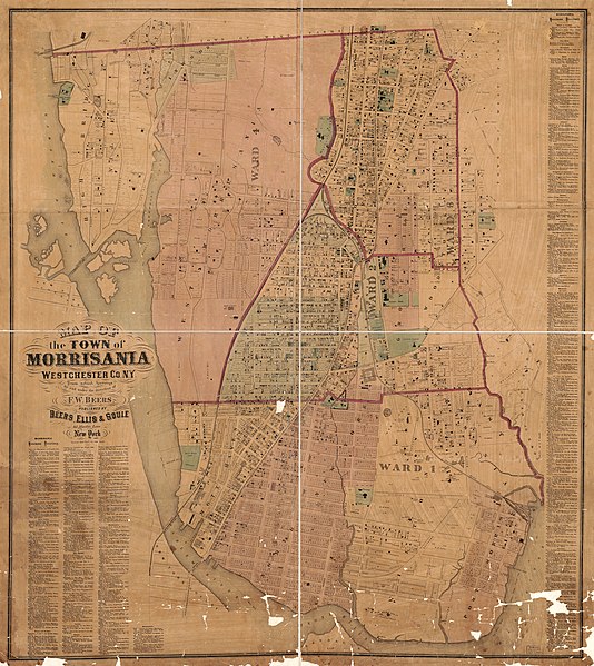
English: Cadastral map showing wards, buildings, block numbers, lot lines/numbers, and owner's names. Imperfect: Mounted on cloth/paper backing, brittle, missing small edge/internal sections, shellacked, quartered for folding. Includes business directory (in 2 segments). Available also through the Library of Congress Web site as a raster image. |
||
| Title | Map of the town of Morrisania, Westchester Co. N.Y. | ||
| Shelf ID | G3804.N4:2M664G46 1865 .B4 | ||
| Date | |||
| Source | https://www.loc.gov/item/2004625898/ | ||
| Author | Beers, F. W. (Frederick W.); Beers, Ellis & Soule | ||
| Permission (Reusing this file) |
|
||
| Location | United States · New York · Morrisania · New York (State) | ||
| Part of | American Memory · General Maps · Catalog · County Landownership Maps · Geography And Map Division | ||
| Subject | Directories · Morrisania · Landowners · United States · Maps · Business Enterprises · New York · Administrative And Political Divisions · Real Property · New York (State) · Morrisania (New York, N.Y.) |

Licensing
[edit]
|
This is a faithful photographic reproduction of a two-dimensional, public domain work of art. The work of art itself is in the public domain for the following reason:
The official position taken by the Wikimedia Foundation is that "faithful reproductions of two-dimensional public domain works of art are public domain".
This photographic reproduction is therefore also considered to be in the public domain in the United States. In other jurisdictions, re-use of this content may be restricted; see Reuse of PD-Art photographs for details. | ||||
File history
Click on a date/time to view the file as it appeared at that time.
| Date/Time | Thumbnail | Dimensions | User | Comment | |
|---|---|---|---|---|---|
| current | 15:35, 18 May 2018 | | 13,640 × 15,303 (33.66 MB) | Fæ (talk | contribs) | LOC Maps https://www.loc.gov/item/2004625898/ #1880 |
You cannot overwrite this file.
File usage on Commons
There are no pages that use this file.