File:Mapa-Potengi.png
Jump to navigation
Jump to search

Size of this preview: 446 × 599 pixels. Other resolutions: 179 × 240 pixels | 357 × 480 pixels | 572 × 768 pixels | 762 × 1,024 pixels | 1,703 × 2,288 pixels.
Original file (1,703 × 2,288 pixels, file size: 225 KB, MIME type: image/png)
Captions
Captions
Add a one-line explanation of what this file represents
Summary
[edit]
| Description |
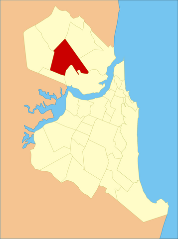
Português: Localização do bairro na cidade de Natal |
| Source | Own work |
| Author | Wellber Drayton |
Licensing
[edit]
| I, the copyright holder of this work, release this work into the public domain. This applies worldwide. In some countries this may not be legally possible; if so: I grant anyone the right to use this work for any purpose, without any conditions, unless such conditions are required by law. |
File history
Click on a date/time to view the file as it appeared at that time.
| Date/Time | Thumbnail | Dimensions | User | Comment | |
|---|---|---|---|---|---|
| current | 21:34, 25 May 2015 | | 1,703 × 2,288 (225 KB) | Cmdrjameson (talk | contribs) | Compressed with pngout. Reduced by 117kB (34% decrease). |
| 01:24, 29 November 2011 |  | 1,703 × 2,288 (342 KB) | MOC (talk | contribs) | Removendo a cor verde do Parque das Dunas. | |
| 00:35, 18 February 2010 |  | 1,703 × 2,288 (400 KB) | Sir Drayton (talk | contribs) | {{Information |Description={{pt|1=Localização do bairro na cidade de Natal}} |Source={{own}} |Author=Wellber Drayton |Date= |Permission= |other_versions= }} Category:Maps Category:Natal R |
You cannot overwrite this file.
File usage on Commons
The following 2 pages use this file:
- File:Potengi.png (file redirect)
- Category:Potengi (Natal)
File usage on other wikis
The following other wikis use this file:
- Usage on pt.wikipedia.org
- Usage on www.wikidata.org