Category:Maps
Jump to navigation
Jump to search

visual representation of a concept space; symbolic depiction emphasizing relationships between elements of some space, such as objects, regions, or themes _ESA23162625.png) 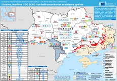 | |||||
| Upload media | |||||
| Pronunciation audio | |||||
|---|---|---|---|---|---|
| Instance of | |||||
| Subclass of |
| ||||
| Part of |
| ||||
| Different from | |||||
| |||||
Before changing or adding maps, please read the brief guideline on the organizational schema About this Category developed during an eight month effort by a working group in 2007–2008.
- See also maps needing categories in Category:Unidentified maps
- See also these related categories: (These categories may contain more maps. Please categorize them in map categories.)
- Category:Cartography – for map symbols, projections, etc.
- Category:Demography
- Category:Geography
- Category:Aerial photographs
- Category:Satellite pictures
- Category:Astronomical maps – maps and star charts
- Category:Cartographic reliefs for models of landscape profiles
Resources:
Subcategories
This category has the following 29 subcategories, out of 29 total.
Pages in category "Maps"
The following 5 pages are in this category, out of 5 total.
Media in category "Maps"
The following 200 files are in this category, out of 246 total.
(previous page) (next page)-
 2004 CA Mock Senate Election Map.png 429 × 582; 154 KB
-
 2004 Mock Senate Election in California Map.png 800 × 800; 102 KB
-
 2036 election.png 1,209 × 773; 156 KB
-
 23 0009705 Convair Negative Image.jpg 1,594 × 1,600; 1.19 MB
-
 23 0009707 Convair Negative Image.jpg 1,600 × 1,591; 1.38 MB
-
 ALAN EL.jpg 4,096 × 2,304; 4.43 MB
-
 Alt2008.svg 1,020 × 593; 32 KB
-
 American diaspora.jpg 1,414 × 1,744; 471 KB
-
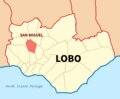 Barangay San Miguel, Lobo Map.png 1,624 × 1,343; 467 KB
-
 Battle of Thorgo Map 3.jpg 4,129 × 3,568; 592 KB
-
 Battle of Thorgo Map 4.jpg 4,129 × 3,568; 685 KB
-
 Blank Map of the United Republic of Aurelia 22.svg 512 × 659; 398 KB
-
 BRUMMWAY.png 486 × 623; 110 KB
-
 Busiest Railway Stations in Europe.jpg 1,414 × 1,752; 518 KB
-
 Damaquiel.png 754 × 573; 75 KB
-
 Demographics of Liechtenstein.jpg 1,414 × 1,733; 330 KB
-
 Dendermonde en deelgemeenten.png 934 × 657; 129 KB
-
 Desa Sei Lumut.jpg 1,122 × 794; 393 KB
-
 Dhana-Governorate.png 1,080 × 1,080; 58 KB
-
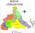 División territorial de Nueva Concepción.png 753 × 720; 168 KB
-
 Députés des français de l'étranger XVIe législature.svg 512 × 260; 912 KB
-
 ECSA-HC-Map.jpg 596 × 584; 65 KB
-
 Emplacement Villas romaines Villers.jpg 1,509 × 1,404; 1.15 MB
-
 English Antalas Presence map.png 1,024 × 901; 214 KB
-
 ETS 2 Map DLC.png 4,592 × 3,196; 1.56 MB
-
 ETS 2 Map.png 4,592 × 3,196; 1.54 MB
-
 EU air carrier restrictions map revised Feb 2022.png 2,754 × 1,398; 467 KB
-
 Evacuation-cost-map-based-on-land-use-and-slope.jpg 1,260 × 1,059; 1.66 MB
-
 Everett Smelter Contaminated Soil Cleanup Map.png 890 × 1,126; 366 KB
-
 Exilien atlasbassinversantdetroisrivieres2015 2~2.jpg 1,232 × 1,272; 316 KB
-
 Exposure-left-and-relative-risk-right-map-for-infrastructure-roads-railways-pathways.png 1,831 × 1,329; 1.12 MB
-
 ExtremePuntenVlaanderen.png 1,102 × 458; 73 KB
-
 Falk Oberdorf Karte Bergkirchen.png 620 × 596; 59 KB
-
 First Sino-Japanese War - Chinese version.jpg 2,000 × 2,615; 407 KB
-
 G commonwealth g map.gif 800 × 400; 61 KB
-
 Galabert projet Louis-Philippe-Ville.pdf 1,239 × 1,752; 290 KB
-
 Gaziantep Kahramanmaraş depremleri harita 2.jpg 3,933 × 2,002; 2.29 MB
-
 Grenzen Naturschutzgebiet.png 832 × 999; 1.86 MB
-
 Harta fizike e rrethit Tropoje.png 656 × 506; 431 KB
-
 Hazara Division Map and Jagirdars.jpg 1,080 × 1,710; 841 KB
-
 Heavily Indebted Poor Countries As of 29 Jan 2021.svg 940 × 415; 1.49 MB
-
 Herrera y la fábrica de jabón de Josefa Tito Recalde hacia 1851.jpg 660 × 548; 226 KB
-
 Hip test 08-31-21.svg 1,514 × 800; 462 KB
-
 Hk416 map 2024 02 08.png 6,460 × 3,403; 2.24 MB
-
 HO -2570, Moresby Passage to Gabriola Pass - NARA - 84785960.jpg 24,892 × 18,624; 60.7 MB
-
 Hotakid-Dynasty-1728.png 620 × 429; 232 KB
-
 Hounslow London UK local election 2022 map.svg 512 × 338; 6.57 MB
-
 Hurricane Laura rainfall.png 462 × 557; 159 KB
-
 I dialet del catalan.jpg 1,496 × 1,745; 871 KB
-
 I dialet del romagnoeul.jpg 916 × 775; 377 KB
-
 Idea and the attempted actualization - Reworked.svg 1,415 × 479; 59 KB
-
 IHM שביל דרום הגולן.jpeg 1,600 × 1,267; 322 KB
-
 Iliria.jpg 1,427 × 1,410; 153 KB
-
 Imperio bizantino siglo XV.jpg 1,024 × 905; 188 KB
-
 Indicator exilis range map.png 2,036 × 814; 158 KB
-
 Interceptores-aguas-servidas-en-santiago.png 374 × 334; 88 KB
-
 Islam World.png 1,920 × 848; 284 KB
-
 Italian Invasion 1940 in Pindus Epirus ru.svg 1,335 × 996; 729 KB
-
 Ivmworld.png 2,000 × 1,050; 494 KB
-
 January 12, 1938's Unnamed system.png 638 × 442; 356 KB
-
 JESC.2022.jpg 684 × 536; 66 KB
-
 Just for user I never cry.jpg 176 × 180; 12 KB
-
 Kadena and Yomitan, January to December 1945.png 2,418 × 1,144; 2.62 MB
-
 Karte Ortsumgehung Toljatti.jpg 1,217 × 824; 287 KB
-
 Kazakh Horde (Khanate) map.png 1,658 × 1,247; 150 KB
-
 KempensDialectKaart.png 881 × 653; 29 KB
-
 KempensDialectKaartV2.png 800 × 593; 210 KB
-
 Khasavyurtovsky district locator map.svg 744 × 1,064; 481 KB
-
 Kinson map, highlighting Cunningham Crescent and Moorside Close.png 2,064 × 1,227; 2.1 MB
-
 Lage Adasiyyah im Heligen Land.jpg 502 × 713; 104 KB
-
 Las Calles de las Mujeres.png 2,818 × 1,374; 658 KB
-
 Localización de Sosote en la Parroquia Sosote.jpg 610 × 705; 109 KB
-
 Location map1.gif 361 × 292; 10 KB
-
 Location of teams in the 2019–20 PSL.png 508 × 438; 68 KB
-
 Location of teams in the 2020–21 PSL.png 564 × 482; 99 KB
-
 Location of teams in the 2021–22 PSL.jpg 447 × 384; 34 KB
-
 Location plan.webp 649 × 790; 77 KB
-
 Locator Kacamatan Kabangka.jpg 866 × 827; 195 KB
-
 Lokeren Industrieparken Overzichtskaart.png 1,834 × 2,175; 3.94 MB
-
 M 6.3 Explosion - 22km ENE of Sungjibaegam, North Korea.png 1,429 × 1,014; 317 KB
-
 M.R.N.C map.tif 1,366 × 768; 857 KB
-
 Maesuai Map.jpg 3,060 × 4,080; 3.58 MB
-
 Makedonya (anlam ayrımı).png 286 × 332; 10 KB
-
 Mangladien mapa.jpg 1,024 × 494; 53 KB
-
 Maniwaki Quebec location diagram.png 329 × 290; 17 KB
-
 Map of Africa (1880).png 3,654 × 3,539; 1.16 MB
-
 Map of Attu during Allied Invasion.png 1,424 × 1,073; 234 KB
-
 Map of AYODHYA or OUDH in year 1862.jpg 432 × 664; 85 KB
-
 Map of Bama.jpg 267 × 189; 14 KB
-
 Map of Clifden. Medina County, Texas..jpg 6,817 × 10,423; 6.56 MB
-
 Map of Emilia and Romagna with provinces and bounderies 2.jpg 800 × 423; 53 KB
-
 Map of Highton and it's boundaries.png 446 × 544; 145 KB
-
 Map of Hrubieszów District.png 575 × 768; 308 KB
-
 Map of Netzarim corridor, mostly Hebrew titles.png 800 × 566; 119 KB
-
 Map of the Labrador & Irminger seas. With depth contours and current data.png 1,728 × 1,080; 514 KB
-
 Map of the Majeerteen Sultanate.png 1,162 × 1,862; 818 KB
-
 Map-of-cancer-cluster-feb-2020.jpg 3,000 × 2,318; 1.22 MB
-
 Map-timeline-new.svg 4,821 × 1,024; 6.65 MB
-
 Map-to-Londolozi-scaled-e1608291953212-788x779.jpg 788 × 779; 68 KB
-
 Map. Location of Buckingham House (HBC) and other trading posts in Canada.png 1,326 × 768; 1.37 MB
-
 Map03 large.jpg 2,339 × 1,654; 816 KB
-

-
 Mapa de artistas PortAmérica.png 630 × 474; 93 KB
-
 Mapa de las bandas del rey sindel y duque mihali llega a Barcelona.jpg 1,266 × 707; 134 KB
-
 Mapa de localização da Phalotris nasutus.png 909 × 364; 58 KB
-
 Mapa de Ubicación de Touwa.png 2,300 × 1,100; 77 KB
-
 MAPA DEL CANTÓN QUINSALOMA.jpg 5,498 × 13,717; 7.81 MB
-
 Mapa división política de Manzanares.jpg 1,786 × 1,429; 460 KB
-
 Mapa dos municípios do Algarve.png 1,264 × 624; 126 KB
-
 Mapa esquemático Serra do Espinhaço meridional.png 456 × 600; 292 KB
-
 Mapa físico - San Diego, Carabobo.png 4,767 × 6,704; 7.51 MB
-
 Mapa Hupda.png 720 × 538; 101 KB
-
 Mapa Kociewia.png 224 × 253; 26 KB
-
 Mapa oficinas KAS en Latinoamerica.png 1,920 × 1,080; 473 KB
-
 Mapa RECIDA.png 466 × 479; 148 KB
-
 Mapa RMVA e Colar Metropolitano.jpg 2,001 × 2,264; 2.99 MB
-
 Mapa TP2024.png 800 × 941; 171 KB
-
 Mapa zemí Evropy s patentovým boxem pro rok 2022.png 910 × 517; 94 KB
-
 Mapa-voseo-latinoamerica-real.png 1,472 × 1,960; 630 KB
-
 Mapa.Igel greziarra.pdf 1,241 × 1,754; 345 KB
-
 MapAltayRH.jpg 336 × 372; 13 KB
-
 Mapapozuelodearagon.gif 275 × 300; 3 KB
-
 MapaTP23-2.png 800 × 941; 126 KB
-
 MapaTP23-3.png 800 × 941; 134 KB
-
 MapaTP23-4.png 800 × 941; 127 KB
-
 MapcartaScreenshot.jpg 2,128 × 1,021; 1,020 KB
-
 MapoArbaroOrleans eo.gif 2,245 × 1,587; 84 KB
-
 MapofAbik.png 1,280 × 548; 139 KB
-
 MapofHasanlu.jpg 700 × 577; 69 KB
-
 MapofHasanlu2.jpg 446 × 490; 48 KB
-
 Mappa canali agro pontino.png 917 × 574; 472 KB
-
 Mappa-s-maria-in-campis.png 589 × 841; 400 KB
-
 Maps of Locations (Mark).jpg 936 × 583; 206 KB
-
 MAPS- vepsät - laaksot.png 500 × 467; 89 KB
-
 Maunsell Fort Locations.png 1,359 × 1,019; 392 KB
-
 Miasta-retowniki Ukrajiny.png 1,200 × 1,001; 52 KB
-
 Miguel Auza property.jpg 512 × 373; 66 KB
-
 Misiraki jerimeni.png 1,024 × 1,024; 353 KB
-
 Mission San Jose map 1878 original.jpg 3,690 × 1,389; 1.82 MB
-
 Mitchell's Water Monitor distribution.tiff 3,508 × 2,481; 5.4 MB
-
 Miyakonojo city map 2.png 10,030 × 10,175; 3.81 MB
-
 Mkd jazik.png 508 × 313; 12 KB
-
 Mon Repos Map.jpg 1,600 × 3,597; 1.16 MB
-
 Morocco map full.png 596 × 600; 107 KB
-
 MRC2 2022.jpg 7,200 × 5,400; 3.2 MB
-
 MSU MAP Plan-02.jpg 3,508 × 2,481; 1.54 MB
-
 MUB BH Dandara.jpg 6,622 × 9,361; 9.21 MB
-
 Murrgau-Grenze03.svg 1,383 × 880; 477 KB
-
 National Days map 2024.png 2,754 × 1,398; 506 KB
-
 National Days map 5 July 2024.png 2,754 × 1,398; 506 KB
-
 Nyangatome map.jpg 1,740 × 970; 274 KB
-
 Nùng Autonomous Territory, French Indo-China (Concept map).png 1,920 × 1,257; 1.02 MB
-
 Ocean-wind-atmosphere-ice-arctic-terrain-1123814-pxhere.jpg 2,048 × 1,024; 321 KB
-
 Ohm 2013 map.jpg 3,483 × 3,021; 1.83 MB
-
 OjOtter 1996 Alternate Election Map.svg 1,020 × 593; 28 KB
-
 Olympic games countries by seasons updated.svg 512 × 263; 775 KB
-
 Ostracod abundance.png 607 × 767; 741 KB
-
 P18 edits map Commons app.png 1,909 × 938; 774 KB
-
 PACE 2019.jpg 4,096 × 2,850; 572 KB
-
 Pan Celtic Festival winners (2024).svg 680 × 520; 238 KB
-
 ParadoxoFigura10.jpg 1,439 × 872; 238 KB
-
 Parramatta developed map.png 1,360 × 1,060; 775 KB
-
 Partenariats étrangers.png 938 × 532; 405 KB
-
 Países da Ásia e Pacífico por IDH.png 3,584 × 3,053; 758 KB
-
 Państwa członkowskie ISE.png 836 × 904; 227 KB
-
 Permia map.png 679 × 461; 24 KB
-
 Peta jenis tanah Sumatera Utara.png 1,031 × 825; 583 KB
-
 Philister Nord.jpg 762 × 909; 192 KB
-
 Philister Süd.jpg 1,115 × 958; 335 KB
-
 Philister Zentrum.jpg 934 × 921; 322 KB
-
 Philistäa zur Assyrerzeit.jpg 1,078 × 915; 158 KB
-
 Philistäa.jpg 1,044 × 915; 248 KB
-
 Plan Cotroceni 1876.jpg 1,600 × 959; 187 KB
-
 Plan des lignes de tramway dans la province de Flandre-Orientale 1950-01-01.jpg 1,041 × 914; 492 KB
-
 Plan des lignes de tramway dans la province de Namur 1950-01-01.jpg 777 × 695; 278 KB
-
 Plano comunal Quilicura.png 1,037 × 752; 1.52 MB
-
 Pop dens LDZ.jpg 1,553 × 1,294; 397 KB
-
 Primer imperio colonial francés.png 250 × 136; 19 KB
-
 Print-Across-South-America-2020-JS-walk-and-raft-768x648.jpg 768 × 648; 135 KB
-
 Provisional government of Alash-Orda (1918).png 1,280 × 1,144; 159 KB
-
 PSAE1956T.svg 610 × 521; 153 KB
-
 Purwakarta Regency Location.png 243 × 171; 6 KB
-
 Puurs-Sint-Amands.png 883 × 616; 103 KB
-
 QGIS Colormap Problem 2.0.png 1,920 × 1,040; 482 KB
-
 Quartiers de Grassa.jpg 2,813 × 2,734; 521 KB
-
 Richmond upon Thames London UK local election 2022 map.svg 512 × 488; 5.92 MB
-
 Romanische Reliktwortareale im Rheinland.jpg 501 × 696; 198 KB
-
 RR Nagar Police Station jurisdictional map.jpg 1,080 × 1,712; 472 KB
-
 Ruhr Valley Metropolitan Area map.jpg 1,280 × 720; 394 KB
-
 Rundling Association Map.png 1,020 × 692; 872 KB
-
 Ruta Y-685, Bahía Catalina.png 638 × 337; 19 KB
-
 SaDec2-1973.jpg 2,242 × 3,000; 278 KB
-
 Sanhaja tribes 11th century.jpg 1,125 × 1,353; 344 KB
-
 Sanpailou station 1927.png 618 × 542; 656 KB
-
 Sanrafaelriver.png 2,600 × 2,266; 6.86 MB
-
 Saudiar.jpg 3,769 × 1,714; 1.43 MB
-
 Saverne OSM 02.png 881 × 547; 568 KB
-
 SEHORE.jpg 592 × 518; 32 KB
-
 Seisho.png 1,280 × 897; 325 KB
-
 Sepulcres de Fossa Culture.jpg 564 × 457; 119 KB


_map.png)


.png)


.png)


_and_other_trading_posts_in_Canada.png)


.jpg)


.png)


.svg)


.png)


