File:Mapa de las provincias de Chile en 1920.jpg
Jump to navigation
Jump to search

Size of this preview: 459 × 599 pixels. Other resolutions: 184 × 240 pixels | 368 × 480 pixels | 589 × 768 pixels | 785 × 1,024 pixels | 1,570 × 2,048 pixels.
Original file (1,570 × 2,048 pixels, file size: 845 KB, MIME type: image/jpeg)
Captions
Captions
Add a one-line explanation of what this file represents
Summary
[edit]
| Description |
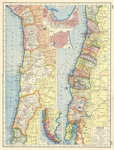
Español: Mapa de las provincias de Chile en 1920
English: Map of the provinces of Chile in 1920
Chile; Inset Valparaíso; Concepción |
| Date | |
| Source | https://m.media-amazon.com/images/I/91vMkPuwv+L.jpg |
| Author | Harmsworth |
Licensing
[edit]
This file is part of the common cultural heritage (public domain) according to the Intellectual Property Law of Chile (Law No. 17336 and its amendments). Nevertheless, its author and source must be acknowledged.
See here for the type of material that is part of the common cultural heritage (public domain).
|

|
File history
Click on a date/time to view the file as it appeared at that time.
| Date/Time | Thumbnail | Dimensions | User | Comment | |
|---|---|---|---|---|---|
| current | 14:34, 3 January 2023 | | 1,570 × 2,048 (845 KB) | Janitoalevic (talk | contribs) | Uploaded a work by Harmsworth from https://m.media-amazon.com/images/I/91vMkPuwv+L.jpg with UploadWizard |
You cannot overwrite this file.
File usage on Commons
There are no pages that use this file.