File:Marles-les-Mines - Fosse n° 2 des mines de Marles (B).jpg
Jump to navigation
Jump to search
Size of this preview: 500 × 599 pixels. Other resolutions: 200 × 240 pixels | 401 × 480 pixels | 641 × 768 pixels | 855 × 1,024 pixels | 1,511 × 1,810 pixels.
Original file (1,511 × 1,810 pixels, file size: 1.07 MB, MIME type: image/jpeg)
Captions
Captions
Add a one-line explanation of what this file represents
| Description |
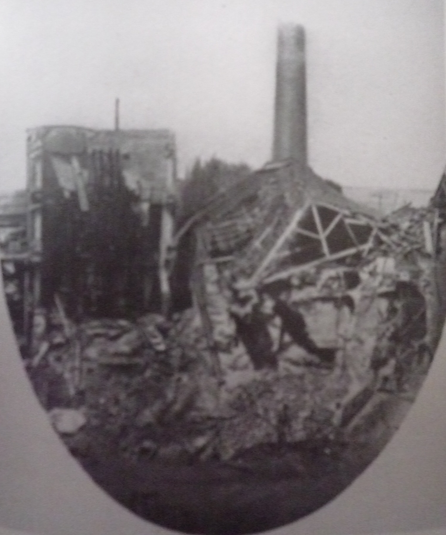
Français : La fosse no 2 dite Saint-Émile de la Compagnie des mines de Marles était un charbonnage du bassin minier du Nord-Pas-de-Calais constitué d'un seul puits situé à Marles-les-Mines, Pas-de-Calais, Nord-Pas-de-Calais, France. L'avaleresse no 1 est localisée sur le site. Le chevalement de la fosse no 2 avec les parties anciennes du bâtiment de la machine d'extraction sont inscrits aux monuments historiques le 6 mai 1992. La fosse est également inscrite sur la liste du patrimoine mondial par l'Unesco le 30 juin 2012 et y constitue le site no 101. |
|||||||||
| Date | circa 1866 | |||||||||
| Source |
Français : Carte postale ancienne, modifiée par JÄNNICK Jérémy. |
|||||||||
| Author | Unknown author | |||||||||
| Permission (Reusing this file) |
|
|||||||||


| Object location | | View this and other nearby images on: OpenStreetMap |
|---|
.jpg¶ms=050.503567_N_0002.506733_E_globe:Earth_class:object_type:object_scale:1000_region:FR_&language=en)
File history
Click on a date/time to view the file as it appeared at that time.
| Date/Time | Thumbnail | Dimensions | User | Comment | |
|---|---|---|---|---|---|
| current | 14:56, 11 November 2011 | | 1,511 × 1,810 (1.07 MB) | Jérémy-Günther-Heinz Jähnick (talk | contribs) | {{Information |Description ={{fr|1=La '''Fosse n° 2''' de la Compagnie des mines de Marles était un charbonnage constitué d'un seul puits situé à [[:fr:Marles-les-Mines| |
You cannot overwrite this file.
File usage on Commons
There are no pages that use this file.
File usage on other wikis
The following other wikis use this file:
- Usage on fr.wikipedia.org
.jpg&oldid=848372031)