File:Massive Dust Storm in the Taklimakan (MODIS 2022-07-10).jpg

Original file (7,880 × 6,301 pixels, file size: 4.49 MB, MIME type: image/jpeg)
Captions
Captions
Summary
[edit].jpg&action=edit§ion=1)
| Description |
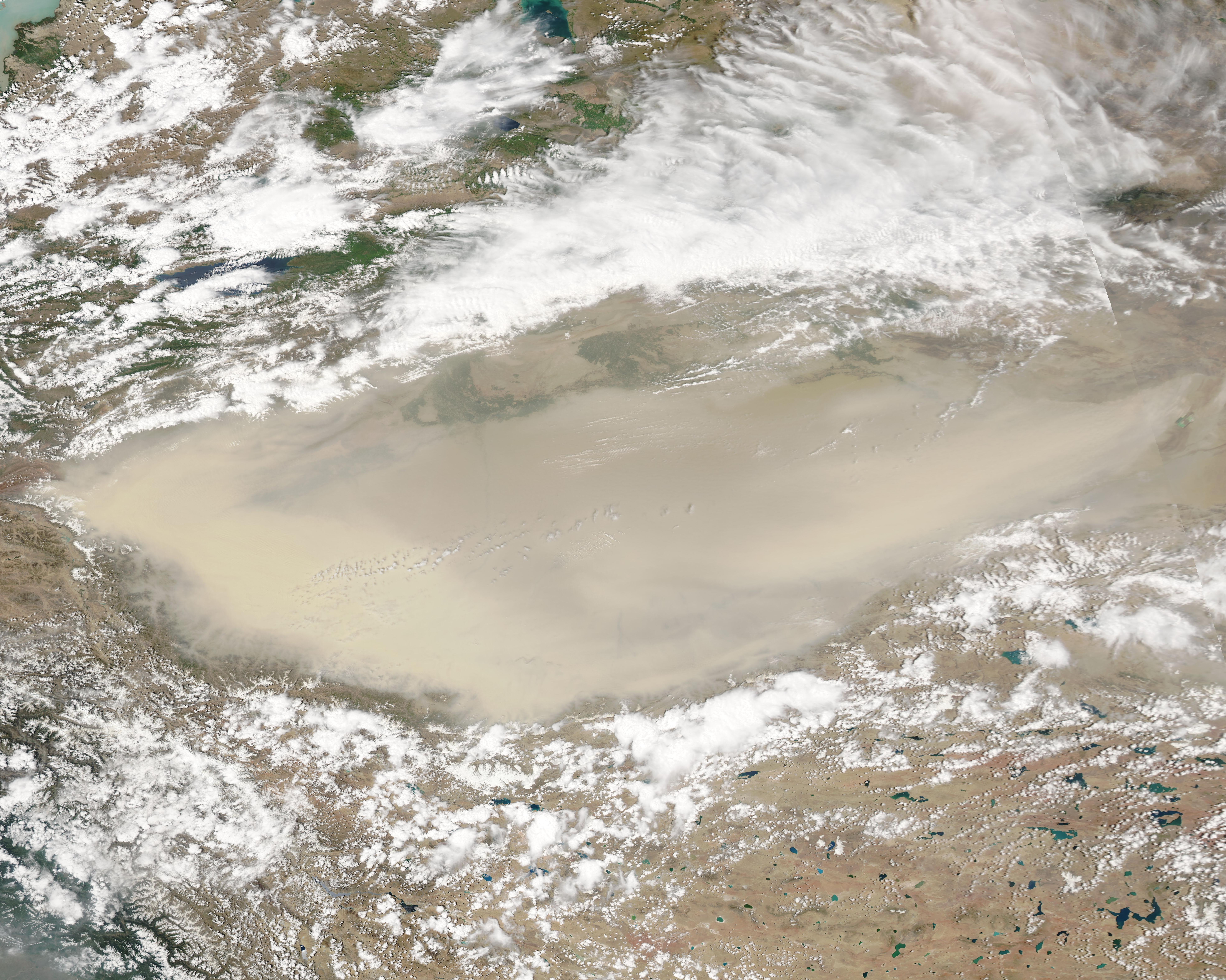
English: A massive shroud of airborne dust covered the Taklamakan Desert in early July 2022. Strong winds were moving dust across the desert—which is one of the harshest, driest, and most barren places on Earth—continuously since July 1. By July 7, when the Moderate Resolution Imaging Spectroradiometer (MODIS) on board NASA’s Terra satellite acquired this true-color image, the dust was so thick that at least 95 percent of the desert was obscured from view.
Located in Xinjiang province in western China, the Taklimakan Desert sits in a depression formed by the tall Tien Shan Mountains to the north and the Kunlun Mountains to the south. It is the largest desert in China, and the largest shifting-sand desert in the world. Eighty-five percent of the Taklimakan’s surface consists of crescent-shaped dunes, some reaching a height of 200 meters (650 feet). It is one of the main sources of dust-and-sand storms in China, although, thanks to the encircling mountains, the dust usually remains mostly confined within the Tarim Basin. Dust storms are frequent across the Taklamakan Desert, with an average of more than 100 sand-dust days each year across the entire basin. In some areas, the average exceeds 200 days each year. |
||
| Date | Taken on 7 July 2022 | ||
| Source |
Massive Dust Storm in the Taklimakan (direct link)
|
||
| Author | MODIS Land Rapid Response Team, NASA GSFC |
| This media is a product of the Aqua mission Credit and attribution belongs to the mission team, if not already specified in the "author" row |
Licensing
[edit].jpg&action=edit§ion=2)
| This file is in the public domain in the United States because it was solely created by NASA. NASA copyright policy states that "NASA material is not protected by copyright unless noted". (See Template:PD-USGov, NASA copyright policy page or JPL Image Use Policy.) | ||
 |
Warnings:
|
File history
Click on a date/time to view the file as it appeared at that time.
| Date/Time | Thumbnail | Dimensions | User | Comment | |
|---|---|---|---|---|---|
| current | 21:57, 9 January 2024 | | 7,880 × 6,301 (4.49 MB) | OptimusPrimeBot (talk | contribs) | #Spacemedia - Upload of http://modis.gsfc.nasa.gov/gallery/images/image07102022_500m.jpg via Commons:Spacemedia |
You cannot overwrite this file.
File usage on Commons
There are no pages that use this file.
.jpg&oldid=909384701)