File:Measuring Effects of the Flood (c97e4b0b-155d-4519-3e57-11dab16deaee).jpg
Jump to navigation
Jump to search
No higher resolution available.
Measuring_Effects_of_the_Flood_(c97e4b0b-155d-4519-3e57-11dab16deaee).jpg (604 × 453 pixels, file size: 158 KB, MIME type: image/jpeg)
Captions
Captions
Add a one-line explanation of what this file represents

|
The categories of this image need checking. You can do so here.
|
.jpg&action=edit&withJS=MediaWiki:Catcheck.js)
Summary
[edit].jpg&action=edit§ion=1)
| English: Measuring Effects of the Flood | ||||
|---|---|---|---|---|
| Photographer |
English: NPS |
|||
| Title |
English: Measuring Effects of the Flood |
|||
| Publisher |
English: U.S. National Park Service |
|||
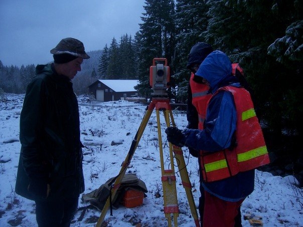
| Description |
English: Several people look at a survey camera on a tripod set up on a snowy river bank with a damaged building in the background. Geologists set up survey equipment at Longmire to measure the effects of November's flood. |
|||
| Depicted place |
English: Mount Rainier National Park, Washington |
|||
| Date | Taken on 16 July 2010 | |||
| Accession number | ||||
| Source |
English: NPGallery |
|||
| Permission (Reusing this file) |
|
|||
| NPS Unit Code | MORA | |||
| Album(s) | English: 2006 Flood Research; Research |
|||
File history
Click on a date/time to view the file as it appeared at that time.
| Date/Time | Thumbnail | Dimensions | User | Comment | |
|---|---|---|---|---|---|
| current | 03:17, 15 May 2024 | | 604 × 453 (158 KB) | BMacZeroBot (talk | contribs) | Batch upload (Commons:Batch uploading/NPGallery) |
You cannot overwrite this file.
File usage on Commons
There are no pages that use this file.
.jpg&oldid=876497929)