File:Merseyside UK location map.svg
跳至導覽
跳至搜尋

此 SVG 檔案的 PNG 預覽的大小:565 × 599 像素。 其他解析度:226 × 240 像素 | 453 × 480 像素 | 724 × 768 像素 | 966 × 1,024 像素 | 1,932 × 2,048 像素 | 1,231 × 1,305 像素。
原始檔案 (SVG 檔案,表面大小:1,231 × 1,305 像素,檔案大小:1.3 MB)
說明
說明
添加單行說明來描述出檔案所代表的內容
| 描述 |
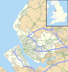
Map of Merseyside, UK with the following information shown:
Equirectangular map projection on WGS 84 datum, with N/S stretched 165% Geographic limits:
|
| 日期 | |
| 來源 |
|
| 作者 | Nilfanion, created using Ordnance Survey data |
| 授權許可 (重用此檔案) |
此檔案採用共享創意 姓名標示-相同方式分享 3.0 未在地化版本授權條款。 姓名標示: Contains Ordnance Survey data © Crown copyright and database right
|
| 其他版本 | File:Bedfordshire UK district map (blank).svg - Blank map |
.svg)
檔案歷史
點選日期/時間以檢視該時間的檔案版本。
| 日期/時間 | 縮圖 | 尺寸 | 用戶 | 備註 | |
|---|---|---|---|---|---|
| 目前 | 2010年9月26日 (日) 19:01 | | 1,231 × 1,305(1.3 MB) | Nilfanion(對話 | 貢獻) | {{Information |Description=Map of Merseyside, UK with the following information shown: *Administrative borders *Coastline, lakes and rivers *Roads and railways *Urban areas Equirectangular map projection on WGS 84 datum, with N/S stretche |
無法覆蓋此檔案。
檔案用途
下列3個頁面有用到此檔案:
全域檔案使用狀況
以下其他 wiki 使用了這個檔案:
- ar.wikipedia.org 的使用狀況
- ast.wikipedia.org 的使用狀況
- bg.wikipedia.org 的使用狀況
- br.wikipedia.org 的使用狀況
- ceb.wikipedia.org 的使用狀況
- en.wikipedia.org 的使用狀況
- Liverpool John Lennon Airport
- Leasowe
- Birkenhead
- Prescot
- Kirkby
- Halewood
- Huyton
- Southport
- Rainhill
- Earlestown
- Bootle
- Great Crosby
- Newton-le-Willows
- Edge Hill, Liverpool
- Litherland
- Formby
- Maghull
- Aigburth
- Allerton, Liverpool
- St Michael's Hamlet
- Crosby, Merseyside
- Little Crosby
- Waterloo, Merseyside
- RAF Woodvale
- Liverpool Castle
- Bebington
- Toxteth
- Birkdale
- Hoylake
- West Derby
- Norris Green
- Everton, Liverpool
- Croxteth
- Anfield (suburb)
- Aintree
- Port Sunlight
- Dingle, Liverpool
- Lydiate
- Switch Island
- Melling, Merseyside
- Sefton, Merseyside
- Rainford
- Speke
- Childwall
檢視此檔案的更多全域使用狀況。