File:Metrô do Rio de Janeiro (4011922240).jpg
Original file (3,264 × 2,448 pixels, file size: 3.92 MB, MIME type: image/jpeg)
Captions
Captions
Summary[edit]
.jpg&action=edit§ion=1)
| Description |
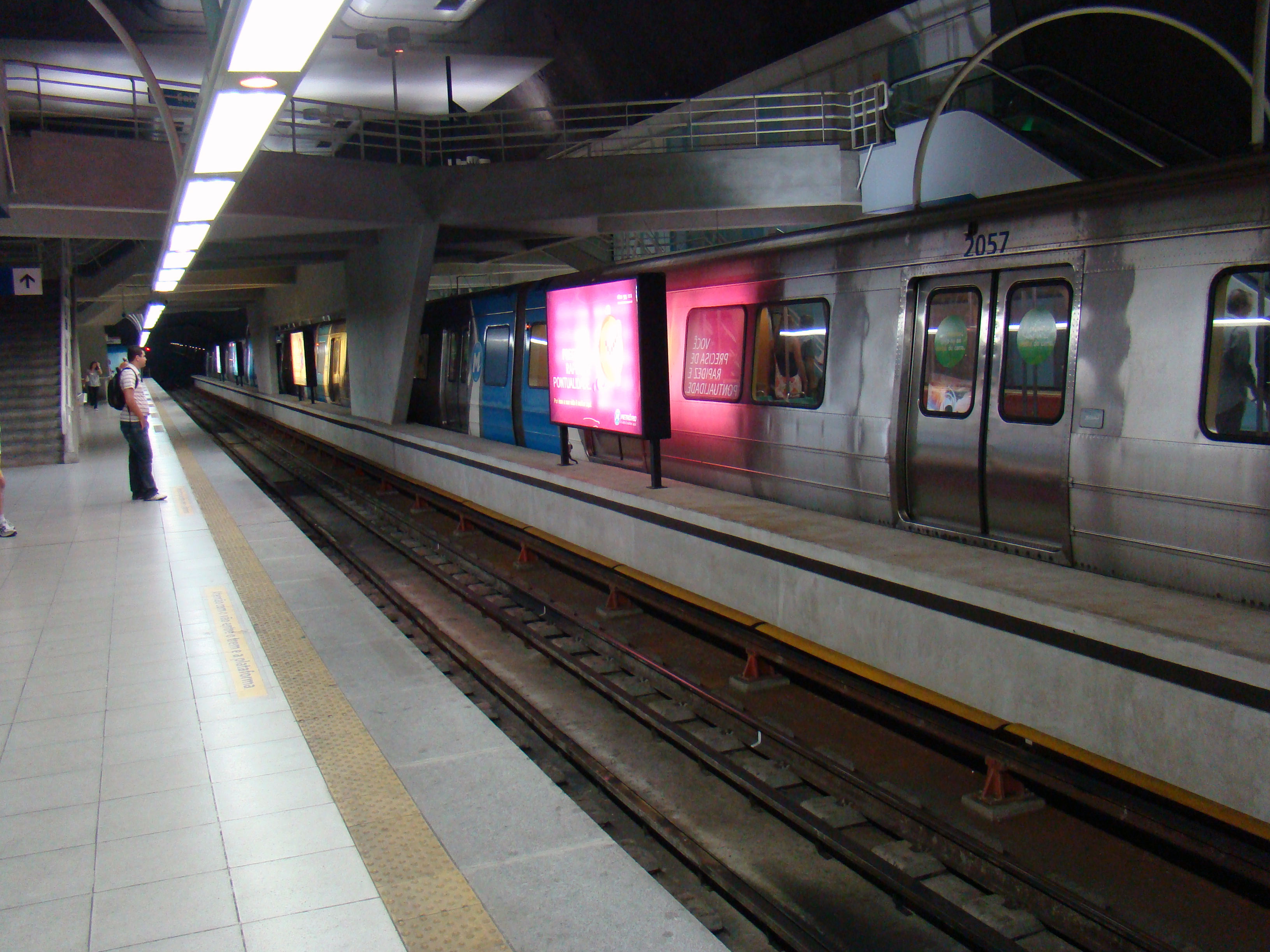
O Metrô do Rio de Janeiro opera desde março de 1979, quando foi inaugurado pela administração do governador Chagas Freitas. Desde 1997, com a concessão, a administração e a operação das linhas e estações ficaram a encargo do Consórcio Opportrans (Metrô Rio), concessionário pelo período de 20 anos. O Governo do Estado do Rio de Janeiro continua responsável pelas expansões da rede metroviária, por meio da empresa Rio Trilhos. No final de dezembro de 2007, a concessão foi renovada até 2038 e o Metrô Rio assumiu a responsabilidade pela construção da Linha 1A, que ligará a linha 2 à Linha 1, acabando com a necessidade de transferência em Estácio, pela compra de 114 carros e construção das Estações Uruguai e Cidade Nova. É a segunda rede mais extensa do país, com 42 km distribuídos em duas linhas e 38 estações, perdendo apenas para o Metrô de São Paulo. Transporta diariamente cerca de 550 mil passageiros. __________________ The Rio de Janeiro Metro (Metrô Rio) is a mass-transit underground railway network that serves the city of Rio de Janeiro, Brazil. Founded in 1979 with five stations operating on one line, it now includes 32 stations and two separate lines and serves on average nearly half a million passengers per day. The system currently consists of two lines: Line 1 (orange line), which serves the city's downtown business center, tourist areas in the city's South Zone, and several neighborhoods in the North Zone. It is a semi-circular line, and is fully underground. It runs from Saens Peña to Cantagalo. Line 1 A (orange line), is the expansion between stations São Cristóvão and Central, leading to an line to Botafogo. In its traject, the Cidade Nova estation is placed in front of the City Hall. Line 2 (green line), which serves working-class residential neighborhoods extending toward the north. It is a diagonal line, and almost completely over ground (mostly at graded and partly elevated). This line started as a light rail, but for increasing commuters, it gradually changed to metro. For its origin as light rail, it is fully over ground except Estácio station, although Cidade Nova station will be lifted. |
| Date | |
| Source | Metrô do Rio de Janeiro |
| Author | Rodrigo Soldon from Rio de Janeiro, Brazil |
| Camera location | | View this and other nearby images on: OpenStreetMap |
|---|
.jpg¶ms=-22.964789_N_-043.180689_E_globe:Earth_type:camera_source:Flickr_&language=en)
Licensing[edit]
.jpg&action=edit§ion=2)
- You are free:
- to share – to copy, distribute and transmit the work
- to remix – to adapt the work
- Under the following conditions:
- attribution – You must give appropriate credit, provide a link to the license, and indicate if changes were made. You may do so in any reasonable manner, but not in any way that suggests the licensor endorses you or your use.
| This image was originally posted to Flickr by Rodrigo_Soldon at https://flickr.com/photos/8865243@N02/4011922240. It was reviewed on 31 August 2016 by FlickreviewR and was confirmed to be licensed under the terms of the cc-by-2.0. |
File history
Click on a date/time to view the file as it appeared at that time.
| Date/Time | Thumbnail | Dimensions | User | Comment | |
|---|---|---|---|---|---|
| current | 03:32, 31 August 2016 | | 3,264 × 2,448 (3.92 MB) | Sturm (talk | contribs) | Transferred from Flickr via Flickr2Commons |
You cannot overwrite this file.
File usage on Commons
There are no pages that use this file.
.jpg&oldid=744134216)