File:Milton-Keynes-OpenStreetMap.png
Jump to navigation
Jump to search
Size of this preview: 715 × 600 pixels. Other resolutions: 286 × 240 pixels | 572 × 480 pixels | 720 × 604 pixels.
Original file (720 × 604 pixels, file size: 159 KB, MIME type: image/png)
Captions
Captions
Add a one-line explanation of what this file represents
Summary
[edit]
| Description |
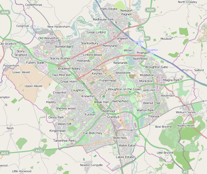
English: A map of Milton Keynes, England |
| Date | |
| Source | Openstreetmap.org |
| Author | User:John Maynard Friedman selecting from OpenStreetMap mapping |
Licensing
[edit]
This file is licensed under the Creative Commons Attribution-Share Alike 2.0 Generic license.
- You are free:
- to share – to copy, distribute and transmit the work
- to remix – to adapt the work
- Under the following conditions:
- attribution – You must give appropriate credit, provide a link to the license, and indicate if changes were made. You may do so in any reasonable manner, but not in any way that suggests the licensor endorses you or your use.
- share alike – If you remix, transform, or build upon the material, you must distribute your contributions under the same or compatible license as the original.
File history
Click on a date/time to view the file as it appeared at that time.
| Date/Time | Thumbnail | Dimensions | User | Comment | |
|---|---|---|---|---|---|
| current | 16:01, 1 July 2014 | | 720 × 604 (159 KB) | JMF (talk | contribs) | New capture to show changes to the source since 2010 |
| 12:21, 8 July 2010 |  | 740 × 571 (151 KB) | JMF (talk | contribs) | screen cap that reflects recent updates to the original material on openstreetmap.org | |
| 19:40, 9 November 2009 |  | 697 × 552 (371 KB) | Jon Maynard Friedman (talk | contribs) | ||
| 17:55, 26 July 2009 |  | 1,310 × 1,181 (1.13 MB) | Jon Maynard Friedman (talk | contribs) | {{Information |Description={{en|1=A map of Milton Keynes, England}} |Source=Openstreetmap.org |Author=User:John Maynard Friedman selecting from Open Street Map mapping |Date=2009 July 26 |Permission= |other_versions= }} Category:Maps |
You cannot overwrite this file.
File usage on Commons
The following page uses this file:
File usage on other wikis
The following other wikis use this file:
- Usage on en.wikipedia.org
- M25 motorway
- The Ridgeway
- Grand Union Canal
- Metropolitan line
- River Great Ouse
- Watling Street
- M1 motorway
- West Coast Main Line
- M4 motorway
- A413 road
- A41 road
- M40 motorway
- A40 road
- A4 road (England)
- A5 road (Great Britain)
- Buckinghamshire Railway Centre
- Great Western Main Line
- Ouse Valley Way
- Chinnor and Princes Risborough Railway
- Chiltern Main Line
- Marston Vale line
- Denham Roundabout
- Woburn Sands railway station
- Bow Brickhill railway station
- Fenny Stratford railway station
- Bletchley railway station
- Milton Keynes Central railway station
- Wolverton railway station
- Arriva Herts & Essex
- Varsity Line
- A428 road
- Midshires Way
- Thames Path
- A421 road
- A509 road
- A422 road
- A418 road
- Aylesbury–Princes Risborough line
- London–Aylesbury line
- Milton Keynes redway system
- Newport Pagnell services
- Swan's Way (footpath)
- Greater Ridgeway
- Marlow branch line
- Bletchley TMD
- A4146 road
- A5130 road
- Great Central Main Line
- Talk:Middleton, Milton Keynes
- Denham Aerodrome
View more global usage of this file.