File:Mt.Dajianshi-ChunHaoChen-02.jpg
Original file (4,032 × 3,024 pixels, file size: 2.41 MB, MIME type: image/jpeg)
Captions
Summary
[edit]DescriptionMt.Dajianshi-ChunHaoChen-02.jpg |
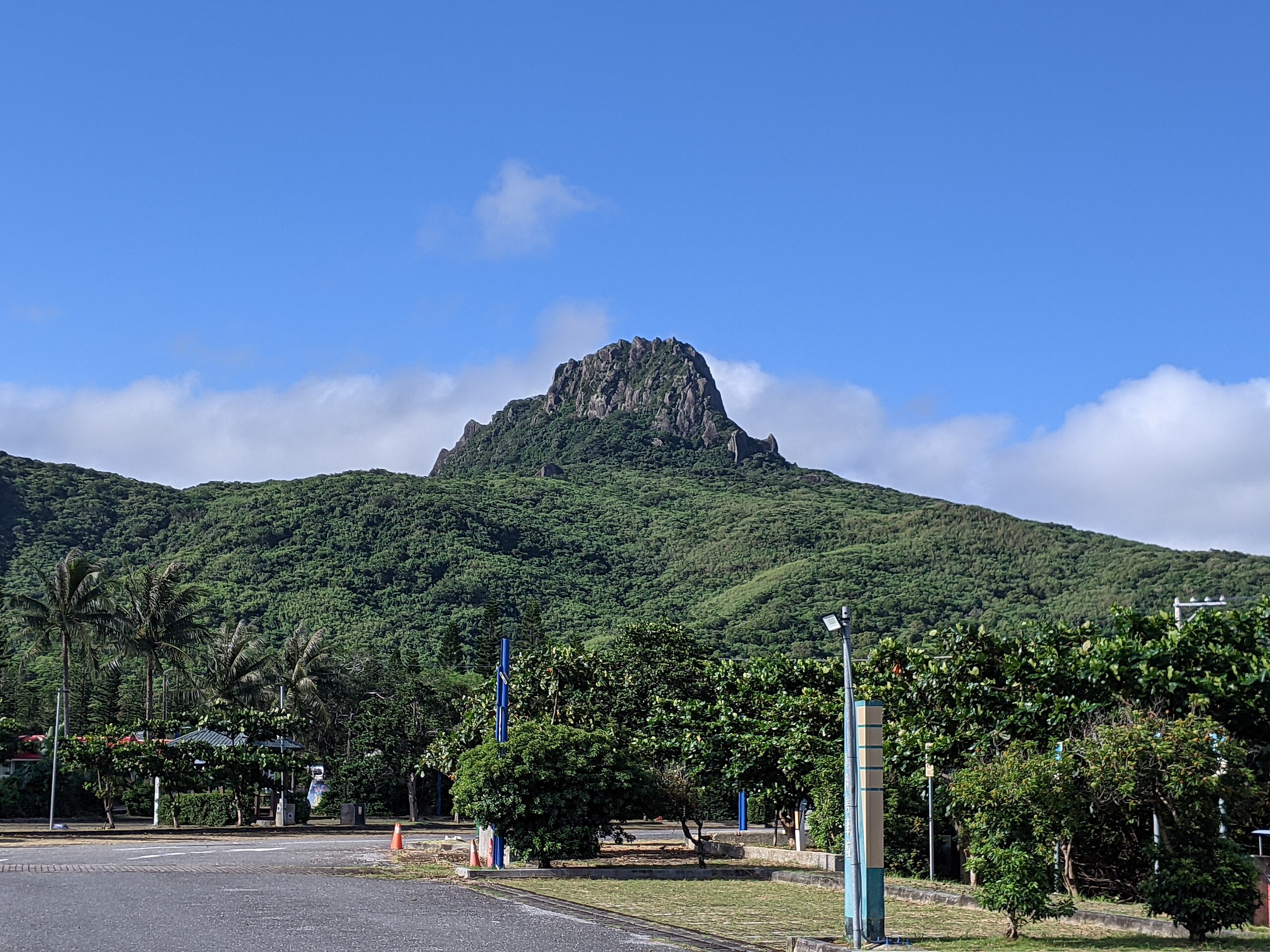
中文(臺灣):Legend has it that Mt.Dajianshi is the holy place for SEQALU indigenous people.
|
||
Date | |||
Source | Own work | ||
Author | 陳俊豪 |
Camera location | 21° 56′ 46″ N, 120° 47′ 37.8″ E | View this and other nearby images on: OpenStreetMap | 21.946111; 120.793833 |
---|
Licensing
[edit]- You are free:
- to share – to copy, distribute and transmit the work
- to remix – to adapt the work
- Under the following conditions:
- attribution – You must give appropriate credit, provide a link to the license, and indicate if changes were made. You may do so in any reasonable manner, but not in any way that suggests the licensor endorses you or your use.
- share alike – If you remix, transform, or build upon the material, you must distribute your contributions under the same or compatible license as the original.
This image was uploaded as part of Wiki Loves Earth 2022.
aragonés ∙ asturianu ∙ azərbaycanca ∙ Bahasa Indonesia ∙ Bahasa Melayu ∙ brezhoneg ∙ català ∙ čeština ∙ Cymraeg ∙ dagbanli ∙ Deutsch ∙ eesti ∙ English ∙ español ∙ euskara ∙ français ∙ galego ∙ hrvatski ∙ italiano ∙ latviešu ∙ Nederlands ∙ norsk ∙ norsk bokmål ∙ português ∙ polski ∙ português do Brasil ∙ română ∙ shqip ∙ sicilianu ∙ slovenščina ∙ svenska ∙ Tagalog ∙ Türkçe ∙ Ελληνικά ∙ беларуская (тарашкевіца) ∙ български ∙ македонски ∙ русский ∙ српски / srpski ∙ українська ∙ ქართული ∙ հայերեն ∙ नेपाली ∙ मराठी ∙ বাংলা ∙ മലയാളം ∙ ไทย ∙ 한국어 ∙ 日本語 ∙ 中文 ∙ 中文(台灣) ∙ 中文(简体) ∙ 中文(繁體) ∙ עברית ∙ اردو ∙ العربية ∙ فارسی ∙ +/− |
File history
Click on a date/time to view the file as it appeared at that time.
Date/Time | Thumbnail | Dimensions | User | Comment | |
---|---|---|---|---|---|
current | 12:30, 15 June 2022 | 4,032 × 3,024 (2.41 MB) | Zidane0615 (talk | contribs) | Uploaded own work with UploadWizard |
You cannot overwrite this file.
File usage on Commons
There are no pages that use this file.
Metadata
This file contains additional information such as Exif metadata which may have been added by the digital camera, scanner, or software program used to create or digitize it. If the file has been modified from its original state, some details such as the timestamp may not fully reflect those of the original file. The timestamp is only as accurate as the clock in the camera, and it may be completely wrong.
Camera manufacturer | |
---|---|
Camera model | Pixel 3a XL |
Exposure time | 383/1,000,000 sec (0.000383) |
F-number | f/1.8 |
ISO speed rating | 60 |
Date and time of data generation | 16:11, 14 August 2021 |
Lens focal length | 4.44 mm |
Latitude | 21° 56′ 46″ N |
Longitude | 120° 47′ 37.8″ E |
Altitude | 34.93 meters above sea level |
Width | 4,032 px |
Height | 3,024 px |
Orientation | Normal |
Horizontal resolution | 72 dpi |
Vertical resolution | 72 dpi |
Software used | HDR+ 1.0.377695977zd |
File change date and time | 16:11, 14 August 2021 |
Y and C positioning | Centered |
Exposure Program | Normal program |
Exif version | 2.31 |
Date and time of digitizing | 16:11, 14 August 2021 |
Meaning of each component |
|
APEX shutter speed | 11.35 |
APEX aperture | 1.7 |
APEX brightness | 8.78 |
APEX exposure bias | 0 |
Maximum land aperture | 1.7 APEX (f/1.8) |
Subject distance | 0.898 meters |
Metering mode | Center weighted average |
Flash | Flash did not fire, auto mode |
DateTime subseconds | 975 |
DateTimeOriginal subseconds | 975 |
DateTimeDigitized subseconds | 975 |
Supported Flashpix version | 1 |
Color space | sRGB |
Sensing method | One-chip color area sensor |
Scene type | A directly photographed image |
Custom image processing | Custom process |
Exposure mode | Auto exposure |
White balance | Auto white balance |
Digital zoom ratio | 2.23 |
Focal length in 35 mm film | 27 mm |
Scene capture type | Standard |
Contrast | Normal |
Saturation | Normal |
Sharpness | Normal |
Subject distance range | Macro |
GPS time (atomic clock) | 08:11 |
Reference for direction of image | Magnetic direction |
Direction of image | 70 |
GPS date | 14 August 2021 |
Structured data
Items portrayed in this file
depicts
14 August 2021
21°56'46.000"N, 120°47'37.799"E
2,526,196 byte
3,024 pixel
4,032 pixel
image/jpeg
33041bd26b2bfeef746bd38bf4f2d1dded0fd4fb
0.000383 second
1.8
4.44 millimetre
- Protected areas with known WDPA-ID
- Files with coordinates missing SDC location of creation
- CC-BY-SA-4.0
- Self-published work
- Images from Wiki Loves Earth 2022
- Images from Wiki Loves Earth 2022 in Taiwan
- Images from Wiki Loves Earth missing SDC depicts
- Images from Wiki Loves Earth missing SDC location of creation
- Uploaded via Campaign:wle-tw