File:Mullerova mapa Cech 10 Broumov.jpg
Jump to navigation
Jump to search

Size of this preview: 662 × 600 pixels. Other resolutions: 265 × 240 pixels | 530 × 480 pixels | 847 × 768 pixels | 1,130 × 1,024 pixels | 2,049 × 1,857 pixels.
Original file (2,049 × 1,857 pixels, file size: 2.9 MB, MIME type: image/jpeg)
Captions
Captions
Add a one-line explanation of what this file represents
Summary
[edit]
| Description |
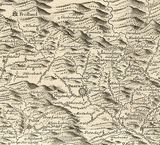
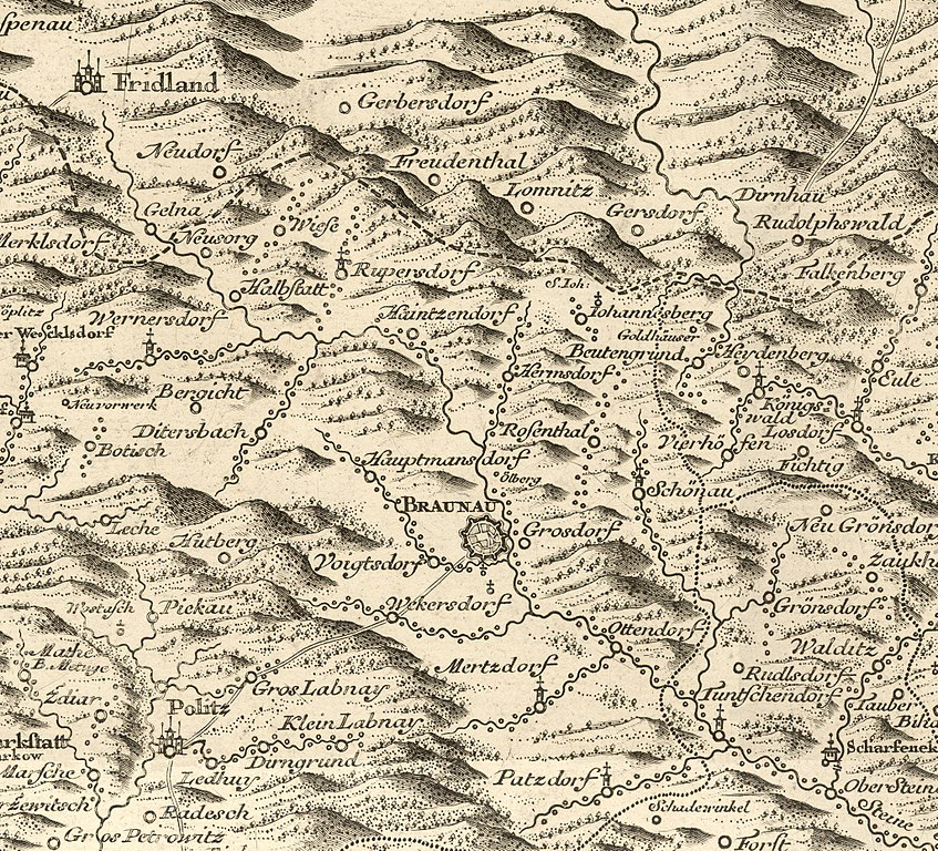
Čeština: Müllerova mapa Čech z roku 1720, mapový list 10, výřez okolí města Broumov. |
|||||||||||||||||||
| Date | ||||||||||||||||||||
| Source | File:Mullerova mapa Cech 10.jpg | |||||||||||||||||||
| Author |
|
|||||||||||||||||||
| Camera location | | View this and other nearby images on: OpenStreetMap |
|---|
This image was acquired during the event Wikiměsto Broumov 2018.
|
Licensing
[edit]
|
This work is in the public domain in its country of origin and other countries and areas where the copyright term is the author's life plus 70 years or fewer. This work is in the public domain in the United States because it was published (or registered with the U.S. Copyright Office) before January 1, 1929. | |
| This file has been identified as being free of known restrictions under copyright law, including all related and neighboring rights. | |
| Annotations | This image is annotated: View the annotations at Commons |
File history
Click on a date/time to view the file as it appeared at that time.
| Date/Time | Thumbnail | Dimensions | User | Comment | |
|---|---|---|---|---|---|
| current | 06:55, 21 May 2018 | | 2,049 × 1,857 (2.9 MB) | Gampe (talk | contribs) | User created page with UploadWizard |
You cannot overwrite this file.
File usage on Commons
The following page uses this file:
File usage on other wikis
The following other wikis use this file:
- Usage on cs.wikipedia.org