File:NPS grand-canyon-national-park-map.pdf
Jump to navigation
Jump to search

Size of this JPG preview of this PDF file: 792 × 599 pixels. Other resolutions: 317 × 240 pixels | 634 × 480 pixels | 1,015 × 768 pixels | 1,280 × 969 pixels | 2,560 × 1,937 pixels | 3,314 × 2,508 pixels.
Original file (3,314 × 2,508 pixels, file size: 15.2 MB, MIME type: application/pdf)
Captions
Captions
Add a one-line explanation of what this file represents
Summary[edit]
| Description |
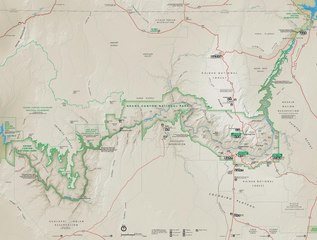
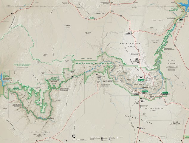
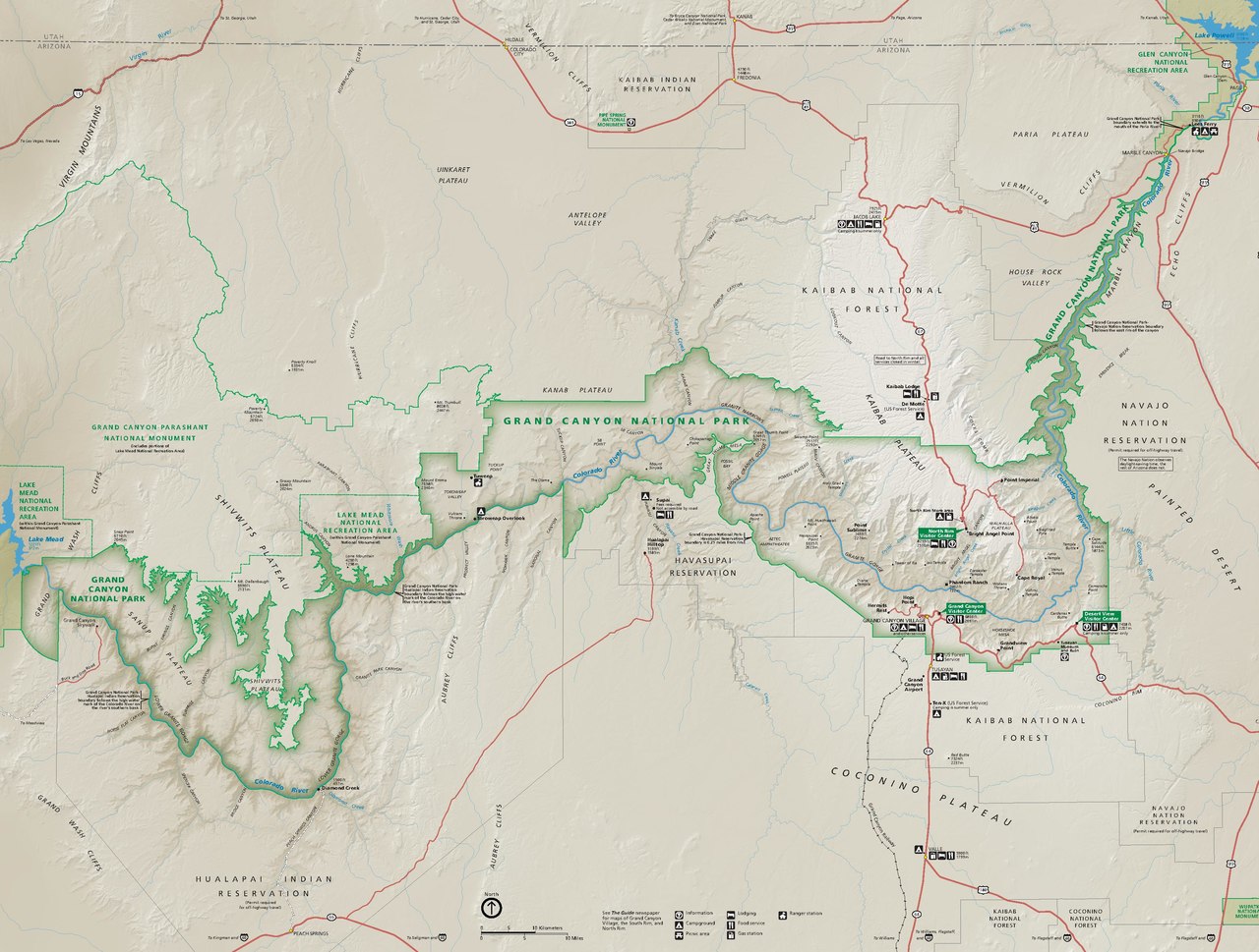
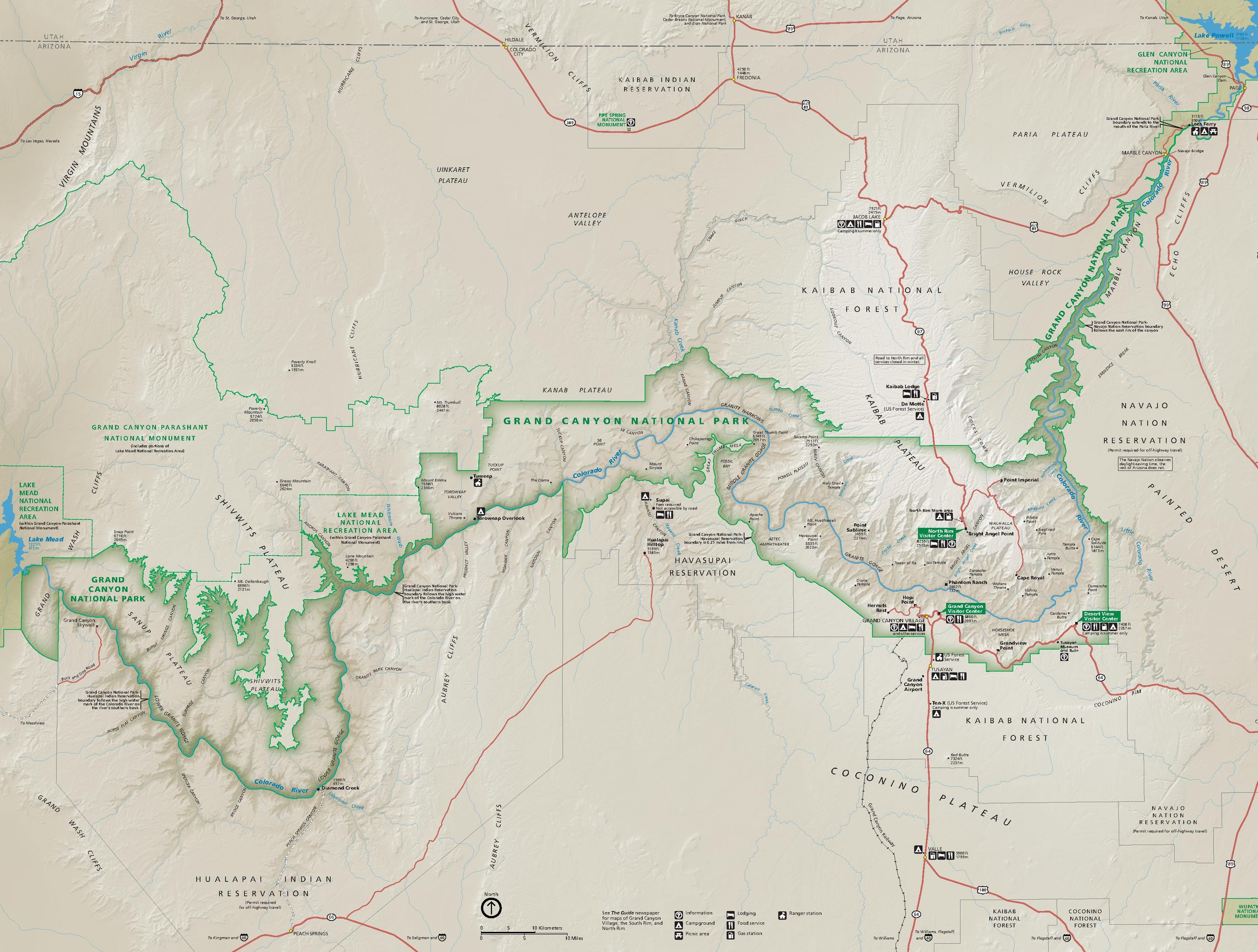
English: Newest Grand Canyon National Park map, and shows the entire national park including the far-flung less-visited locations. |
| Date | |
| Source | U.S. National Park Service (http://npmaps.com/wp-content/uploads/grand-canyon-national-park-map.pdf) |
| Author | U.S. National Park Service, restoration/cleanup by Matt Holly |
| Other versions |
 |
Licensing[edit]
| This image or media file contains material based on a work of a National Park Service employee, created as part of that person's official duties. As a work of the U.S. federal government, such work is in the public domain in the United States. See the NPS website and NPS copyright policy for more information. |
File history
Click on a date/time to view the file as it appeared at that time.
| Date/Time | Thumbnail | Dimensions | User | Comment | |
|---|---|---|---|---|---|
| current | 23:11, 16 May 2017 | 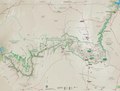 | 3,314 × 2,508 (15.2 MB) | RKBot (talk | contribs) | =={{int:filedesc}}== {{Information |description= {{en|1=Newest Grand Canyon National Park map, and shows the entire national park including the far-flung less-visited locations.}} |date= 2016-02-01 |source= U.S. National Park Service (http://npmaps.com... |
You cannot overwrite this file.
File usage on Commons
The following 2 pages use this file:
Metadata
Categories:
- Maps of Grand Canyon National Park
- Grand Canyon Skywalk
- Grand Canyon West
- Grand Canyon, West Region
- Kanab Canyon
- Kanab Creek
- Jumpup Canyon
- Great Thumb Point
- Great Thumb Mesa
- Granite Narrows
- Middle Granite Gorge
- Tapeats Canyon
- Tapeats Creek
- Powell Plateau
- Swamp Point
- Muav Canyon
- Shinumo Canyon
- Shinumo Creek
- Point Sublime
- Crystal Canyon
- Crystal Creek (Arizona)
- Diana Temple
- Nankoweap Canyon
- Nankoweap Creek
- Cape Solitude
- Comanche Point
- Shivwits Plateau
- Parashant Canyon
- Tuckup Point
- Tuckup Canyon
- SB Point
- SB Canyon
- Tuweep
- Tuweep Area