File:NY 43 former routing map late 1940s.png
Jump to navigation
Jump to search
Size of this preview: 800 × 421 pixels. Other resolutions: 320 × 168 pixels | 640 × 337 pixels | 1,024 × 539 pixels | 1,601 × 843 pixels.
Original file (1,601 × 843 pixels, file size: 3.13 MB, MIME type: image/png)
Captions
Captions
Add a one-line explanation of what this file represents
Summary[edit]
| Description |
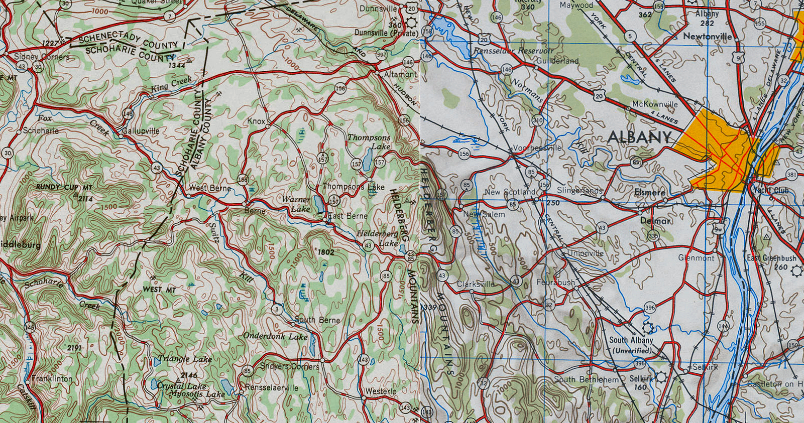
English: A map of New York State Route 43's former routing west of Albany, New York, created by cropping portions of the United State Geological Survey's 1947 Albany and 1948 Binghamton 1:250,000 scale quadrangles and splicing them together. |
| Date | (Albany quad); 1948 (Binghamton quad) |
| Source | http://www.lib.utexas.edu/maps/topo/250k/txu-pclmaps-topo-us-albany-1947.jpg and http://www.lib.utexas.edu/maps/topo/250k/txu-pclmaps-topo-us-binghamton-1948.jpg |
| Author | United States Geological Survey |
Licensing[edit]
This image is in the public domain in the United States because it only contains materials that originally came from the United States Geological Survey, an agency of the United States Department of the Interior. For more information, see the official USGS copyright policy.
|
File history
Click on a date/time to view the file as it appeared at that time.
| Date/Time | Thumbnail | Dimensions | User | Comment | |
|---|---|---|---|---|---|
| current | 16:32, 19 June 2009 | | 1,601 × 843 (3.13 MB) | TwinsMetsFan (talk | contribs) | {{Information |Description={{en|1=A map of w:New York State Route 43's former routing west of Albany, New York, created by cropping portions of the United State Geological Survey's 1947 Albany and 1948 Binghamton 1:250,000 scale quadrangles and splic |
You cannot overwrite this file.
File usage on Commons
The following page uses this file:
File usage on other wikis
The following other wikis use this file:
- Usage on en.wikipedia.org