File:Nanzhao.png
Jump to navigation
Jump to search
Size of this preview: 800 × 536 pixels. Other resolutions: 320 × 214 pixels | 640 × 429 pixels | 1,024 × 686 pixels | 1,280 × 857 pixels | 1,560 × 1,045 pixels.
Original file (1,560 × 1,045 pixels, file size: 3.11 MB, MIME type: image/png)
Captions
Captions
Add a one-line explanation of what this file represents
Summary[edit]
| Description |
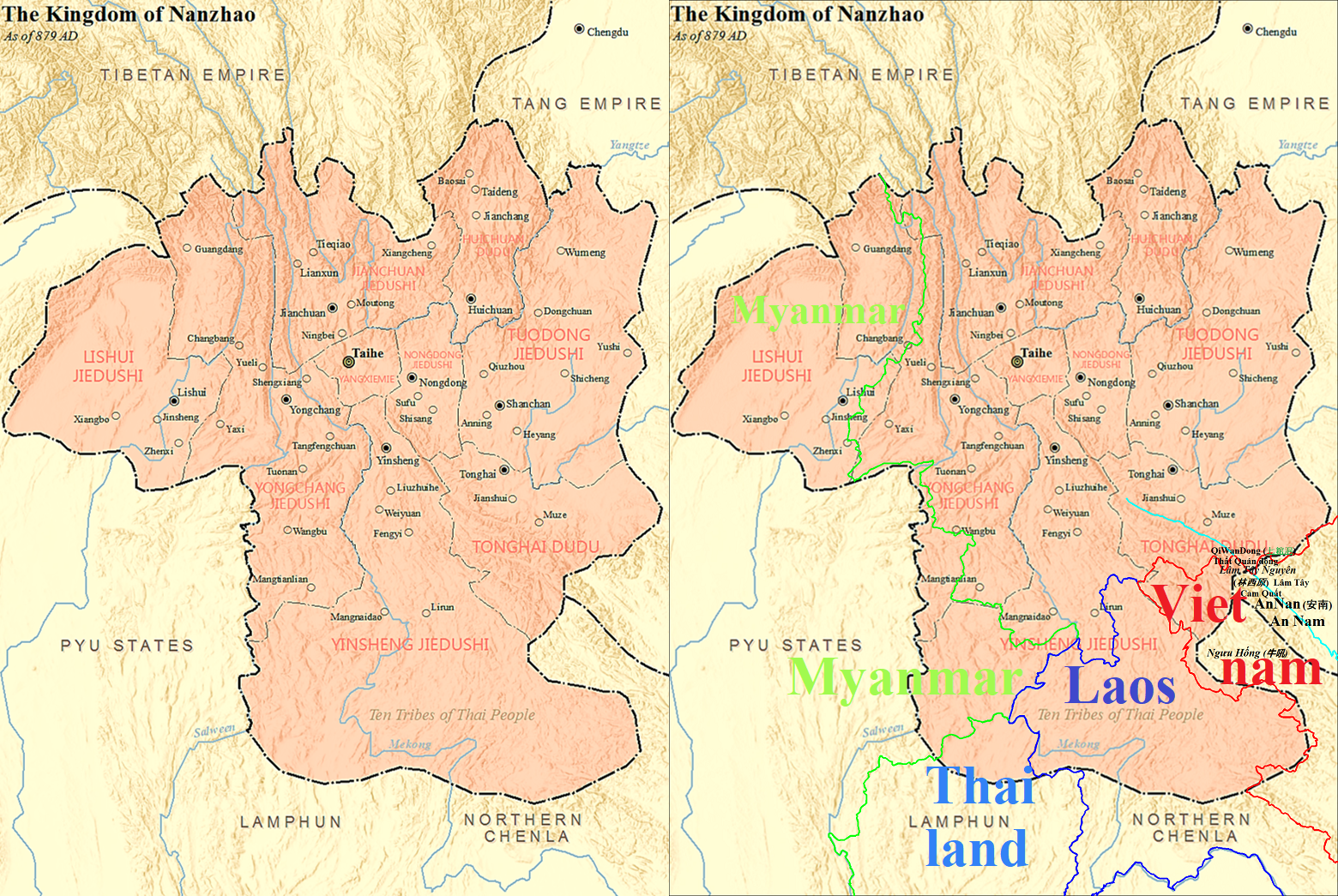
English: Map of the Kingdom of Nanzhao (left) as of 879 AD, comparing with the modern national borders (right). 中文(简体):公元879年南诏国地图(左)与现代国境线相比较。 |
| Date | |
| Source | Own work |
| Author | SY |
| Other versions |
 |
Licensing[edit]
I, the copyright holder of this work, hereby publish it under the following license:
This file is licensed under the Creative Commons Attribution-Share Alike 4.0 International license.
- You are free:
- to share – to copy, distribute and transmit the work
- to remix – to adapt the work
- Under the following conditions:
- attribution – You must give appropriate credit, provide a link to the license, and indicate if changes were made. You may do so in any reasonable manner, but not in any way that suggests the licensor endorses you or your use.
- share alike – If you remix, transform, or build upon the material, you must distribute your contributions under the same or compatible license as the original.
File history
Click on a date/time to view the file as it appeared at that time.
| Date/Time | Thumbnail | Dimensions | User | Comment | |
|---|---|---|---|---|---|
| current | 04:33, 21 May 2022 | | 1,560 × 1,045 (3.11 MB) | Doãn Hiệu (talk | contribs) | Drawing the territories of modern Southeast Asian countries. |
| 12:22, 24 March 2022 |  | 1,560 × 1,045 (3.11 MB) | Doãn Hiệu (talk | contribs) | Thêm bản sao có vẽ đường biên giới các quốc gia hiện đại. |
You cannot overwrite this file.
File usage on Commons
The following page uses this file:
File usage on other wikis
The following other wikis use this file:
- Usage on pt.wikipedia.org
- Usage on uk.wikipedia.org
- Usage on vi.wikipedia.org