File:National forest wilderness and primitive areas, January 1, 1965 LOC 79692719.jpg
Jump to navigation
Jump to search
Size of this preview: 800 × 342 pixels. Other resolutions: 320 × 137 pixels | 640 × 273 pixels | 1,024 × 437 pixels | 1,280 × 547 pixels | 2,560 × 1,093 pixels | 7,358 × 3,142 pixels.
Original file (7,358 × 3,142 pixels, file size: 2.87 MB, MIME type: image/jpeg)
Captions
Captions
Add a one-line explanation of what this file represents
Summary
[edit]| Description |
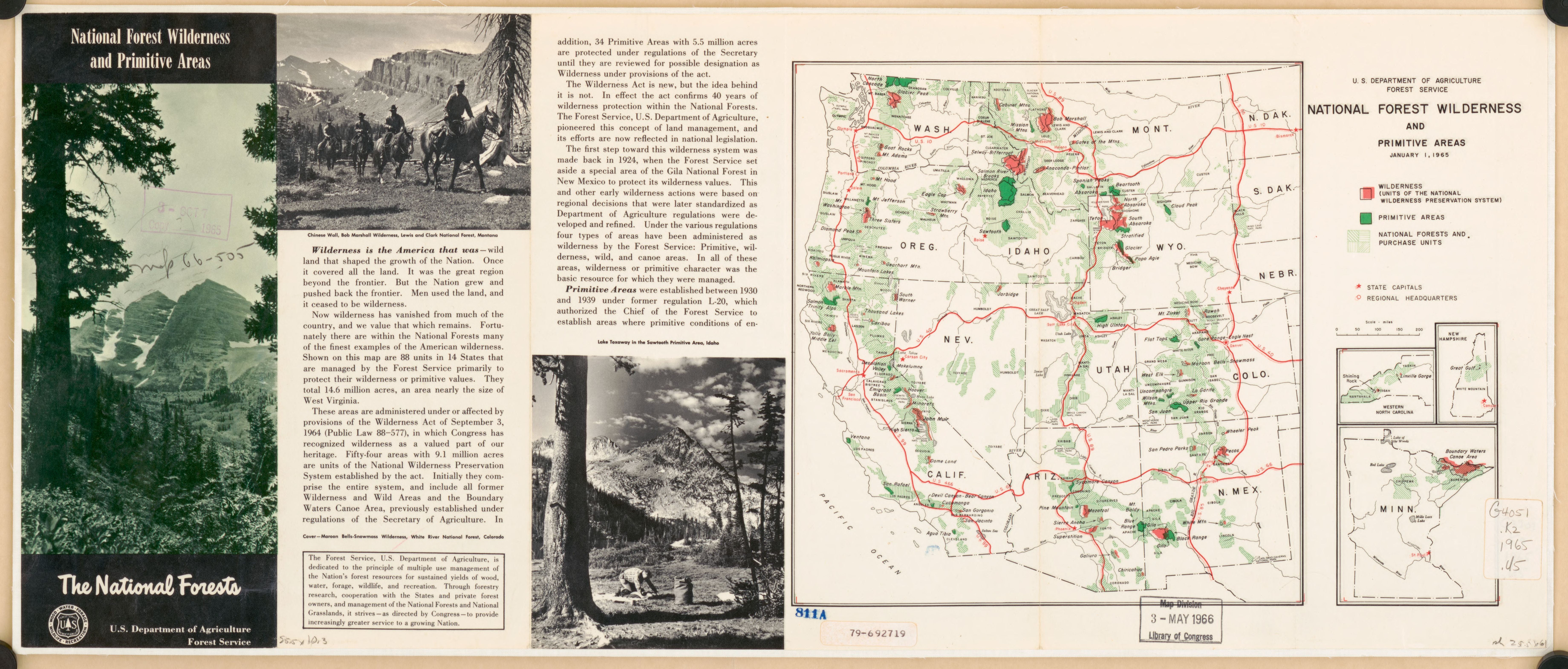
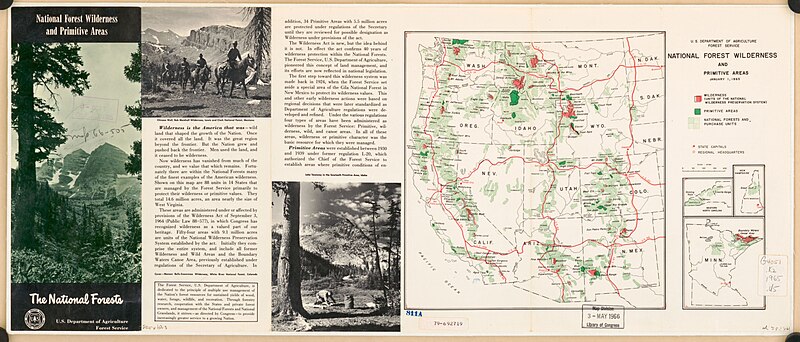
English: Scale ca. 1:9,200,000. Folded title: National forest wilderness and primitive areas : the national forests. Includes maps of "Western North Carolina," "New Hampshire," and Minnesota, text, and ill. (some col.). Available also through the Library of Congress Web site as a raster image. AACR2 |
||
| Title | National forest wilderness and primitive areas, January 1, 1965 | ||
| Shelf ID | G4051.K2 1965 .U5 | ||
| Date | |||
| Source | https://www.loc.gov/item/79692719/ | ||
| Author | United States. Forest Service | ||
| Permission (Reusing this file) |
|
||
| Other versions |
|
||
| Location | United States · West · West. | ||
| Part of | American Memory · General Maps · Catalog · Geography And Map Division | ||
| Subject | Forest Reserves · West · Wilderness Areas · West (U.S.) · United States · Maps |

Licensing
[edit]
| This work is from the Library of Congress. According to the library, there are no known copyright restrictions on the use of this work. |  |
File history
Click on a date/time to view the file as it appeared at that time.
| Date/Time | Thumbnail | Dimensions | User | Comment | |
|---|---|---|---|---|---|
| current | 12:52, 4 March 2020 | | 7,358 × 3,142 (2.87 MB) | Fæ (talk | contribs) | LOC Maps https://www.loc.gov/item/79692719/ #4730 |
You cannot overwrite this file.
File usage on Commons
The following page uses this file: