File:NetherlandsNewGuinea-1916.jpg

Original file (3,000 × 1,895 pixels, file size: 6.3 MB, MIME type: image/jpeg)
Captions
Captions
Summary
[edit]
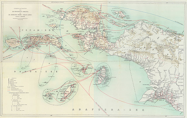
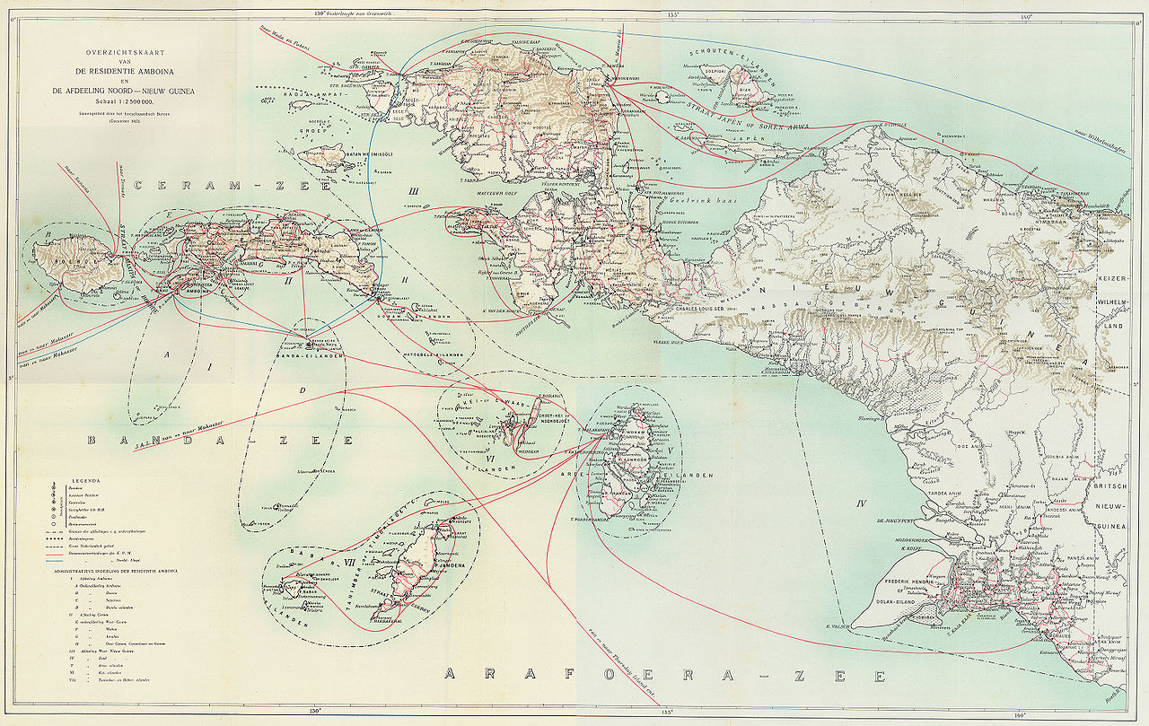
Steamboat connections in Netherlands New Guinea (1915)
[edit]
This map, published in 1915, is an overview of steamboat connections in the Western New Guinea region. The image was published in Batavia (now Jakarta, Indonesia) in what was then known as the Dutch East Indies. The map is published by a company called G. Kolff & Co and uploaded by PapuaWeb.org archive copy at the Wayback Machine on the Maps of Papua archive copy at the Wayback Machine page. As per the Netherlands Copyright Act of 1912 archive copy at the Wayback Machine, which applies to works published in the Dutch East Indies (Article 47a), the copyright has expired on 1 January 1986 because only the publishing company, not the author, is known (Article 38).
From en:Image:NetherlandsNewGuinea-1916.jpg by en:User:Arsonal
Licensing
[edit]
|
This work is in the public domain in its country of origin and other countries and areas where the copyright term is the author's life plus 70 years or fewer. | |
| This file has been identified as being free of known restrictions under copyright law, including all related and neighboring rights. | |
File history
Click on a date/time to view the file as it appeared at that time.
| Date/Time | Thumbnail | Dimensions | User | Comment | |
|---|---|---|---|---|---|
| current | 21:52, 6 July 2006 | | 3,000 × 1,895 (6.3 MB) | Hardscarf (talk | contribs) | == Summary == === Military Expeditions to Nederlands Nieuw-Guinea 1907-1915 === This map published in 1916 is a documentation of Dutch military expeditions to the Western New Guinea region. The image was published in Batavia (now Jakarta, Indonesia) in |
You cannot overwrite this file.
File usage on Commons
The following 5 pages use this file:
File usage on other wikis
The following other wikis use this file:
- Usage on ar.wikipedia.org
- Usage on arz.wikipedia.org
- Usage on ban.wikipedia.org
- Usage on ca.wikipedia.org
- Usage on cs.wikipedia.org
- Usage on de.wikipedia.org
- Usage on en.wikipedia.org
- Usage on eo.wikipedia.org
- Usage on es.wikipedia.org
- Usage on fr.wikipedia.org
- Usage on id.wikipedia.org
- Usage on it.wikipedia.org
- Usage on ja.wikipedia.org
- Usage on ko.wikipedia.org
- Usage on nl.wikipedia.org
- Usage on pam.wikipedia.org
- Usage on pl.wikipedia.org
- Usage on pt.wikipedia.org
- Usage on ru.wikipedia.org
- Usage on sq.wikipedia.org
- Usage on sv.wikipedia.org
- Usage on tr.wikipedia.org
- Usage on www.wikidata.org
- Usage on zea.wikipedia.org
- Usage on zh.wikipedia.org