File:Nevada ecoregion map.gif
From Wikimedia Commons, the free media repository
Jump to navigation
Jump to search

Size of this preview: 416 × 599 pixels. Other resolutions: 167 × 240 pixels | 333 × 480 pixels | 533 × 768 pixels | 711 × 1,024 pixels | 1,434 × 2,065 pixels.
Original file (1,434 × 2,065 pixels, file size: 481 KB, MIME type: image/gif, 0.1 s)
File information
Structured data
Captions
Captions
Add a one-line explanation of what this file represents
Summary[edit]
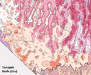
| DescriptionNevada ecoregion map.gif | Map of EPA ecoregions of Nevada | ||||||
| Date | 1 May 2022 (original upload date) | ||||||
| Source | https://gaftp.epa.gov/EPADataCommons/ORD/Ecoregions/nv/nv_eco_pg.pdf | ||||||
| Author | U.S. Environmental Protection Agency | ||||||
| Permission (Reusing this file) |
|
||||||
| Other versions |
|
||||||
| Key InfoField |
|
File history
Click on a date/time to view the file as it appeared at that time.
| Date/Time | Thumbnail | Dimensions | User | Comment | |
|---|---|---|---|---|---|
| current | 06:46, 2 May 2022 |  | 1,434 × 2,065 (481 KB) | Hike395 (talk | contribs) | remove minor artifacts |
| 03:12, 2 May 2022 |  | 1,434 × 2,065 (484 KB) | Hike395 (talk | contribs) | {{Information |Description=Map of EPA ecoregions of Nevada |Source=https://gaftp.epa.gov/EPADataCommons/ORD/Ecoregions/nv/nv_eco_pg.pdf |Date={{Original upload date|2022-05-01}} |Author=U.S. Environmental Protection Agency |Permission={{PD-USGov-EPA}} |other_versions={{Extracted|TonopahBasin.png|size=50}} }} |
You cannot overwrite this file.
File usage on Commons
There are no pages that use this file.
Metadata
This file contains additional information such as Exif metadata which may have been added by the digital camera, scanner, or software program used to create or digitize it. If the file has been modified from its original state, some details such as the timestamp may not fully reflect those of the original file. The timestamp is only as accurate as the clock in the camera, and it may be completely wrong.
| GIF file comment | Optimized with https://ezgif.com/optimize |
|---|
Hidden categories:


