File:Niger River, Mali (MODIS 2018-10-20).jpg
Jump to navigation
Jump to search

Size of this preview: 800 × 556 pixels. Other resolutions: 320 × 222 pixels | 640 × 445 pixels | 1,024 × 712 pixels | 1,280 × 890 pixels | 2,560 × 1,779 pixels | 4,445 × 3,089 pixels.
Original file (4,445 × 3,089 pixels, file size: 1.59 MB, MIME type: image/jpeg)
Captions
Captions
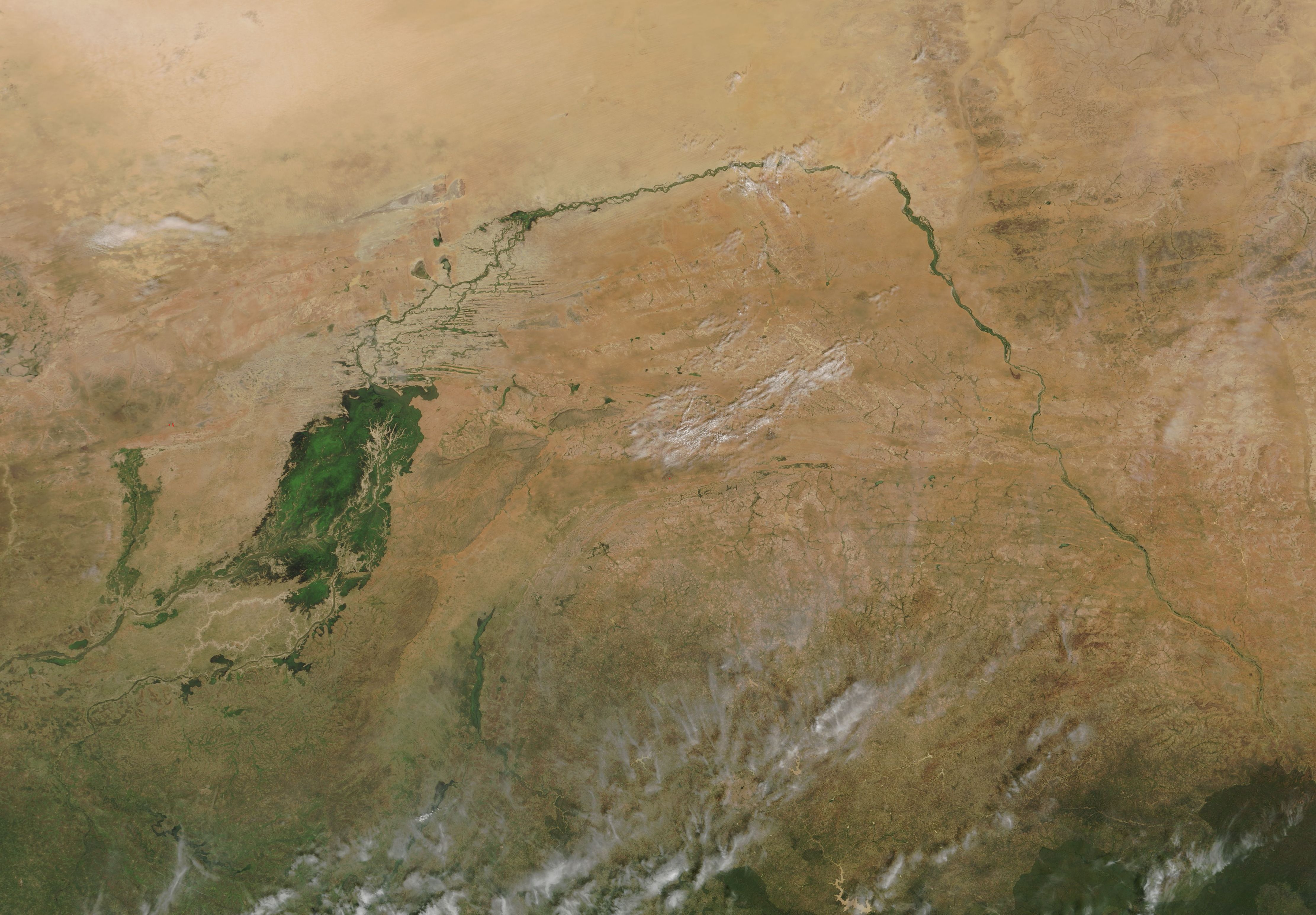
The Moderate Resolution Imaging Spectroradiometer (MODIS) on board NASA’s Terra satellite acquired a true-color image of the Niger River as it makes its way across Mali and the green Inland Niger Delta on October 17, 2018.
Summary[edit]
.jpg&action=edit§ion=1)
| Description |
English: The Niger River courses along a crescent shape through parched, landlocked Mali. The third-longest river in Africa, the Niger skirts the edge of the Sahara Desert before turning southward to join the Bani River. The confluence of the two rivers – and a network of smaller streams – gives rise to the Inland Niger Delta, a green oasis comprised of twisting waterways and tiny islands.
The size of the Inland Delta depends on the season - the delta grows to about 20,000 square kilometers (7,700 square miles) during the four-month rainy season that begins in July and can shrink to about 3,900 square kilometers (1,500 square miles) during the dry season. The Moderate Resolution Imaging Spectroradiometer (MODIS) on board NASA’s Terra satellite acquired a true-color image of the Niger River as it makes its way across Mali and the green Inland Niger Delta on October 17, 2018. |
||
| Date | Taken on 17 October 2018 | ||
| Source |
Niger River, Mali (direct link)
|
||
| Author | MODIS Land Rapid Response Team, NASA GSFC |
| This media is a product of the Terra mission Credit and attribution belongs to the mission team, if not already specified in the "author" row |
Licensing[edit]
.jpg&action=edit§ion=2)
| This file is in the public domain in the United States because it was solely created by NASA. NASA copyright policy states that "NASA material is not protected by copyright unless noted". (See Template:PD-USGov, NASA copyright policy page or JPL Image Use Policy.) | ||
 |
Warnings:
|
File history
Click on a date/time to view the file as it appeared at that time.
| Date/Time | Thumbnail | Dimensions | User | Comment | |
|---|---|---|---|---|---|
| current | 01:26, 17 February 2024 | | 4,445 × 3,089 (1.59 MB) | OptimusPrimeBot (talk | contribs) | #Spacemedia - Upload of http://modis.gsfc.nasa.gov/gallery/images/image10202018_250m.jpg via Commons:Spacemedia |
You cannot overwrite this file.
File usage on Commons
There are no pages that use this file.
.jpg&oldid=852771019)