File:North East England districts 2011 map.svg
ナビゲーションに移動
検索に移動

この SVG ファイルのこの PNG プレビューのサイズ: 482 × 599 ピクセル. その他の解像度: 193 × 240 ピクセル | 386 × 480 ピクセル | 618 × 768 ピクセル | 824 × 1,024 ピクセル | 1,647 × 2,048 ピクセル | 1,082 × 1,345 ピクセル。
元のファイル (SVG ファイル、1,082 × 1,345 ピクセル、ファイルサイズ: 697キロバイト)
キャプション
キャプション
このファイルの内容を1行で記述してください
概要
[編集]
| 解説 |
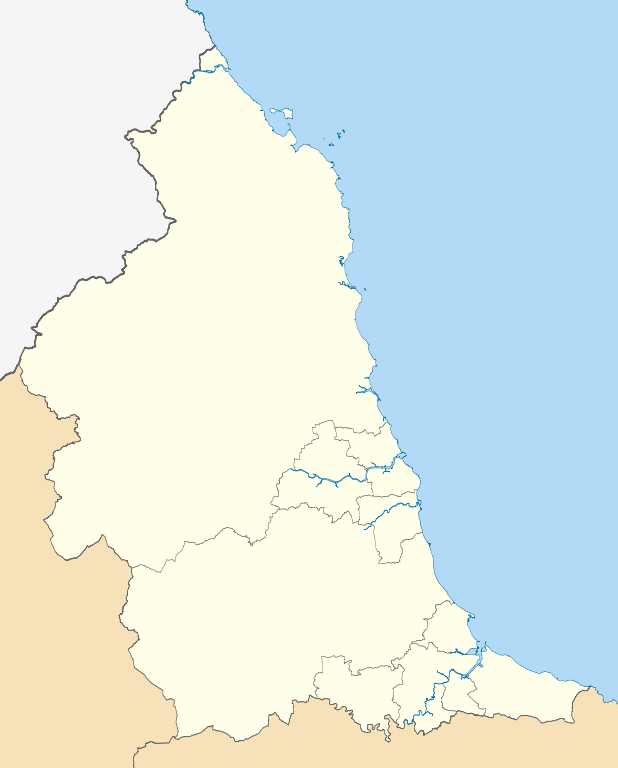
Map of the North East England region showing the administrative districts. Equirectangular map projection on WGS 84 datum, with N/S stretched 170% Geographic limits:
|
| 日付 | |
| 原典 |
|
| 作者 | Nilfanion, created using Ordnance Survey data |
| その他のバージョン |
このファイルの派生的著作物: |
ライセンス
[編集]
この作品の著作権者である私は、この作品を以下のライセンスで提供します。
このファイルはクリエイティブ・コモンズ 表示-継承 3.0 非移植ライセンスのもとに利用を許諾されています。
- あなたは以下の条件に従う場合に限り、自由に
- 共有 – 本作品を複製、頒布、展示、実演できます。
- 再構成 – 二次的著作物を作成できます。
- あなたの従うべき条件は以下の通りです。
- 表示 – あなたは適切なクレジットを表示し、ライセンスへのリンクを提供し、変更があったらその旨を示さなければなりません。これらは合理的であればどのような方法で行っても構いませんが、許諾者があなたやあなたの利用行為を支持していると示唆するような方法は除きます。
- 継承 – もしあなたがこの作品をリミックスしたり、改変したり、加工した場合には、あなたはあなたの貢献部分を元の作品とこれと同一または互換性があるライセンスの下に頒布しなければなりません。

|
この文書は、フリーソフトウェア財団発行のGNUフリー文書利用許諾書 (GNU Free Documentation License) 1.2またはそれ以降のバージョンの規約に基づき、複製や再配布、改変が許可されます。不可変更部分、表紙、背表紙はありません。このライセンスの複製は、GNUフリー文書利用許諾書という章に含まれています。 |
あなたは上記のライセンスから、どれか一つ以上を選択できます。
ファイルの履歴
過去の版のファイルを表示するには、その版の日時をクリックしてください。
| 日付と時刻 | サムネイル | 寸法 | 利用者 | コメント | |
|---|---|---|---|---|---|
| 現在の版 | 2011年5月1日 (日) 18:56 | | 1,082 × 1,345 (697キロバイト) | Nilfanion (トーク | 投稿記録) | == Summary == {{Information |Description=Map of the North East England region showing the administrative districts. Equirectangular map projection on WGS 84 datum, with N/S stretched 170% Geographic limits: *West: 2.75W *East: 0 |
このファイルは上書きできません。
ファイルの使用状況
以下の 3 ページがこのファイルを使用しています:
グローバルなファイル使用状況
以下に挙げる他のウィキがこの画像を使っています:
- ar.wikipedia.org での使用状況
- en.wikipedia.org での使用状況
- North East England
- Northumberland
- Newcastle upon Tyne
- Tyne and Wear
- Guisborough
- Battle of Newburn
- Northern Football League
- Middlesbrough
- South Tyneside
- Redcar and Cleveland
- North Tyneside
- Redcar
- County Durham
- Template:NE England
- City of Sunderland
- Metropolitan Borough of Gateshead
- Borough of Stockton-on-Tees
- Tees Valley
- Saltburn-by-the-Sea
- Borough of Darlington
- Borough of Hartlepool
- User:Phildav76/Regional templates
- Greater Eston
- Portal:North East England
- North 1 East
- Cleveland (county)
- Wikipedia:WikiProject Countries/Templates/Navboxes/European country subdivisions
- Bishops' Wars
- Morpeth Chantry Bagpipe Museum
- Weardale campaign
- Francis Anderson (MP for Newcastle-upon-Tyne)
- Henry Anderson (Cavalier)
- North East Regional Women's Football League
- Counties 2 Durham & Northumberland
- Counties 3 Durham & Northumberland
- Portal:North East England/Topics
- 1990–91 Northern Counties East Football League
- 1989–90 Northern Counties East Football League
- Darlington Hebrew Congregation
- List of boundary changes in North East England
- Module:Location map/data/North East England
- Module:Location map/data/North East England/doc
- 1991–92 Northern Counties East Football League
- 1992–93 Northern Counties East Football League
- 2018–19 Northern Football League
- 2019–20 Northern Football League
- Sieges of Berwick (1355 and 1356)
- 2020–21 Northern Football League
このファイルのグローバル使用状況を表示する。