File:North Warwickshire UK ward map 2019.svg
Jump to navigation
Jump to search

Size of this PNG preview of this SVG file: 548 × 600 pixels. Other resolutions: 219 × 240 pixels | 439 × 480 pixels | 702 × 768 pixels | 936 × 1,024 pixels | 1,872 × 2,048 pixels | 1,157 × 1,266 pixels.
Original file (SVG file, nominally 1,157 × 1,266 pixels, file size: 453 KB)
Captions
Captions
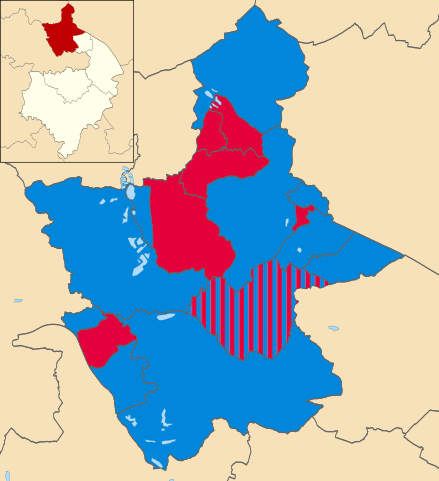
Map of North Warwickshire, Warwickshire, UK showing the current representation on the Borough Council as of the elections of May 2019.
Summary[edit]
| Description |
English: Map of North Warwickshire, Warwickshire, UK showing the current representation on the Borough Council as of the elections of May 2019. Colours: Labour Conservative |
| Date | |
| Source | |
| Author |
North_Warwickshire_UK_ward_map_2010_(blank).svg: Nilfanion, created using Ordnance Survey data |
.svg)
Licensing[edit]
This file is licensed under the Creative Commons Attribution-Share Alike 3.0 Unported license.
- You are free:
- to share – to copy, distribute and transmit the work
- to remix – to adapt the work
- Under the following conditions:
- attribution – You must give appropriate credit, provide a link to the license, and indicate if changes were made. You may do so in any reasonable manner, but not in any way that suggests the licensor endorses you or your use.
- share alike – If you remix, transform, or build upon the material, you must distribute your contributions under the same or compatible license as the original.
File history
Click on a date/time to view the file as it appeared at that time.
| Date/Time | Thumbnail | Dimensions | User | Comment | |
|---|---|---|---|---|---|
| current | 21:47, 25 November 2020 | | 1,157 × 1,266 (453 KB) | ImprovedWikiImprovment (talk | contribs) | Uploaded a work by North_Warwickshire_UK_ward_map_2010_(blank).svg: Nilfanion, created using Ordnance Survey data *derivative work:~~~ from *North_Warwickshire_UK_ward_map_2010_(blank).svg with UploadWizard |
You cannot overwrite this file.
File usage on Commons
There are no pages that use this file.
File usage on other wikis
The following other wikis use this file:
- Usage on en.wikipedia.org
- Usage on www.wikidata.org