File:Northeast United States (MODIS 2017-04-24).jpg

Original file (3,915 × 2,842 pixels, file size: 1.68 MB, MIME type: image/jpeg)
Captions
Captions
Summary
[edit].jpg&action=edit§ion=1)
| Description |
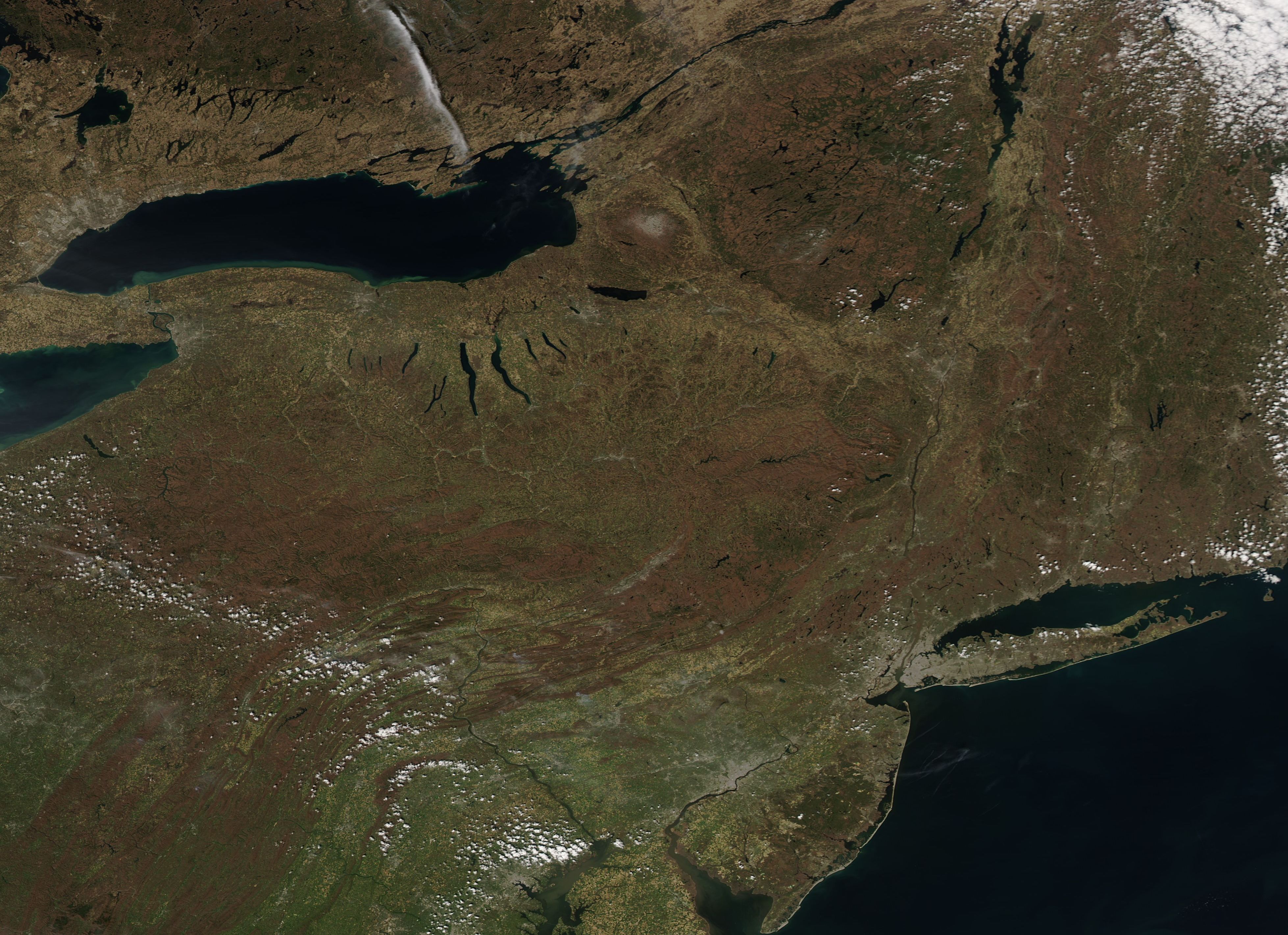
English: On April 18, 2017, the Moderate Resolution Imaging Spectroradiometer (MODIS) aboard NASA’s Aqua satellite acquired a true-color image of a sunny spring day across the northeast United States.
The state of Maine sits in the northeast section of the image, with the province of Quebec, Canada along the northwestern edge. The large lake is Lake Ontario, one of the Great Lakes that lie on the boundary between Canada and the United States. Part of Lake Erie, another Great Lake, can be seen on the western edge of the image. South of Lake Ontario are a series of thin, long lakes that run roughly form north to south. These are the Finger Lakes of the state of New York, which derive their name from the similar appearance to fingers stretching out roughly parallel from a hand. > The Appalachian Mountains are the primary feature of the southwestern section of the image, which can be seen snaking over the landscape from West Virginia, Virginia, and Kentucky (in the southwest) towards the northeast. The Delaware Bay can be seen in the south-central section of the image. Following the coast northward, Long Island runs parallel to the Connecticut coast. The gray pixels at the western edge of Long Island marks the city of New York, New York. |
||
| Date | Taken on 18 April 2017 | ||
| Source |
Northeast United States (direct link)
|
||
| Author | Jeff Schmaltz, MODIS Land Rapid Response Team, NASA GSFC |
| This media is a product of the Aqua mission Credit and attribution belongs to the mission team, if not already specified in the "author" row |
Licensing
[edit].jpg&action=edit§ion=2)
| This file is in the public domain in the United States because it was solely created by NASA. NASA copyright policy states that "NASA material is not protected by copyright unless noted". (See Template:PD-USGov, NASA copyright policy page or JPL Image Use Policy.) | ||
 |
Warnings:
|
File history
Click on a date/time to view the file as it appeared at that time.
| Date/Time | Thumbnail | Dimensions | User | Comment | |
|---|---|---|---|---|---|
| current | 18:53, 16 February 2024 | | 3,915 × 2,842 (1.68 MB) | OptimusPrimeBot (talk | contribs) | #Spacemedia - Upload of http://modis.gsfc.nasa.gov/gallery/images/image04242017_250m.jpg via Commons:Spacemedia |
You cannot overwrite this file.
File usage on Commons
There are no pages that use this file.
.jpg&oldid=852771467)