File:Northwestern Russia (MODIS 2016-05-06).jpg

Original file (5,600 × 7,200 pixels, file size: 7.66 MB, MIME type: image/jpeg)
Captions
Captions
Summary
[edit].jpg&action=edit§ion=1)
| Description |
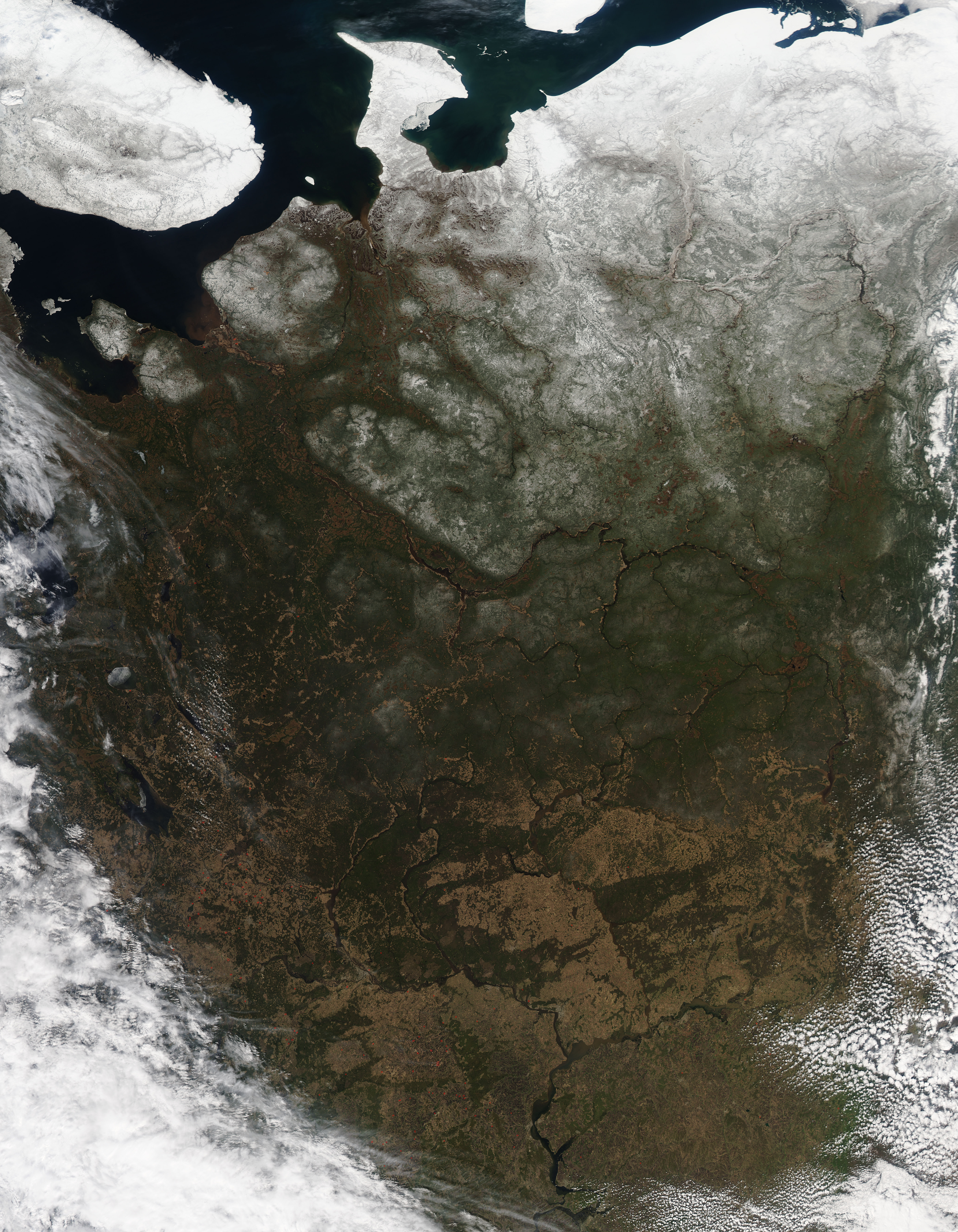
English: On April 28, 2016, the Moderate Resolution Imaging Spectroradiometer (MODIS) aboard NASA's Aqua satellite captured a true-color image of a spring day across northwestern Russia.
Snow covers most of the northern landscape, which is typical for this time of year. Further south the early greening of spring vegetation and the year-round green of evergreen forests wear a more subtle dusting of snowy white. The bright white, snow-capped peaks of the Ural Mountains can be seen along the eastern edge of the image, running generally north to south. The Urals mark the eastern edge of European Russia. To the west of the Urals the land flattens into the broad European Plain, which reaches to the Pyrenees Mountains on the border of France and Spain. The bright blue waters of the Barents Sea (north) and White Sea (south) sit in the northwest corner of the image, separated by the broad Kola Peninsula. The more angular peninsula projecting into the Barents Sea is the Kanin Peninsula. The heavy white blanket of snow covers the undulating sand dunes which stretch tens of kilometers along the coast of the Kanin Peninsula. It has earned the title of the world's northern-most desert. |
||
| Date | Taken on 28 April 2016 | ||
| Source |
Northwestern Russia (direct link)
|
||
| Author | Jeff Schmaltz, MODIS Land Rapid Response Team, NASA GSFC |
| This media is a product of the Aqua mission Credit and attribution belongs to the mission team, if not already specified in the "author" row |
Licensing
[edit].jpg&action=edit§ion=2)
| This file is in the public domain in the United States because it was solely created by NASA. NASA copyright policy states that "NASA material is not protected by copyright unless noted". (See Template:PD-USGov, NASA copyright policy page or JPL Image Use Policy.) | ||
 |
Warnings:
|
File history
Click on a date/time to view the file as it appeared at that time.
| Date/Time | Thumbnail | Dimensions | User | Comment | |
|---|---|---|---|---|---|
| current | 19:36, 15 February 2024 | | 5,600 × 7,200 (7.66 MB) | OptimusPrimeBot (talk | contribs) | #Spacemedia - Upload of http://modis.gsfc.nasa.gov/gallery/images/image05062016_250m.jpg via Commons:Spacemedia |
You cannot overwrite this file.
File usage on Commons
There are no pages that use this file.
.jpg&oldid=852072210)