File:Norway location map.svg
跳转到导航
跳转到搜索

此SVG文件的PNG预览的大小:564 × 599像素。 其他分辨率:226 × 240像素 | 452 × 480像素 | 723 × 768像素 | 964 × 1,024像素 | 1,928 × 2,048像素 | 2,215 × 2,353像素。
原始文件 (SVG文件,尺寸为2,215 × 2,353像素,文件大小:1.32 MB)
说明
说明
添加一行文字以描述该文件所表现的内容
摘要[编辑]
| 描述 |
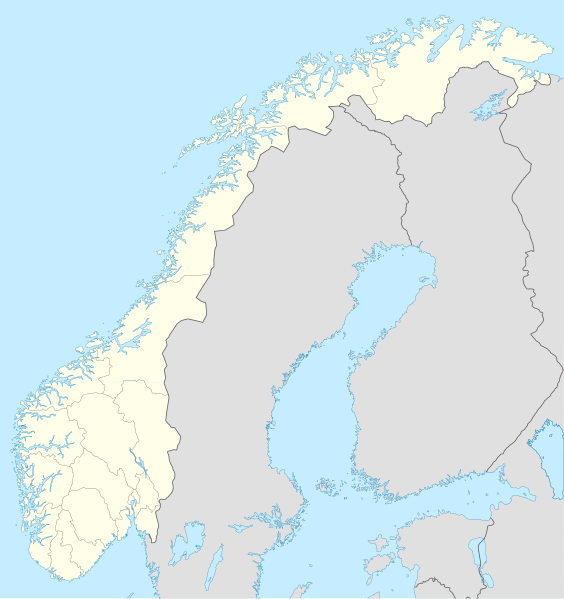
Deutsch: Positionskarte von Norwegen
Quadratische Plattkarte, N-S-Streckung 210 %. Geographische Begrenzung der Karte:
English: Location map of Norway
Equirectangular projection, N/S stretching 210 %. Geographic limits of the map:
|
| 日期 | |
| 来源 |
own work, using
|
| 作者 | NordNordWest |
| 其他版本 | Derivative works of this file: Regenbogen location map.svg |

|
|
许可协议[编辑]
我,本作品著作权人,特此采用以下许可协议发表本作品:

|
已授权您依据自由软件基金会发行的无固定段落及封面封底文字(Invariant Sections, Front-Cover Texts, and Back-Cover Texts)的GNU自由文件许可协议1.2版或任意后续版本的条款,复制、传播和/或修改本文件。该协议的副本请见“GNU Free Documentation License”。 |
本文件采用知识共享署名-相同方式共享 3.0 未本地化版本许可协议授权。
- 您可以自由地:
- 共享 – 复制、发行并传播本作品
- 修改 – 改编作品
- 惟须遵守下列条件:
- 署名 – 您必须对作品进行署名,提供授权条款的链接,并说明是否对原始内容进行了更改。您可以用任何合理的方式来署名,但不得以任何方式表明许可人认可您或您的使用。
- 相同方式共享 – 如果您再混合、转换或者基于本作品进行创作,您必须以与原先许可协议相同或相兼容的许可协议分发您贡献的作品。
您可以选择您需要的许可协议。
文件历史
点击某个日期/时间查看对应时刻的文件。
| 日期/时间 | 缩略图 | 大小 | 用户 | 备注 | |
|---|---|---|---|---|---|
| 当前 | 2017年12月30日 (六) 20:59 | | 2,215 × 2,353(1.32 MB) | NordNordWest(留言 | 贡献) | upd |
| 2008年10月25日 (六) 20:26 |  | 2,215 × 2,353(2.12 MB) | NordNordWest(留言 | 贡献) | corrected | |
| 2008年8月29日 (五) 07:56 |  | 2,215 × 2,351(2.12 MB) | NordNordWest(留言 | 贡献) | ||
| 2008年7月28日 (一) 20:12 |  | 2,214 × 2,351(1.81 MB) | NordNordWest(留言 | 贡献) | some corrections | |
| 2008年7月28日 (一) 19:47 |  | 2,214 × 2,351(1.81 MB) | NordNordWest(留言 | 贡献) | {{Information |Description= {{de|Positionskarte der Norwegen}} Quadratische Plattkarte, N-S-Streckung 210 %. Geographische Begrenzung der Karte: * N: 71.5° N * S: 57.6° N * W: 4.1° O * O: 31.6° O {{en|Location map of [[:en:Norway|Norw |
您不可以覆盖此文件。
文件用途
以下52个页面使用本文件:
- User:NordNordWest/Gallery/Location maps
- File:Akershus in Norway.svg
- File:Akershus in Norway (plus).svg
- File:Aust-Agder in Norway.svg
- File:Aust-Agder in Norway (plus).svg
- File:Buskerud in Norway.svg
- File:Buskerud in Norway (plus).svg
- File:Finnmark in Norway.svg
- File:Finnmark in Norway (plus).svg
- File:Hedmark in Norway.svg
- File:Hedmark in Norway (plus).svg
- File:Hordaland in Norway.svg
- File:Hordaland in Norway (plus).svg
- File:Jan Mayen in Norway (plus).svg
- File:More og Romsdal in Norway.svg
- File:Møre og Romsdal in Norway (plus).svg
- File:Nord-Norge in Norway.svg
- File:Nord-Norge in Norway (plus).svg
- File:Nord-Trondelag in Norway (plus).svg
- File:Nord-Trøndelag in Norway.svg
- File:Nordland in Norway.svg
- File:Nordland in Norway (plus).svg
- File:Norway Wikivoyage locator maps - Hardangervidda.png
- File:Norway Wikivoyage locator maps - Jotunheimen.png
- File:Oppland in Norway.svg
- File:Oppland in Norway (plus).svg
- File:Oslo in Norway.svg
- File:Oslo in Norway (plus).svg
- File:Ostfold in Norway.svg
- File:Ostfold in Norway (plus).svg
- File:Ostlandet in Norway.svg
- File:Ostlandet in Norway (plus).svg
- File:Rogaland in Norway.svg
- File:Rogaland in Norway (plus).svg
- File:Sogn og Fjordane in Norway.svg
- File:Sogn og Fjordane in Norway (plus).svg
- File:Sor-Trondelag in Norway.svg
- File:Sor-Trondelag in Norway (plus).svg
- File:Sorlandet in Norway.svg
- File:Sorlandet in Norway (plus).svg
- File:Svalbard in Norway (plus).svg
- File:Telemark in Norway.svg
- File:Telemark in Norway (plus).svg
- File:Troms in Norway.svg
- File:Trondelag in Norway.svg
- File:Trondelag in Norway (plus).svg
- File:Vest-Agder in Norway.svg
- File:Vest-Agder in Norway (plus).svg
- File:Vestfold in Norway.svg
- File:Vestfold in Norway (plus).svg
- File:Vestlandet in Norway.svg
- File:Vestlandet in Norway (plus).svg
.svg)
.svg)
.svg)
.svg)
.svg)
.svg)
.svg)
.svg)
.svg)
.svg)
.svg)
.svg)
.svg)
.svg)
.svg)
.svg)
.svg)
.svg)
.svg)
.svg)
.svg)
.svg)
.svg)
.svg)
.svg)
全域文件用途
以下其他wiki使用此文件:
- af.wikipedia.org上的用途
- als.wikipedia.org上的用途
- an.wikipedia.org上的用途
- ar.wikipedia.org上的用途
- ast.wikipedia.org上的用途
- Estrechu de Skagerrak
- Mar del Norte
- Oslu
- Kinnarodden
- Cabu Norte
- Fiordu de Trondheim
- Fiordu de Bøk
- Fiordu de Geiranger
- Fiordu de Nærøy
- Ríu Tana
- Península Escandinava
- Bergen
- Trondheim
- Ópera d'Oslu
- Fiordu d'Oslu
- Edificiu del Storting
- Ramnefjellsfossen
- Mongefossen
- Kjelfossen
- Knivskjelodden
- Magerøyá
- Palaciu Real d'Oslu
- Catedral de Nidaros
- Bolsa d'Oslu
- Módulu:Mapa de llocalización/datos/Noruega
- Módulu:Mapa de llocalización/datos/Noruega/usu
- Haraldshaugen
- Sverd i fjell
- Aeropuertu d'Alta
- Aeropuertu d'Andøyá-Andenes
- Aeropuertu de Bardufoss
查看此文件的更多全域用途。