File:ORP Zatec LN CZ.png
Jump to navigation
Jump to search
Size of this preview: 791 × 600 pixels. Other resolutions: 317 × 240 pixels | 633 × 480 pixels | 1,013 × 768 pixels | 1,240 × 940 pixels.
Original file (1,240 × 940 pixels, file size: 66 KB, MIME type: image/png)
Captions
Captions
Add a one-line explanation of what this file represents
| Description |
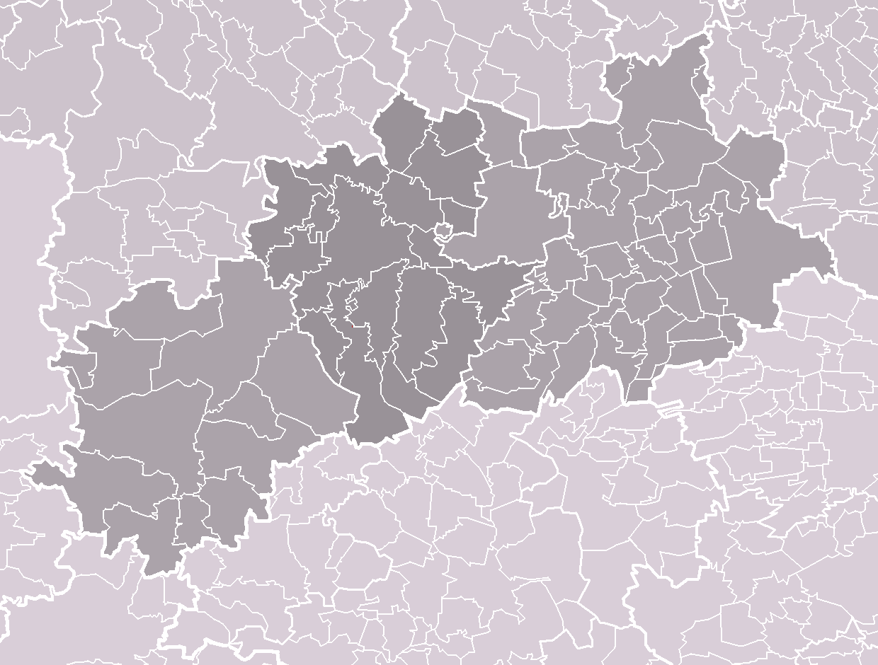
Čeština: Vymezení správního obvodu obce s rozšířenou působností Žatec v rámci okresu Louny. Tmavěji vyznačená prostřední třetina okresu představuje obvod ORP Žatec, světleji znázorněný zbytek připadá na obvody ORP Podbořany (západ) a ORP Louny (východ). Bílé linie o různé tloušťce představují hranice obcí, správních obvodů, okresů a krajů.
English: Location of administrative area of Žatec as a Municipality with Extended Competence within Louny District. Darker grey in central third of the district represents MEC area of Žatec, remaining lighter grey parts represent MEC areas of Podbořany (west) and Louny (east). White lines of variable thickness show boundaries of municipalities, administrative areas, districts and regions. |
| Date | |
| Source | Self made, based on File:Louny_District_2010_LN_CZ.png |
| Author | User:Miaow Miaow |
| Permission (Reusing this file) |
PD-self |
| Other versions |
|


Licensing[edit]
| I, the copyright holder of this work, release this work into the public domain. This applies worldwide. In some countries this may not be legally possible; if so: I grant anyone the right to use this work for any purpose, without any conditions, unless such conditions are required by law. |
File history
Click on a date/time to view the file as it appeared at that time.
| Date/Time | Thumbnail | Dimensions | User | Comment | |
|---|---|---|---|---|---|
| current | 15:55, 5 April 2010 | | 1,240 × 940 (66 KB) | Miaow Miaow (talk | contribs) | {{Information |Description={{cs|Vymezení '''správního obvodu obce s rozšířenou působností Žatec''' v rámci okresu Louny. Tmavěji vyznačená prostřední třetina okresu |
You cannot overwrite this file.
File usage on Commons
The following 5 pages use this file: