File:Oblast Kaliningrad OSM 0 labels.png
Jump to navigation
Jump to search

Size of this preview: 786 × 599 pixels. Other resolutions: 315 × 240 pixels | 630 × 480 pixels | 1,007 × 768 pixels | 1,280 × 976 pixels | 1,546 × 1,179 pixels.
Original file (1,546 × 1,179 pixels, file size: 1.21 MB, MIME type: image/png)
Captions
Captions
Add a one-line explanation of what this file represents
Summary
[edit]
| Description |
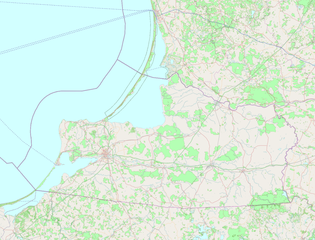
Location ma fpr Kaliningrad Olast, based on OSM without labels
|
| Date | |
| Source | https://josm.openstreetmap.de/mapsview?entry=OpenStreetMap%20%28Mapnik%2C%20no%20labels%29 |
| Author | Ulamm (talk) 19:04, 23 July 2018 (UTC) |
Licensing
[edit]
I, the copyright holder of this work, hereby publish it under the following license:
This file is licensed under the Creative Commons Attribution ShareAlike license, versions 2.0, 2.5, 3.0, 4.0 and any later version released by Creative Commons. You may select the version of your choice. In short: you are free to share and make derivative works of the file under the conditions that you appropriately attribute it, and that you distribute it only under a license identical to this one. Official license: 2.0, 2.5, 3.0, 4.0
|
This file, which was originally posted to
https://josm.openstreetmap.de/mapsview?entry=OpenStreetMap%20%28Mapnik%2C%20no%20labels%29, was reviewed on 24 July 2018 by reviewer Guanaco, who confirmed that it was available there under the stated license on that date.
|
File history
Click on a date/time to view the file as it appeared at that time.
| Date/Time | Thumbnail | Dimensions | User | Comment | |
|---|---|---|---|---|---|
| current | 00:51, 24 July 2018 | | 1,546 × 1,179 (1.21 MB) | Ulamm (talk | contribs) | once more |
| 19:04, 23 July 2018 |  | 1,546 × 1,179 (1.21 MB) | Ulamm (talk | contribs) | {{Information |Description=Location ma fpr Kaliningrad Olast, based on OSM without labels * equirectangular projection * N: 55.8 ° N * S: 54.1° N * W: 19.2° E * E: 23.1° E |Source=https://josm.openstreetmap.de/mapsview?entry=OpenStreetMap%20%28Mapnik%2C%20no%20labels%29 |Date=2018-07-23 |Author=~~~~ |Permission= |other_versions= }} Category:Location maps of Kaliningrad Oblast Category:Maps by Ulamm |
You cannot overwrite this file.
File usage on Commons
There are no pages that use this file.
File usage on other wikis
The following other wikis use this file: