File:Operation25yu.jpg
跳至導覽
跳至搜尋

預覽大小:689 × 599 像素。 其他解析度:276 × 240 像素 | 552 × 480 像素 | 883 × 768 像素 | 1,177 × 1,024 像素 | 1,775 × 1,544 像素。
原始檔案 (1,775 × 1,544 像素,檔案大小:1.03 MB,MIME 類型:image/jpeg)
說明
說明
添加單行說明來描述出檔案所代表的內容
摘要
[編輯]
| 描述 |
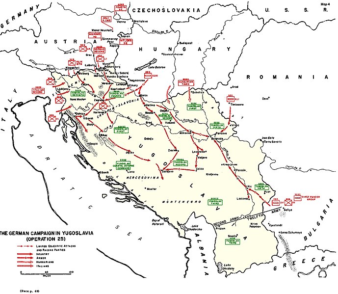
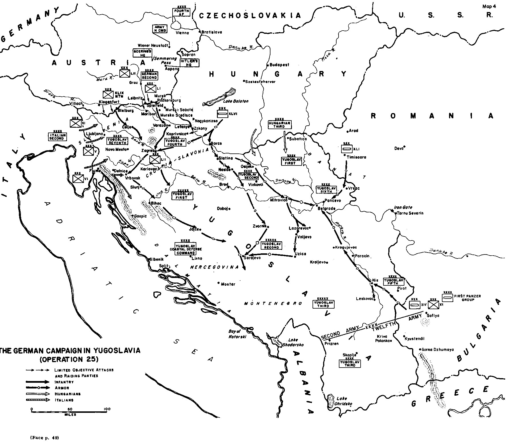
English: A black and white map showing the Axis invasion of Yugoslavia in April 1941
|
| 日期 | |
| 來源 | http://www.army.mil/cmh-pg/books/wwii/balkan/Maps/4.jpg |
| 作者 | US Army |

|
File:Map of invasion of Yugoslavia - Situation map.svg是本檔案的向量版本。 如果品質不低,就應該優先使用該檔案,而非JPG檔案。
File:Operation25yu.jpg → File:Map of invasion of Yugoslavia - Situation map.svg
更多資訊請參閱Help:SVG/zh。 |
 |
授權條款
[編輯]
|
|
 |
derivative works
[編輯]
Derivative works of this file: InvasiónDeYugoslaviaAbrilDe1941.svg
檔案歷史
點選日期/時間以檢視該時間的檔案版本。
| 日期/時間 | 縮圖 | 尺寸 | 用戶 | 備註 | |
|---|---|---|---|---|---|
| 目前 | 2017年9月23日 (六) 13:34 | | 1,775 × 1,544(1.03 MB) | Hohum(對話 | 貢獻) | Darker red and green |
| 2017年9月23日 (六) 13:23 |  | 1,775 × 1,544(1.03 MB) | Hohum(對話 | 貢獻) | Use colours to clarify | |
| 2006年5月14日 (日) 11:14 |  | 1,775 × 1,544(452 KB) | Orlovic(對話 | 貢獻) | Unternhmen 25 Source: [http://www.army.mil/cmh-pg/books/wwii/balkan/Maps/4.jpg http://www.army.mil/cmh-pg/books/wwii/balkan/Maps/4.jpg] |
無法覆蓋此檔案。
檔案用途
下列11個頁面有用到此檔案:
- Atlas of Bosnia and Herzegovina
- Atlas of Republika Srpska
- Atlas of Serbia
- Atlas of Slovenia
- Atlas of World War II
- Atlas of Yugoslavia
- User:J budissin/Uploads/BiH/2017 September 21-30
- User:Magog the Ogre/Maps of conflicts/2017 September
- File:InvasiónDeYugoslaviaAbrilDe1941.svg
- File:Map of invasion of Yugoslavia - Situation map.svg
- Category:Invasion of Yugoslavia
全域檔案使用狀況
以下其他 wiki 使用了這個檔案:
- ar.wikipedia.org 的使用狀況
- bg.wikipedia.org 的使用狀況
- bs.wikipedia.org 的使用狀況
- ca.wikipedia.org 的使用狀況
- de.wikipedia.org 的使用狀況
- en.wikipedia.org 的使用狀況
- fi.wikipedia.org 的使用狀況
- fr.wikipedia.org 的使用狀況
- hu.wikipedia.org 的使用狀況
- it.wikipedia.org 的使用狀況
- ja.wikipedia.org 的使用狀況
- ko.wikipedia.org 的使用狀況
- ms.wikipedia.org 的使用狀況
- nl.wikipedia.org 的使用狀況
- no.wikipedia.org 的使用狀況
- pt.wikipedia.org 的使用狀況
- ro.wikipedia.org 的使用狀況
- ru.wikipedia.org 的使用狀況
- sl.wikipedia.org 的使用狀況
- sr.wikipedia.org 的使用狀況
- ta.wikipedia.org 的使用狀況
- uk.wikipedia.org 的使用狀況
- vi.wikipedia.org 的使用狀況
- www.wikidata.org 的使用狀況