File:Orava (mapa).jpg

Original file (1,403 × 1,784 pixels, file size: 660 KB, MIME type: image/jpeg)
Captions
Captions
Summary
[edit].jpg&action=edit§ion=1)
| Description |
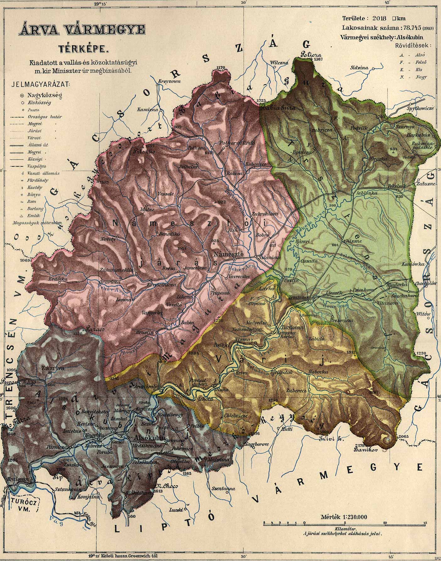
Čeština: Stará mapa Oravy
English: Old map of Orava, Slovakia from about 1910
Magyar: Árva vármegye térképe 1910 körülről
Slovenčina: Stará mapa Oravy - okolo roku 1910 |
| Source |
Transferred from cs.wikipedia to Commons. Zdroj: http://lazarus.elte.hu/hun/maps/1910/arva.jpg z webu http://lazarus.elte.hu/hun/maps/1910/vmlista.htm |
| Author |
Licensing
[edit].jpg&action=edit§ion=2)
|
This work is in the public domain in its country of origin and other countries and areas where the copyright term is the author's life plus 70 years or fewer.
| |
| This file has been identified as being free of known restrictions under copyright law, including all related and neighboring rights. | |
Original upload log
[edit].jpg&action=edit§ion=3)
- 2006-02-15 22:24 Kirk 1403×1784×8 (676312 bytes)
File history
Click on a date/time to view the file as it appeared at that time.
| Date/Time | Thumbnail | Dimensions | User | Comment | |
|---|---|---|---|---|---|
| current | 20:42, 12 August 2007 | | 1,403 × 1,784 (660 KB) | Packa (talk | contribs) | {{Information |Description= {{cs| Stará mapa Oravy}} {{en| Old map of Orava, Slovakia}} |Source=Originally from [http://cs.wikipedia.org cs.wikipedia]; description page is/was [http://cs.wikipedia.org/w/index.php?title=Image%3AOrava_%28mapa%29.jpg here]. |
You cannot overwrite this file.
File usage on Commons
The following page uses this file:
File usage on other wikis
The following other wikis use this file:
- Usage on de.wikipedia.org
- Usage on en.wikipedia.org
- Usage on hu.wikipedia.org
.jpg&oldid=672989404)