File:Ordnance Survey Composite Slater's Loup.jpg
Jump to navigation
Jump to search
Size of this preview: 800 × 563 pixels. Other resolutions: 320 × 225 pixels | 640 × 450 pixels | 1,024 × 721 pixels | 1,280 × 901 pixels | 2,136 × 1,503 pixels.
Original file (2,136 × 1,503 pixels, file size: 1.25 MB, MIME type: image/jpeg)
Captions
Captions
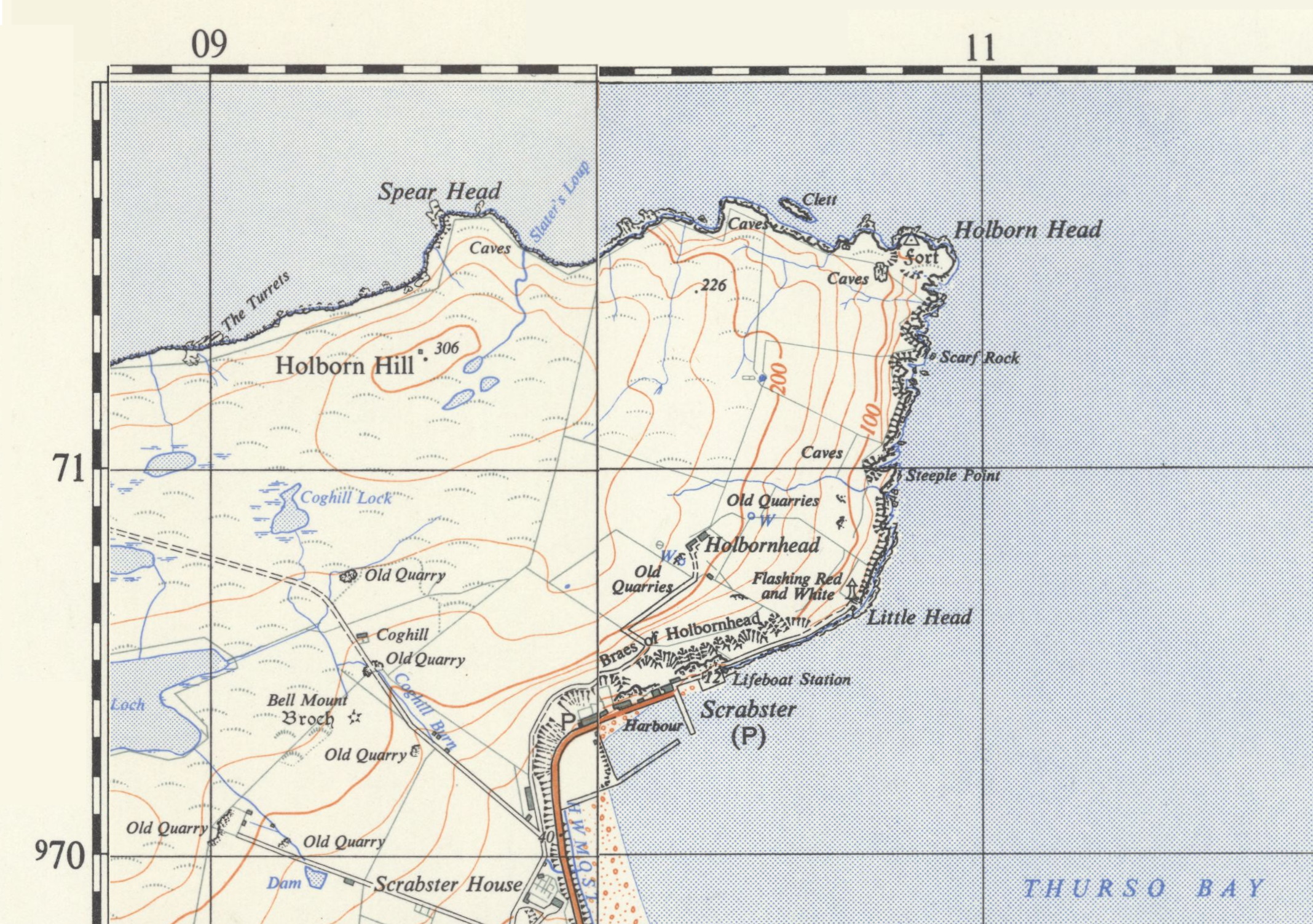
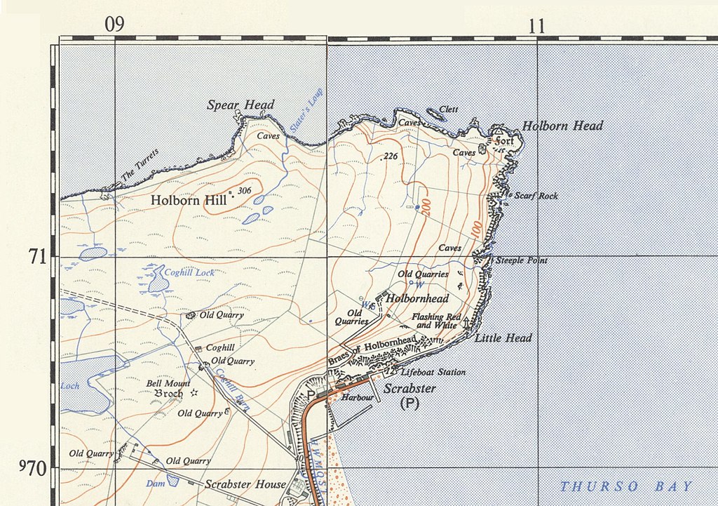
Map showing location of Slater's Loup
Summary
[edit]| Description |
English: Map showing location of Slater's Loup in rlation to Holborn Head and Scrabster, Caithness, Composite of sheets ND 06/07 and ND 16/17. |
| Date | |
| Source | Composite of original OS maps from the National Library of Scotland |
| Author | Director General of the Ordnance Survey, UK |


Licensing
[edit]
This work is an Ordnance Survey map over 50 years old, which is covered by Crown Copyright which in this case expires 50 years after publication. Ordnance Survey does however ask that they be credited and that the date of publication be given.
Any ancillary rights gained through the creation of the electronic version are granted as freely usable under any circumstances.
|
This work created by the United Kingdom Government is in the public domain.
This is because it is one of the following:
HMSO has declared that the expiry of Crown Copyrights applies worldwide (ref: HMSO Email Reply)
|
 |
File history
Click on a date/time to view the file as it appeared at that time.
| Date/Time | Thumbnail | Dimensions | User | Comment | |
|---|---|---|---|---|---|
| current | 19:28, 20 August 2021 | | 2,136 × 1,503 (1.25 MB) | Kognos (talk | contribs) | Uploaded a work by Director General of the Ordnance Survey, UK from Composite of original OS maps from the National Library of Scotland with UploadWizard |
You cannot overwrite this file.
File usage on Commons
The following page uses this file:
File usage on other wikis
The following other wikis use this file:
- Usage on www.wikidata.org