File:Ordnance Survey Ireland One-Inch Sheet 83 84 Killary Harbour, Published 1901.jpg
Jump to navigation
Jump to search

Size of this preview: 800 × 512 pixels. Other resolutions: 320 × 205 pixels | 640 × 410 pixels | 1,024 × 655 pixels | 1,280 × 819 pixels | 2,560 × 1,639 pixels | 9,812 × 6,281 pixels.
Original file (9,812 × 6,281 pixels, file size: 26.51 MB, MIME type: image/jpeg)
Captions
Captions
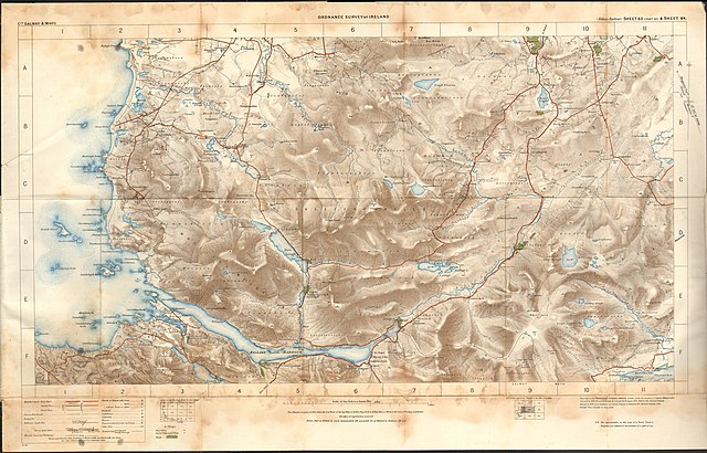
OS one-inch map of Killary Harbour
Summary
[edit]
| Description |
English: OS map of Killary Harbour and the surrounding area in County Galway and County Mayo, at a scale of 1:63,360 or one inch to one mile. |
| Date | |
| Source | Scan of original OS map |
| Author | Director of the Ordnance Survey Office, Dublin |
Licensing
[edit]
This Irish Government or Oireachtas work is in the public domain. According to Chapter 19, §191-193 of the Copyright and Related Rights Act, 2000, copyright has expired in Ireland because it is either:
|
 |
File history
Click on a date/time to view the file as it appeared at that time.
| Date/Time | Thumbnail | Dimensions | User | Comment | |
|---|---|---|---|---|---|
| current | 12:47, 30 April 2020 | | 9,812 × 6,281 (26.51 MB) | Kognos (talk | contribs) | Uploaded a work by Director of the Ordnance Survey Office, Dublin from Scan of original OS map with UploadWizard |
You cannot overwrite this file.
File usage on Commons
There are no pages that use this file.