File:Ordnance Survey Quarter-inch sheet 4 Western Highlands, published 1967.jpg
Перейти к навигации
Перейти к поиску

Размер этого предпросмотра: 651 × 600 пкс. Другие разрешения: 261 × 240 пкс | 521 × 480 пкс | 834 × 768 пкс | 1112 × 1024 пкс | 2223 × 2048 пкс | 9627 × 8869 пкс.
Исходный файл (9627 × 8869 пкс, размер файла: 8,85 МБ, MIME-тип: image/jpeg)
Краткие подписи
Краткие подписи
Добавьте однострочное описание того, что собой представляет этот файл
Краткое описание
[править]
| Описание |
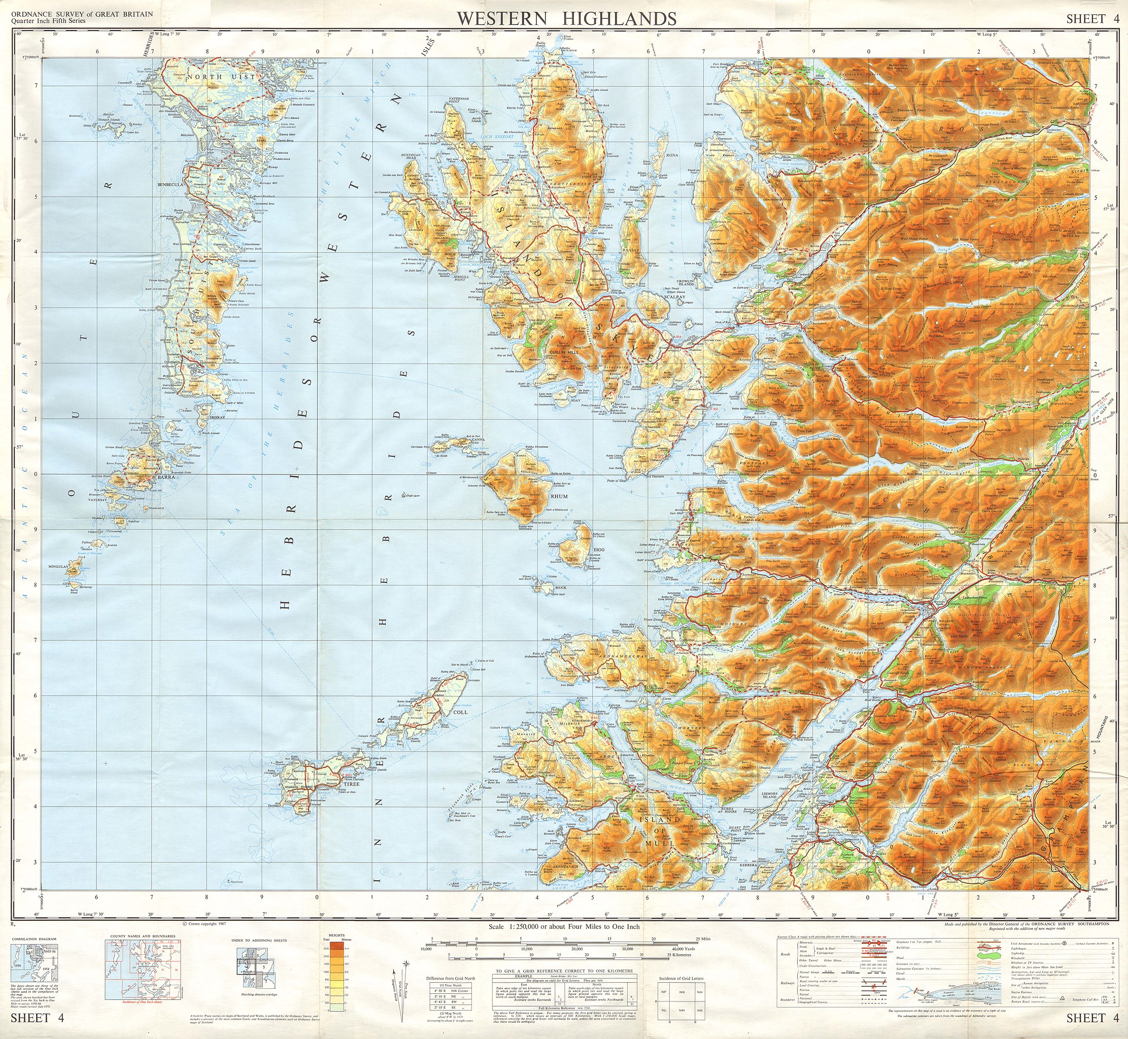
English: OS map of the Western Highlands of Scotland, at a scale of 1:250,000, including Skye, part of North Uist, and South Uist |
| Дата | |
| Источник | Scan of OS Sheet 4 Western Highlands |
| Автор | Director General of the Ordnance Survey, Southampton, UK |
Лицензирование
[править]
This work is an Ordnance Survey map over 50 years old, which is covered by Crown Copyright which in this case expires 50 years after publication. Ordnance Survey does however ask that they be credited and that the date of publication be given.
Any ancillary rights gained through the creation of the electronic version are granted as freely usable under any circumstances.
|
Это художественное произведение, созданное Правительством Соединённого Королевства Великобритании и Северной Ирландии, находится в общественном достоянии (англ. public domain)
по одной из следующих причин:
Канцелярия Её Величества (HMSO) заявила, что истечение Авторских прав, принадлежащих Короне (англ. Crown copyright), происходит по всему миру (справка: ответ HMSO на сообщение электронной почты)
|
 |
История файла
Нажмите на дату/время, чтобы увидеть версию файла от того времени.
| Дата/время | Миниатюра | Размеры | Участник | Примечание | |
|---|---|---|---|---|---|
| текущий | 19:19, 4 января 2018 | | 9627 × 8869 (8,85 МБ) | Kognos (обсуждение | вклад) | User created page with UploadWizard |
Вы не можете перезаписать этот файл.
Использование файла
Нет страниц, использующих этот файл.
Категории:
- Maps of the Hebrides
- Maps of the Isle of Skye
- Maps of the Small Isles, Lochaber
- Maps of the Isle of Mull
- North Uist
- South Uist
- Barra, Scotland
- Arisaig
- Shieldaig, Torridon
- Loch Torridon
- Maps of Ardnamurchan
- Loch Linnhe
- Lismore
- Oban
- Maps of Coll
- Maps of Tiree
- Benbecula
- 1967 maps of the United Kingdom
- 1967-12-31
- Ordnance Survey Quarter-Inch Fifth Series (1962- ) 1:250,000 (full sheets)