File:Orkney Islands UK location map.svg
ナビゲーションに移動
検索に移動

この SVG ファイルのこの PNG プレビューのサイズ: 467 × 599 ピクセル. その他の解像度: 187 × 240 ピクセル | 374 × 480 ピクセル | 599 × 768 ピクセル | 798 × 1,024 ピクセル | 1,596 × 2,048 ピクセル | 1,110 × 1,424 ピクセル。
元のファイル (SVG ファイル、1,110 × 1,424 ピクセル、ファイルサイズ: 2.02メガバイト)
キャプション
キャプション
このファイルの内容を1行で記述してください
| 解説 |
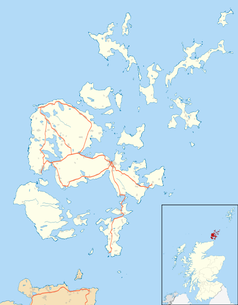
Blank map of the Orkney Islands (excluding Sule Stack and Sule Skerry), UK with the following information shown:
Equirectangular map projection on WGS 84 datum, with N/S stretched 180% Geographic limits:
|
| 日付 | |
| 原典 |
|
| 作者 | Nilfanion, created using Ordnance Survey data |
| 許可 (ファイルの再利用) |
このファイルはクリエイティブ・コモンズ 表示-継承 3.0 非移植ライセンスのもとに利用を許諾されています。 帰属: Contains Ordnance Survey data © Crown copyright and database right
|
| その他のバージョン | Orkney Islands UK blank map.svg - Blank map |
| SVG 開発 |
ファイルの履歴
過去の版のファイルを表示するには、その版の日時をクリックしてください。
| 日付と時刻 | サムネイル | 寸法 | 利用者 | コメント | |
|---|---|---|---|---|---|
| 現在の版 | 2010年9月26日 (日) 20:21 | | 1,110 × 1,424 (2.02メガバイト) | Nilfanion (トーク | 投稿記録) | {{Information |Description=Blank map of the Orkney Islands (excluding Sule Stack and Sule Skerry), UK with the following information shown: *Administrative borders *Coastline, lakes and rivers *Roads |
このファイルは上書きできません。
ファイルの使用状況
以下のページがこのファイルを使用しています:
グローバルなファイル使用状況
以下に挙げる他のウィキがこの画像を使っています:
- ar.wikipedia.org での使用状況
- bg.wikipedia.org での使用状況
- ceb.wikipedia.org での使用状況
- de.wikipedia.org での使用状況
- en.wikipedia.org での使用状況
- Maeshowe
- Orkney
- Skara Brae
- Ring of Brodgar
- Kirkwall
- Stromness
- List of monastic houses in Scotland
- North Caledonian Football Association
- Stones of Stenness
- Barnhouse Settlement
- St Margaret's Hope
- Kirkwall Airport
- St Magnus Cathedral
- Evie, Orkney
- Earl's Palace, Kirkwall
- Bishop's Palace, Kirkwall
- Whitehall, Orkney
- Westray Airport
- Longhope, Orkney
- Voy
- Finstown
- Eday Airport
- North Ronaldsay Airport
- Papa Westray Airport
- Sanday Airport
- Stronsay Airport
- Herston, Orkney
- Burroughston Broch
- Balfour, Orkney
- Houton
- Lyness
- Bimbister
- Ancumtoun
- Backaland
このファイルのグローバル使用状況を表示する。