File:Oulad Abdoun Basin.png
Jump to navigation
Jump to search
Size of this preview: 521 × 599 pixels. Other resolutions: 209 × 240 pixels | 417 × 480 pixels | 668 × 768 pixels | 890 × 1,024 pixels | 1,781 × 2,048 pixels | 2,600 × 2,990 pixels.
Original file (2,600 × 2,990 pixels, file size: 1.58 MB, MIME type: image/png)
Captions
Captions
Add a one-line explanation of what this file represents
Summary[edit]
| Description |
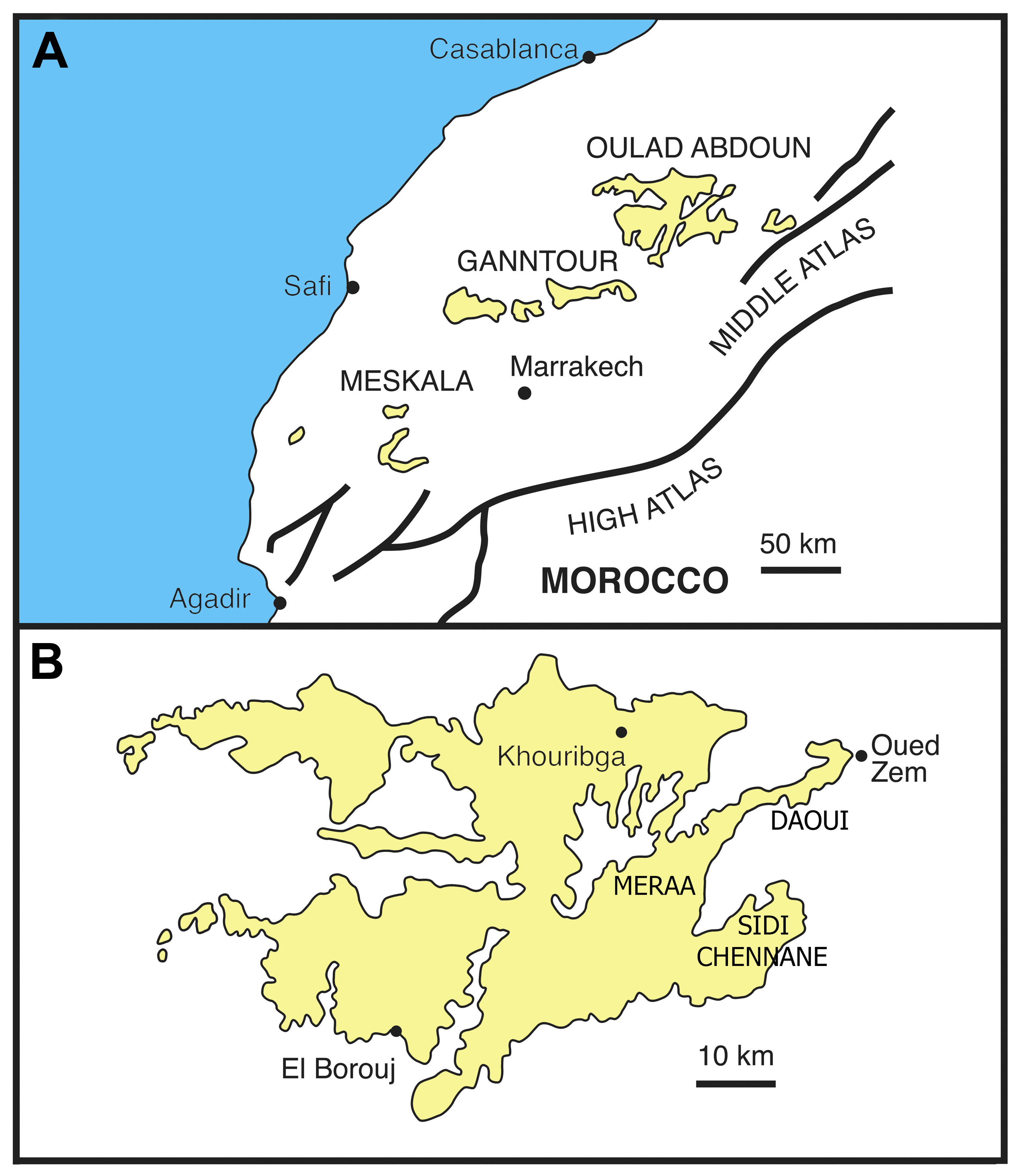
English: A. General geographical map of Morocco showing the main phosphatic basins (Ganntour and Oulad Abdoun basins). B. details of the Oulad Abdoun Basin with some major northeastern excavation areas (Daoui, Meraa El Arach, Sidi Chennane) |
| Date | |
| Source | Bardet N, Jalil N-E, de Lapparent de Broin F, Germain D, Lambert O, et al. (2013) A Giant Chelonioid Turtle from the Late Cretaceous of Morocco with a Suction Feeding Apparatus Unique among Tetrapods. PLoS ONE 8(7): e63586. doi:10.1371/journal.pone.0063586 |
| Author | Nathalie Bardet, Nour-Eddine Jalil, France de Lapparent de Broin, Damien Germain, Olivier Lambert, Mbarek Amaghzaz |
| Other versions |
.png)

Licensing[edit]
This file is licensed under the Creative Commons Attribution 2.5 Generic license.
- You are free:
- to share – to copy, distribute and transmit the work
- to remix – to adapt the work
- Under the following conditions:
- attribution – You must give appropriate credit, provide a link to the license, and indicate if changes were made. You may do so in any reasonable manner, but not in any way that suggests the licensor endorses you or your use.
File history
Click on a date/time to view the file as it appeared at that time.
| Date/Time | Thumbnail | Dimensions | User | Comment | |
|---|---|---|---|---|---|
| current | 05:48, 12 March 2014 | | 2,600 × 2,990 (1.58 MB) | Animalparty (talk | contribs) | User created page with UploadWizard |
You cannot overwrite this file.
File usage on Commons
The following page uses this file:
File usage on other wikis
The following other wikis use this file:
- Usage on de.wikipedia.org
- Usage on es.wikipedia.org