File:Outside Sutton Station.jpg
跳转到导航
跳转到搜索
没有更高的分辨率。
Outside_Sutton_Station.jpg (622 × 366像素,文件大小:384 KB,MIME类型:image/jpeg)
说明
说明
添加一行文字以描述该文件所表现的内容
摘要[编辑]
| 描述 |
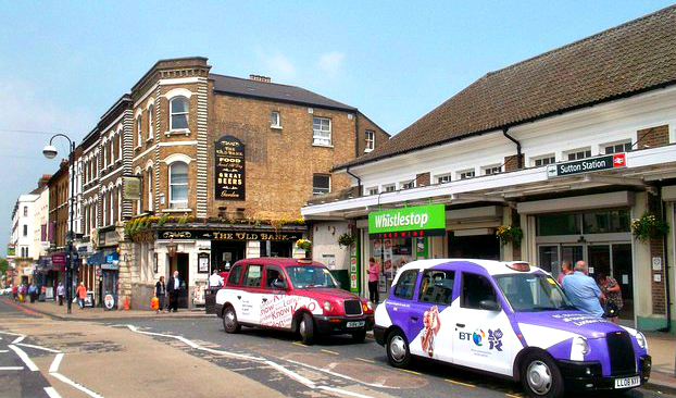
English: Sutton Station was opened on 10th May 1847 by the London Brighton and South Coast Railway.....back in the days when taxis were black.... |
| 日期 | |
| 来源 | https://www.geograph.org.uk/reuse.php?id=2979032 |
| 作者 | Des Blenkinsopp |
| 署名 (由许可协议要求) | Des Blenkinsopp / Outside Sutton Station / |
| 相机位置 | | 在以下服务上查看本图像和附近其他图像: OpenStreetMap |
|---|
_heading:0.00&language=zh)
| 物体位置 | | 在以下服务上查看本图像和附近其他图像: OpenStreetMap |
|---|
_heading:0.00&language=zh)
许可协议[编辑]

|
本图像来自Geograph工程图集。摄影师的联系信息请见Geograph网站上该照片的页面。本图像的著作权人为Des Blenkinsopp,采用知识共享“署名-相同方式共享 2.0”许可协议授权二次使用。
|
本文件采用知识共享署名-相同方式共享 2.0 通用许可协议授权。
署名: Des Blenkinsopp
- 您可以自由地:
- 共享 – 复制、发行并传播本作品
- 修改 – 改编作品
- 惟须遵守下列条件:
- 署名 – 您必须对作品进行署名,提供授权条款的链接,并说明是否对原始内容进行了更改。您可以用任何合理的方式来署名,但不得以任何方式表明许可人认可您或您的使用。
- 相同方式共享 – 如果您再混合、转换或者基于本作品进行创作,您必须以与原先许可协议相同或相兼容的许可协议分发您贡献的作品。
文件历史
点击某个日期/时间查看对应时刻的文件。
| 日期/时间 | 缩略图 | 大小 | 用户 | 备注 | |
|---|---|---|---|---|---|
| 当前 | 2016年11月22日 (二) 19:24 | | 622 × 366(384 KB) | A P Monblat(留言 | 贡献) | crop |
| 2015年1月22日 (四) 04:50 |  | 637 × 400(367 KB) | A P Monblat(留言 | 贡献) | adjust | |
| 2014年11月2日 (日) 21:10 |  | 637 × 400(263 KB) | A P Monblat(留言 | 贡献) | cropped | |
| 2014年10月7日 (二) 17:32 |  | 637 × 418(251 KB) | A P Monblat(留言 | 贡献) | cropped | |
| 2014年9月7日 (日) 18:48 |  | 640 × 455(80 KB) | A P Monblat(留言 | 贡献) | User created page with UploadWizard |
您不可以覆盖此文件。
文件用途
以下3个页面使用本文件:
全域文件用途
以下其他wiki使用此文件:
- en.wikipedia.org上的用途
- pl.wikipedia.org上的用途
- zh.wikipedia.org上的用途