File:Oxfordshire UK locator map 2010.svg
পরিভ্রমণে চলুন
অনুসন্ধানে চলুন

এই SVG ফাইলের জন্য এই PNG প্রাকদর্শনের আকার: ৪৯৪ × ৬০০ পিক্সেল। অন্যান্য আকারসমূহ: ১৯৮ × ২৪০ পিক্সেল | ৩৯৫ × ৪৮০ পিক্সেল | ৬৩৩ × ৭৬৮ পিক্সেল | ৮৪৩ × ১,০২৪ পিক্সেল | ১,৬৮৭ × ২,০৪৮ পিক্সেল | ১,১০৮ × ১,৩৪৫ পিক্সেল।
মূল ফাইল (এসভিজি ফাইল, সাধারণত ১,১০৮ × ১,৩৪৫ পিক্সেল, ফাইলের আকার: ৩০২ কিলোবাইট)
ক্যাপশনসমূহ
ক্যাপশন
এই ফাইল কি প্রতিনিধিত্ব করছে তার এক লাইন ব্যাখ্যা যোগ করুন
সারাংশ
[সম্পাদনা]
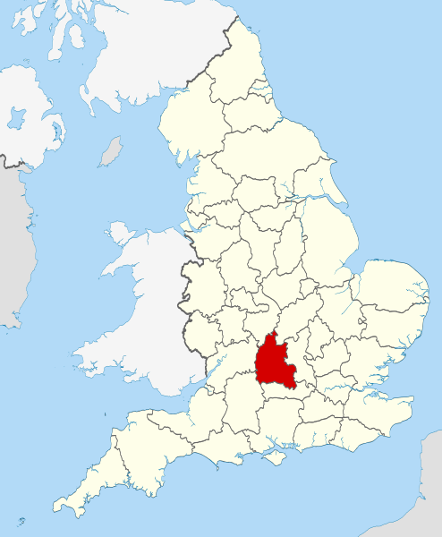
| বিবরণ | Location of the ceremonial county of Oxfordshire within England. |
| তারিখ | |
| উৎস |
National Geospatial-Intelligence Agency
|
| লেখক | Nilfanion |
লাইসেন্স প্রদান
[সম্পাদনা]
আমি, এই কাজের স্বত্বাধিকারী, এতদ্দ্বারা আমি এই কাজকে নিম্ন বর্ণিত লাইসেন্সের আওতায় প্রকাশ করলাম:
এই ফাইলটি ক্রিয়েটিভ কমন্স অ্যাট্রিবিউশন-শেয়ার অ্যালাইক ৩.০ আনপোর্টেড লাইসেন্সের আওতায় লাইসেন্সকৃত।
- আপনি স্বাধীনভাবে:
- বণ্টন করতে পারেন – এ কাজটি অনুলিপি, বিতরণ এবং প্রেরণ করতে পারেন
- পুনঃমিশ্রণ করতে পারেন – কাজটি অভিযোজন করতে পারেন
- নিম্নের শর্তাবলীর ভিত্তিতে:
- স্বীকৃতিপ্রদান – আপনাকে অবশ্যই যথাযথ স্বীকৃতি প্রদান করতে হবে, লাইসেন্সের একটি লিঙ্ক সরবরাহ করতে হবে এবং কোনো পরিবর্তন হয়েছে কিনা তা নির্দেশ করতে হবে। আপনি যেকোনো যুক্তিসঙ্গত পদ্ধতিতে এটি করতে পারেন। কিন্তু এমন ভাবে নয়, যাতে প্রকাশ পায় যে লাইসেন্সধারী আপনাকে বা আপনার এই ব্যবহারের জন্য অনুমোদন দিয়েছে।
- একইভাবে বণ্টন – আপনি যদি কাজটি পুনঃমিশ্রণ, রুপান্তর, বা এর ওপর ভিত্তি করে নতুন সৃষ্টিকর্ম তৈরি করেন, তবে আপনাকে অবশ্যই আপনার অবদান একই লাইসেন্স বা একই রকমের লাইসেন্সের আওতায় বিতরণ করতে হবে।

|
এই নথি অনুলিপি, বিতরণ এবং/বা পরিবর্তন করার অনুমতি ফ্রি সফটওয়্যার ফাউন্ডেশন কর্তৃক প্রকাশিত গনু ফ্রি ডকুমেন্টেশন লাইসেন্স, সংস্করণ ১.২ বা তার পরবর্তী সংস্করণের আওতায় অনুমতিপ্রাপ্ত; যে কোনো রকম অনুচ্ছেদ পরিবর্তন, সম্মুখ-প্রচ্ছদের লেখা, পিছন-প্রচ্ছদের লেখা পরিবর্তন করা ছাড়াই। এই লাইসেন্সের একটি অনুলিপি গনু ফ্রি ডকুমেন্টেশন লাইসেন্স শিরোনামের অনুচ্ছেদে অন্তর্ভুক্ত করা আছে। |
আপনি আপনার পছন্দসই লাইসেন্স নির্বাচন করতে পারেন।

|
This is one of the images forming part of the Valued image set: Locator maps of the Ceremonial counties of England on Wikimedia Commons. The image set has been assessed under the valued image set criteria and is considered the most valued set on Commons within the scope:
Locator maps of the Ceremonial counties of England
You can see its nomination at Commons:Valued image candidates/Locator maps of English ceremonial counties. |
ফাইলের ইতিহাস
যেকোনো তারিখ/সময়ে ক্লিক করে দেখুন ফাইলটি তখন কী অবস্থায় ছিল।
| তারিখ/সময় | সংক্ষেপচিত্র | মাত্রা | ব্যবহারকারী | মন্তব্য | |
|---|---|---|---|---|---|
| বর্তমান | ২২:২৫, ২৩ নভেম্বর ২০১০ | | ১,১০৮ × ১,৩৪৫ (৩০২ কিলোবাইট) | Nilfanion (আলোচনা | অবদান) | use ceremonial counties - corresponds with text of article better |
| ১৬:৩৯, ২৩ নভেম্বর ২০১০ |  | ১,১০৮ × ১,৩৪৫ (৩৩২ কিলোবাইট) | Nilfanion (আলোচনা | অবদান) | Fix coast - add Arran | |
| ০০:৪৭, ১৬ নভেম্বর ২০১০ |  | ১,১০৮ × ১,৩৪৫ (৩২৫ কিলোবাইট) | Nilfanion (আলোচনা | অবদান) | thicker lines | |
| ০০:৪৪, ১৬ নভেম্বর ২০১০ |  | ১,১০৮ × ১,৩৪৫ (৩২৫ কিলোবাইট) | Nilfanion (আলোচনা | অবদান) | {{Information |Description=Location of Oxfordshire within England, with the administrative counties shown. |Source=Ordnance Survey [https://www.ordnancesurvey.co.uk/opendatadownload/products.html OpenData]: *County |
আপনি এই ফাইলটি প্রতিস্থাপন করতে পারবেন না।
ফাইলের ব্যবহার
নিম্নলিখিত 33টি পাতা এই ফাইল ব্যবহার করে:
- Valued image set: Locator maps of the Ceremonial counties of England
- Commons:Valued image candidates/Locator maps of English ceremonial counties
- Category:Almshouses in Oxfordshire
- Category:Alumni by school in Oxfordshire
- Category:Archaeological sites in Oxfordshire
- Category:Births in Oxfordshire
- Category:Bridges in Oxfordshire
- Category:Cemeteries in Oxfordshire
- Category:Deaths in Oxfordshire
- Category:Farms in Oxfordshire
- Category:Geography of Oxfordshire
- Category:Hospitals in Oxfordshire
- Category:Libraries in Oxfordshire
- Category:Maps of Oxfordshire
- Category:Meadows in Oxfordshire
- Category:Oxfordshire
- Category:Oxfordshire in the 18th century
- Category:Oxfordshire in the 19th century
- Category:Oxfordshire in the 2000s
- Category:Oxfordshire in the 2010s
- Category:Oxfordshire in the 20th century
- Category:Oxfordshire in the 21st century
- Category:People of Oxfordshire
- Category:Populated places in Oxfordshire
- Category:Rail transport in Oxfordshire
- Category:Rivers of Oxfordshire
- Category:Roads in Oxfordshire
- Category:Sports venues in Oxfordshire
- Category:Unparished areas in Oxfordshire
- Category:Views of Oxfordshire
- Category:Villages in Oxfordshire
- Category:Visitor attractions in Oxfordshire
- Category:Windmills in Oxfordshire
ফাইলের বৈশ্বিক ব্যবহার
নিচের অন্যান্য উইকিগুলো এই ফাইলটি ব্যবহার করে:
- af.wikipedia.org-এ ব্যবহার
- an.wikipedia.org-এ ব্যবহার
- ar.wikipedia.org-এ ব্যবহার
- arz.wikipedia.org-এ ব্যবহার
- ast.wikipedia.org-এ ব্যবহার
- be-tarask.wikipedia.org-এ ব্যবহার
- bg.wikipedia.org-এ ব্যবহার
- bn.wikipedia.org-এ ব্যবহার
- br.wikipedia.org-এ ব্যবহার
- ca.wikipedia.org-এ ব্যবহার
- ceb.wikipedia.org-এ ব্যবহার
- cs.wikipedia.org-এ ব্যবহার
- en.wikipedia.org-এ ব্যবহার
- Oxfordshire
- Dragon Hill, Uffington
- RAF Bampton Castle
- Whitchurch-on-Thames
- Cowley Road, Oxford
- Redgrave Pinsent Rowing Lake
- Roke
- Farmoor Reservoir
- Mill Meadows, Henley-on-Thames
- River Evenlode
- Radford, Oxfordshire
- Angel & Greyhound Meadow, Oxford
- Curbridge, Oxfordshire
- Risinghurst and Sandhills
- Barford St. John and St. Michael
- Template:Oxfordshire-geo-stub
- Ardington
- Aston, Cote, Shifford and Chimney
- Aston Upthorpe
- Beckley and Stowood
- Bix and Assendon
- Blenheim, Oxfordshire
- Peckwater Quadrangle
- Bourton, Cherwell
- Bruern
- Ploughley Rural District
- Hanney
- Waterperry
- Dunsden Green
- Milton-under-Wychwood
- North Newington
- The Trout Inn
- Badbury Hill
- Oxford MSA
এই ফাইলের অন্যান্য বৈশ্বিক ব্যবহার দেখুন।