File:Oxfordshire UK locator map 2010.svg
Sautar la navigacion
Sautar la recèrca

Talha d'aquesta previsualizacion PNG per aquest fichièr SVG: 494 × 600 pixèls. Autras resolucions : 198 × 240 pixèls | 395 × 480 pixèls | 633 × 768 pixèls | 843 × 1 024 pixèls | 1 687 × 2 048 pixèls | 1 108 × 1 345 pixèls.
Fichièr d'origina (Fichièr SVG, resolucion de 1 108 × 1 345 pixèls, talha : 302 Ko)
Llegendes
Llegendes
Afegeix una explicació d'una línia del que representa aquest fitxer
Descripcion[modificar]
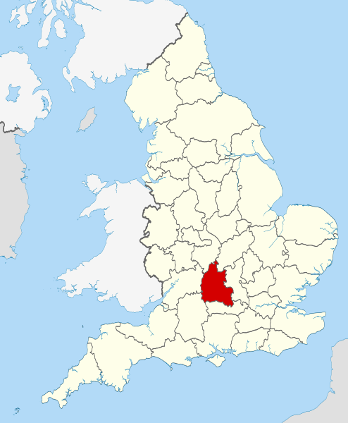
| Descripcion | Location of the ceremonial county of Oxfordshire within England. |
| Data | |
| Font |
National Geospatial-Intelligence Agency
|
| Autor | Nilfanion |
Publicat jos licéncia(s)[modificar]
Ieu, autor d'aquesta òbra, publiqui jos las licéncias seguentas:
Aqueste fichièr es jos licéncia Creative Commons licéncia generica atribucion-partiment a l'identic 3.0
- Sètz liure :
- de partejar – de copiar, distribuir e transmetre aquesta òbra
- d'adaptar – d'adaptar aquesta òbra
- Jos las condicions seguentas :
- atribucion – Vos cal atribuir aquesta òbra amb lo biais especificat per l'autor o lo concedent (mas pas dins un sens que suggerís que vos apròvan o qu'apròvan l'utilizacion d'aquesta òbra).
- partiment a l'identic – Se modificatz, transformatz, o vos basatz sus aquesta òbra, vos cal distribuir l'òbra resultanta jos la meteissa licéncia o una licéncia similara a aquesta.

|
Avètz la permission de copiar, distribuir e modificar aqueste document segon los tèrmes de la Licéncia de documentacion liura GNU, version 1.2 o mai recenta publicada per la Free Software Foundation; sens seccions inalterablas, sens tèxte de primièra pagina de tempa e sens tèxte de darrièra pagina de tempa. Un exemplar de la licéncia es inclús dins la seccion intitulada GNU Free Documentation License. |
Podètz causir la licéncia que volètz.

|
This is one of the images forming part of the Valued image set: Locator maps of the Ceremonial counties of England on Wikimedia Commons. The image set has been assessed under the valued image set criteria and is considered the most valued set on Commons within the scope:
Locator maps of the Ceremonial counties of England
You can see its nomination at Commons:Valued image candidates/Locator maps of English ceremonial counties. |
Istoric del fichièr
Clicar sus una data e una ora per veire lo fichièr tal coma èra a aqueste moment
| Data e ora | Miniatura | Dimensions | Utilizaire | Comentari | |
|---|---|---|---|---|---|
| actual | 23 novembre de 2010 a 22.25 | | 1 108 × 1 345 (302 Ko) | Nilfanion (discussion | contribucions) | use ceremonial counties - corresponds with text of article better |
| 23 novembre de 2010 a 16.39 |  | 1 108 × 1 345 (332 Ko) | Nilfanion (discussion | contribucions) | Fix coast - add Arran | |
| 16 novembre de 2010 a 00.47 |  | 1 108 × 1 345 (325 Ko) | Nilfanion (discussion | contribucions) | thicker lines | |
| 16 novembre de 2010 a 00.44 |  | 1 108 × 1 345 (325 Ko) | Nilfanion (discussion | contribucions) | {{Information |Description=Location of Oxfordshire within England, with the administrative counties shown. |Source=Ordnance Survey [https://www.ordnancesurvey.co.uk/opendatadownload/products.html OpenData]: *County |
Podètz pas remplaçar aqueste fichièr.
Paginas que contenon lo fichièr
Las paginas çaijós compòrtan aqueste imatge :
- Valued image set: Locator maps of the Ceremonial counties of England
- Commons:Valued image candidates/Locator maps of English ceremonial counties
- Category:Almshouses in Oxfordshire
- Category:Alumni by school in Oxfordshire
- Category:Archaeological sites in Oxfordshire
- Category:Births in Oxfordshire
- Category:Bridges in Oxfordshire
- Category:Cemeteries in Oxfordshire
- Category:Deaths in Oxfordshire
- Category:Farms in Oxfordshire
- Category:Geography of Oxfordshire
- Category:Hospitals in Oxfordshire
- Category:Libraries in Oxfordshire
- Category:Maps of Oxfordshire
- Category:Meadows in Oxfordshire
- Category:Oxfordshire
- Category:Oxfordshire in the 18th century
- Category:Oxfordshire in the 19th century
- Category:Oxfordshire in the 2000s
- Category:Oxfordshire in the 2010s
- Category:Oxfordshire in the 20th century
- Category:Oxfordshire in the 21st century
- Category:People of Oxfordshire
- Category:Populated places in Oxfordshire
- Category:Rail transport in Oxfordshire
- Category:Rivers of Oxfordshire
- Category:Roads in Oxfordshire
- Category:Sports venues in Oxfordshire
- Category:Unparished areas in Oxfordshire
- Category:Views of Oxfordshire
- Category:Villages in Oxfordshire
- Category:Visitor attractions in Oxfordshire
- Category:Windmills in Oxfordshire
Usatge global del fichièr
Los autres wikis seguents utilizan aqueste imatge :
- Utilizacion sus af.wikipedia.org
- Utilizacion sus an.wikipedia.org
- Utilizacion sus ar.wikipedia.org
- Utilizacion sus arz.wikipedia.org
- Utilizacion sus ast.wikipedia.org
- Utilizacion sus be-tarask.wikipedia.org
- Utilizacion sus bg.wikipedia.org
- Utilizacion sus bn.wikipedia.org
- Utilizacion sus br.wikipedia.org
- Utilizacion sus ca.wikipedia.org
- Utilizacion sus ceb.wikipedia.org
- Utilizacion sus cs.wikipedia.org
- Utilizacion sus en.wikipedia.org
- Oxfordshire
- Dragon Hill, Uffington
- RAF Bampton Castle
- Whitchurch-on-Thames
- Cowley Road, Oxford
- Redgrave Pinsent Rowing Lake
- Roke
- Farmoor Reservoir
- Mill Meadows, Henley-on-Thames
- River Evenlode
- Radford, Oxfordshire
- Angel & Greyhound Meadow, Oxford
- Curbridge, Oxfordshire
- Risinghurst and Sandhills
- Barford St. John and St. Michael
- Template:Oxfordshire-geo-stub
- Ardington
- Aston, Cote, Shifford and Chimney
- Aston Upthorpe
- Beckley and Stowood
- Bix and Assendon
- Blenheim, Oxfordshire
- Peckwater Quadrangle
- Bourton, Cherwell
- Bruern
- Ploughley Rural District
- Hanney
- Waterperry
- Dunsden Green
- Milton-under-Wychwood
- North Newington
- The Trout Inn
- Badbury Hill
- Oxford MSA
Veire l'utilizacion globala d'aqueste fichièr.