File:Paddington Station-4269161-by-Oast-House-Archive.jpg
ナビゲーションに移動
検索に移動
このプレビューのサイズ: 800 × 600 ピクセル。 その他の解像度: 320 × 240 ピクセル | 640 × 480 ピクセル | 1,024 × 768 ピクセル。
元のファイル (1,024 × 768 ピクセル、ファイルサイズ: 260キロバイト、MIME タイプ: image/jpeg)
キャプション
キャプション
このファイルの内容を1行で記述してください
概要[編集]
| 解説 |
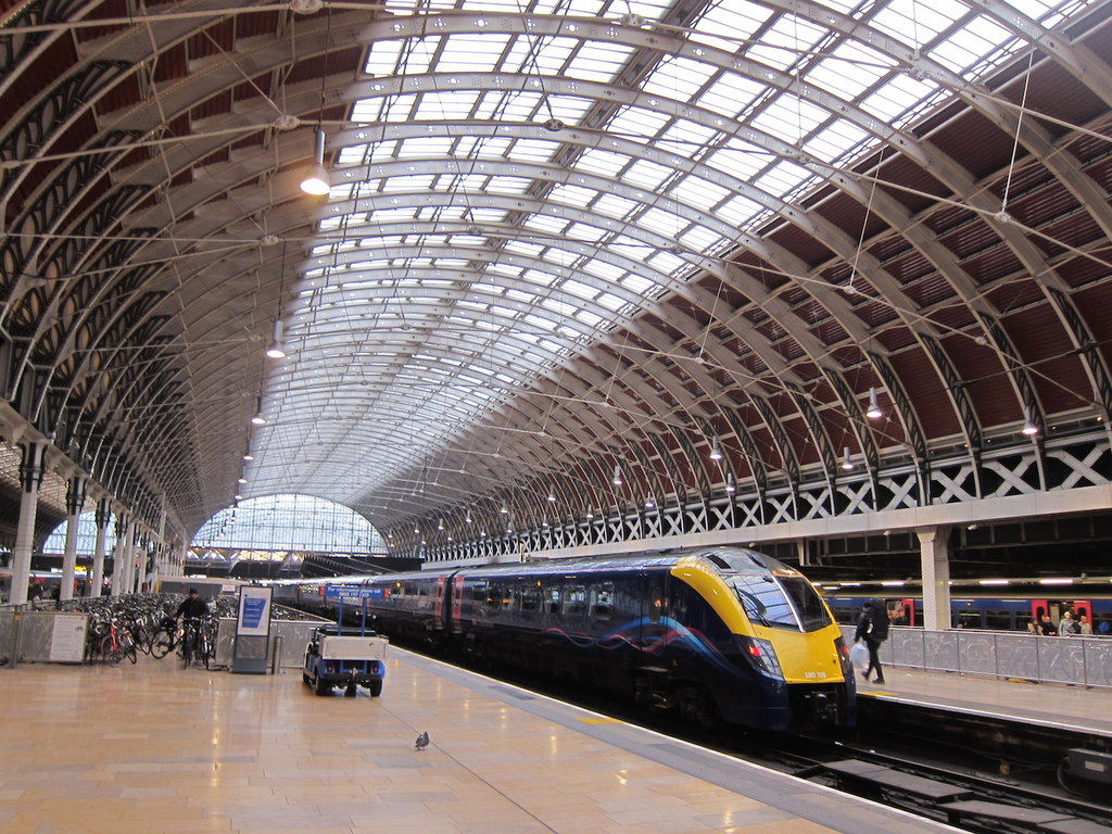
English: Paddington station, also known as London Paddington, is a central London railway terminus and London Underground station complex.
The site is historic, having been the London terminus of the Great Western Railway and its successors since 1838. Much of the current mainline station dates from 1854 and was designed by Isambard Kingdom Brunel. The site was first served by Underground trains in 1863, as the original western terminus of the Metropolitan Railway, the world's first underground railway. The complex has since been modernised and now has an additional role as the London terminus for the dedicated Heathrow Express airport service. Paddington is in fare zone 1. The station is the terminus for services from Reading, Bristol, Cardiff, Swansea, Oxford, Newbury, Taunton, Exeter, Plymouth, Penzance, Cheltenham, Worcester and Hereford, and for inner- and outer-suburban services. |
| 日付 | |
| 原典 | Geograph - https://www.geograph.org.uk/photo/4269161 |
| 作者 | Oast House Archive |
| 帰属 (ライセンスによる要求事項) | Oast House Archive / Platform 8, Paddington Station / |
| カメラの位置 | | 以下のサービスでこの位置を確認する: オープンストリートマップ |
|---|
ライセンス[編集]

|
この写真はGeograph projectコレクションから提供されています。撮影者の連絡先の詳細はGeographの公式サイトにある写真ページをご覧ください。この画像の著作権はOast House Archiveに帰属しており、クリエイティブ・コモンズ 表示 - 継承 2.0 ライセンスの下に利用を許諾されています。
|
このファイルはクリエイティブ・コモンズ 表示-継承 2.0 一般ライセンスのもとに利用を許諾されています。
帰属: Oast House Archive
- あなたは以下の条件に従う場合に限り、自由に
- 共有 – 本作品を複製、頒布、展示、実演できます。
- 再構成 – 二次的著作物を作成できます。
- あなたの従うべき条件は以下の通りです。
- 表示 – あなたは適切なクレジットを表示し、ライセンスへのリンクを提供し、変更があったらその旨を示さなければなりません。これらは合理的であればどのような方法で行っても構いませんが、許諾者があなたやあなたの利用行為を支持していると示唆するような方法は除きます。
- 継承 – もしあなたがこの作品をリミックスしたり、改変したり、加工した場合には、あなたはあなたの貢献部分を元の作品とこれと同一または互換性があるライセンスの下に頒布しなければなりません。
ファイルの履歴
過去の版のファイルを表示するには、その版の日時をクリックしてください。
| 日付と時刻 | サムネイル | 寸法 | 利用者 | コメント | |
|---|---|---|---|---|---|
| 現在の版 | 2017年2月11日 (土) 01:13 | | 1,024 × 768 (260キロバイト) | Bellminsterboy (トーク | 投稿記録) | User created page with UploadWizard |
このファイルは上書きできません。
ファイルの使用状況
以下の 2 ページがこのファイルを使用しています:
グローバルなファイル使用状況
以下に挙げる他のウィキがこの画像を使っています:
- bn.wikipedia.org での使用状況
- de.wikipedia.org での使用状況
- en.wikipedia.org での使用状況
- fa.wikipedia.org での使用状況
- hu.wikipedia.org での使用状況
- it.wikipedia.org での使用状況
- ja.wikipedia.org での使用状況
- tr.wikipedia.org での使用状況
- uk.wikipedia.org での使用状況
- yi.wikipedia.org での使用状況
- zh.wikipedia.org での使用状況