File:Paddington Station-4269161-by-Oast-House-Archive.jpg
跳至導覽
跳至搜尋
預覽大小:800 × 600 像素。 其他解析度:320 × 240 像素 | 640 × 480 像素 | 1,024 × 768 像素。
原始檔案 (1,024 × 768 像素,檔案大小:260 KB,MIME 類型:image/jpeg)
說明
說明
添加單行說明來描述出檔案所代表的內容
摘要[編輯]
| 描述 |
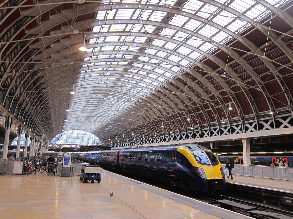
English: Paddington station, also known as London Paddington, is a central London railway terminus and London Underground station complex.
The site is historic, having been the London terminus of the Great Western Railway and its successors since 1838. Much of the current mainline station dates from 1854 and was designed by Isambard Kingdom Brunel. The site was first served by Underground trains in 1863, as the original western terminus of the Metropolitan Railway, the world's first underground railway. The complex has since been modernised and now has an additional role as the London terminus for the dedicated Heathrow Express airport service. Paddington is in fare zone 1. The station is the terminus for services from Reading, Bristol, Cardiff, Swansea, Oxford, Newbury, Taunton, Exeter, Plymouth, Penzance, Cheltenham, Worcester and Hereford, and for inner- and outer-suburban services. |
| 日期 | |
| 來源 | Geograph - https://www.geograph.org.uk/photo/4269161 |
| 作者 | Oast House Archive |
| 姓名標示 (由许可协议要求) | Oast House Archive / Platform 8, Paddington Station / |
| 拍攝地點 | | 位於此地的本圖片與其他圖片: OpenStreetMap |
|---|
授權條款[編輯]

|
此圖像來自Geograph工程圖集。攝影師的聯繫資訊請見Geograph網站上該照片的頁面。此圖像的著作權人為Oast House Archive,採用創用CC 署名-相同方式共享 2.0許可協議授權二次使用。
|
此檔案採用創用CC 姓名標示-相同方式分享 2.0 通用版授權條款。
姓名標示: Oast House Archive
- 您可以自由:
- 分享 – 複製、發佈和傳播本作品
- 重新修改 – 創作演繹作品
- 惟需遵照下列條件:
- 姓名標示 – 您必須指名出正確的製作者,和提供授權條款的連結,以及表示是否有對內容上做出變更。您可以用任何合理的方式來行動,但不得以任何方式表明授權條款是對您許可或是由您所使用。
- 相同方式分享 – 如果您利用本素材進行再混合、轉換或創作,您必須基於如同原先的相同或兼容的條款,來分布您的貢獻成品。
檔案歷史
點選日期/時間以檢視該時間的檔案版本。
| 日期/時間 | 縮圖 | 尺寸 | 使用者 | 備註 | |
|---|---|---|---|---|---|
| 目前 | 2017年2月11日 (六) 01:13 | | 1,024 × 768(260 KB) | Bellminsterboy(留言 | 貢獻) | User created page with UploadWizard |
無法覆蓋此檔案。
檔案用途
下列2個頁面有用到此檔案:
全域檔案使用狀況
以下其他 wiki 使用了這個檔案:
- bn.wikipedia.org 的使用狀況
- de.wikipedia.org 的使用狀況
- en.wikipedia.org 的使用狀況
- fa.wikipedia.org 的使用狀況
- fr.wikipedia.org 的使用狀況
- hu.wikipedia.org 的使用狀況
- it.wikipedia.org 的使用狀況
- ja.wikipedia.org 的使用狀況
- tr.wikipedia.org 的使用狀況
- uk.wikipedia.org 的使用狀況
- yi.wikipedia.org 的使用狀況
- zh.wikipedia.org 的使用狀況