File:Papua New Guinea location map.svg
跳去導覽
跳去搵嘢

呢個「SVG」檔案嘅呢個「PNG」預覽嘅大細:800 × 481 像素。 第啲解像度:320 × 192 像素 | 640 × 385 像素 | 1,024 × 615 像素 | 1,280 × 769 像素 | 2,560 × 1,538 像素 | 2,280 × 1,370 像素。
原本檔案 (SVG檔案,表面大細: 2,280 × 1,370 像素,檔案大細:501 KB)
Captions
Captions
Add a one-line explanation of what this file represents
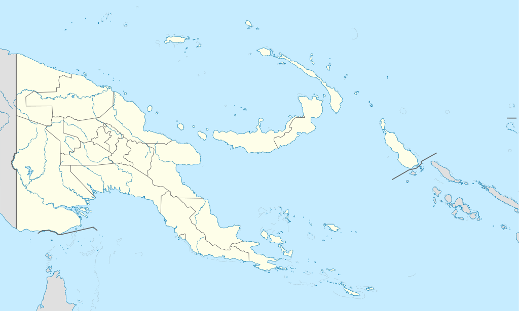
Location map of Papua New Guinea
摘要[編輯]
| 描述 |
Deutsch: Positionskarte von Papua-Neuguinea
Quadratische Plattkarte. Geographische Begrenzung der Karte:
English: Location map of Papua New Guinea
Equirectangular projection. Geographic limits of the map:
|
| 日期 | 05-09-2008 |
| 來源 |
own work, using
|
| 作者 | NordNordWest |
| Other versions |
|


|
This map has been made or improved in the German Kartenwerkstatt (Map Lab). You can propose maps to improve as well.
|
協議[編輯]
I, the copyright holder of this work, hereby publish it under the following licenses:

|
根據自由軟體基金會發佈嘅無固定段落、封面文字同封底文字GNU自由文件授權條款第1.2或打後嘅版本,你獲授權可以重製、散佈同埋修改爾份文件。授權條款嘅副本喺章節GNU自由文件授權條款。 |
呢個檔案用共享創意 姓名標示-非商業性-相同方式分享3.0 未本地化版本條款授權。
- 你可以:
- 去分享 – 複製、發佈同傳播呢個作品
- 再改 – 創作演繹作品
- 要遵照下面嘅條件:
- 署名 – 你一定要畀合適嘅表彰、畀返指向呢個授權條款嘅連結,同埋寫明有無改過嚟。你可以用任何合理方式去做,但唔可以用任何方式暗示授權人認可咗你或者你嘅使用方式。
- 相同方式分享 – 如果你用任何方式改過呢個作品,你必須要用返原本或者相似嘅條款發佈。
你可以揀你想用嘅牌照。
檔案歷史
撳個日期/時間去睇響嗰個時間出現過嘅檔案。
| 日期/時間 | 縮圖 | 尺寸 | 用戶 | 註解 | |
|---|---|---|---|---|---|
| 現時 | 2012年6月5號 (二) 15:48 | | 2,280 × 1,370(501 KB) | NordNordWest(傾偈 | 貢獻) | upd |
| 2011年5月26號 (四) 07:49 |  | 2,280 × 1,370(767 KB) | NordNordWest(傾偈 | 貢獻) | Reverted to version as of 19:42, 8 December 2009 no need to revert | |
| 2011年5月25號 (三) 23:00 |  | 2,280 × 1,370(674 KB) | AlexR.L.(傾偈 | 貢獻) | Reverted to version as of 19:51, 5 September 2008 | |
| 2009年12月8號 (二) 19:42 |  | 2,280 × 1,370(767 KB) | NordNordWest(傾偈 | 貢獻) | + rivers | |
| 2008年9月5號 (五) 19:51 |  | 2,280 × 1,370(674 KB) | NordNordWest(傾偈 | 貢獻) | {{Information |Description= {{de|Positionskarte von Papua-Neuguinea}} Quadratische Plattkarte. Geographische Begrenzung der Karte: * N: 0.6° S * S: 12.2° S * W: 140.4° O * O: 159.7° O {{en|Location map of [[:en:Papua New Guinea |
你無得衾咗個檔案。
檔案用途
以下嘅39版用到呢個檔:
- User:NordNordWest/Gallery/Location maps
- File:Adjora (Abu) language map.svg
- File:Bougainville in Papua New Guinea.svg
- File:Bougainville in Papua New Guinea (special marker).svg
- File:Central in Papua New Guinea.svg
- File:Chimbu in Papua New Guinea.svg
- File:East New Britain in Papua New Guinea.svg
- File:East Sepik in Papua New Guinea.svg
- File:Eastern Highlands in Papua New Guinea.svg
- File:Enga in Papua New Guinea.svg
- File:Gulf in Papua New Guinea.svg
- File:Hela in Papua New Guinea.svg
- File:Highlands Region in Papua New Guinea.svg
- File:Islands Region in Papua New Guinea.svg
- File:Islands Region in Papua New Guinea (special marker).svg
- File:Jiwaka in Papua New Guinea.svg
- File:Madang in Papua New Guinea.svg
- File:Manus in Papua New Guinea.svg
- File:Manus in Papua New Guinea (special marker).svg
- File:Milne Bay in Papua New Guinea.svg
- File:Milne Bay in Papua New Guinea (special marker).svg
- File:Momase Region in Papua New Guinea.svg
- File:Morobe in Papua New Guinea.svg
- File:National Capital District in Papua New Guinea.svg
- File:National Capital District in Papua New Guinea (special marker).svg
- File:New Ireland in Papua New Guinea.svg
- File:Northern in Papua New Guinea.svg
- File:Papua New Guinea, administrative divisions - Nmbrs - colored.svg
- File:Papua New Guinea, administrative divisions - Nmbrs - monochrome.svg
- File:Papua New Guinea, administrative divisions - de - colored.svg
- File:Papua New Guinea, administrative divisions - de - monochrome.svg
- File:Papua New Guinea COVID-19 cases by provinces.svg
- File:Papua New Guinea relief location map.jpg
- File:Papua Region in Papua New Guinea.svg
- File:Southern Highlands in Papua New Guinea.svg
- File:West New Britain in Papua New Guinea.svg
- File:West Sepik in Papua New Guinea.svg
- File:Western Highlands in Papua New Guinea.svg
- File:Western Province in Papua New Guinea.svg
_language_map.svg)
.svg)
.svg)
.svg)
.svg)
.svg)
全域檔案使用情況
下面嘅維基都用緊呢個檔案:
- af.wikipedia.org嘅使用情況
- als.wikipedia.org嘅使用情況
- Vorlage:Positionskarte Papua-Neuguinea
- Port Moresby
- Bismarck-Archipel
- Neubritannien
- Duke-of-York-Inseln
- Admiralitäts-Inseln
- D’Entrecasteaux-Inseln
- Lavongai
- Westliche Inseln
- Feni-Inseln
- Lihir-Inseln
- Tabar-Inseln
- Tanga-Inseln
- St.-Matthias-Inseln
- Vitu-Inseln
- Neuirland
- Louisiade-Archipel
- Marshall-Bennett-Inseln
- Woodlark-Insel
- Trobriand-Inseln
- Mount Wilhelm
- an.wikipedia.org嘅使用情況
- ar.wikipedia.org嘅使用情況
- ast.wikipedia.org嘅使用情況
- Puertu Moresbi
- Nueva Bretaña
- Montes Herzog
- Archipiélagu Bismarck
- Islles del Duque de York
- Tabubil
- Islla Daru
- Estrechu de Dampier
- Islles del Almirantalgu
- Monte Lamington
- Archipiélagu de les Lluisiaes
- Aeropuertu Internacional de Jacksons
- Aeropuertu de Guasopa
- Puertu de Dreger
- Módulu:Mapa de llocalización/datos/Papúa Nueva Guinea
- Módulu:Mapa de llocalización/datos/Papúa Nueva Guinea/usu
- Islles d'Entrecasteaux
- Provincia de Nueva Bretaña Occidental
- Islles Trobriand
- Kitava
- Vakuta
睇呢個檔案嘅更多全域使用情況。