File:Paris map 1672 (Jouvin de Rochefort) 1-4 reduction - Gallica.jpg
Jump to navigation
Jump to search

Size of this preview: 722 × 599 pixels. Other resolutions: 289 × 240 pixels | 578 × 480 pixels | 925 × 768 pixels | 1,234 × 1,024 pixels | 2,468 × 2,048 pixels | 16,855 × 13,990 pixels.
Original file (16,855 × 13,990 pixels, file size: 82.35 MB, MIME type: image/jpeg)
Captions
Captions
Add a one-line explanation of what this file represents
| Warning | The original file is very high-resolution. It might not load properly or could cause your browser to freeze when opened at full size. |
|---|
Summary[edit]
| Description |
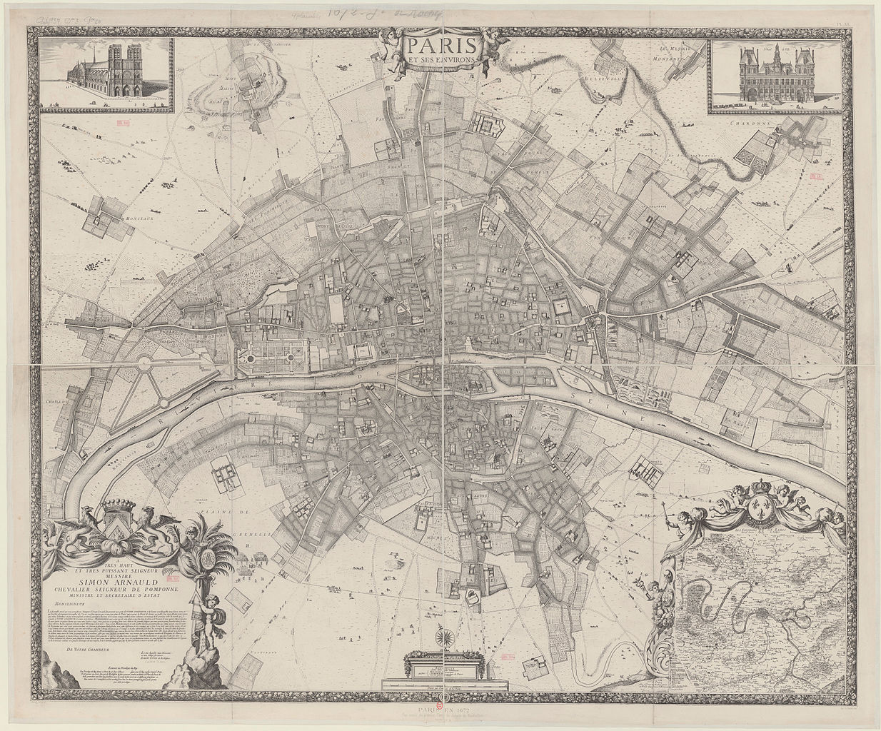
English: Map of Paris in 1672, facsimile (at 1/4 reduction) of the second edition [1674–1675] of the map by Albert Jouvin de Rochefort, facsimile published in Atlas des anciens plans (1880, OCLC 6229765), plate XX, consisting of four plates, 58 x 67 cm each (the original, at scale c. 1:4600, consisted of 9 plates, c. 49 x 60 cm each) |
| Date | |
| Source | Gallica |
| Author |
(Albert) Jouvin de Rochefort (16..–17..?), Trésorier de France, VIAF François de La Pointe (fl. 1666–1690) engraver P[ierre] Brissar (16..-1682), graphic artist, VIAF Jacqueline Panouze, scripsit |
| Other versions |
|

_1-4_reduction_-_Gallica.jpg&action=edit§ion=1)
Licensing[edit]
_1-4_reduction_-_Gallica.jpg&action=edit§ion=2)
|
This work is in the public domain in its country of origin and other countries and areas where the copyright term is the author's life plus 100 years or fewer. | |
| This file has been identified as being free of known restrictions under copyright law, including all related and neighboring rights. | |
File history
Click on a date/time to view the file as it appeared at that time.
| Date/Time | Thumbnail | Dimensions | User | Comment | |
|---|---|---|---|---|---|
| current | 11:13, 11 October 2012 | | 16,855 × 13,990 (82.35 MB) | Robert.Allen (talk | contribs) | {{Information |Description ={{en|1=Map of Paris in 1672}} |Source =[http://gallica.bnf.fr/ark:/12148/btv1b53010929s.r=.langEN Gallica] |Author =Jouvin de Rochefort |Date =1672 |Permission = |other_versions =<gallery>Fil... |
You cannot overwrite this file.
File usage on Commons
The following 4 pages use this file:
.jpg)
File usage on other wikis
The following other wikis use this file:
- Usage on fr.wikipedia.org
_1-4_reduction_-_Gallica.jpg&oldid=593826444)