File:Pinus devoniana range map.jpg
Jump to navigation
Jump to search
Size of this preview: 655 × 600 pixels. Other resolutions: 262 × 240 pixels | 524 × 480 pixels | 947 × 867 pixels.
Original file (947 × 867 pixels, file size: 113 KB, MIME type: image/jpeg)
Captions
Captions
Add a one-line explanation of what this file represents
Summary[edit]

|
This biogeographical map image could be re-created using vector graphics as an SVG file. This has several advantages; see Commons:Media for cleanup for more information. If an SVG form of this image is available, please upload it and afterwards replace this template with
{{vector version available|new image name}}.
It is recommended to name the SVG file “Pinus devoniana range map.svg”—then the template Vector version available (or Vva) does not need the new image name parameter. |


| Description |
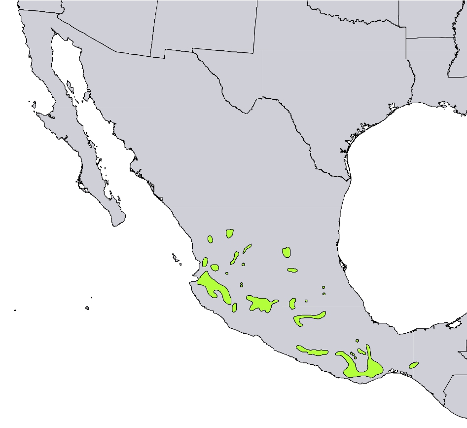
English: Range map of Pinus devoniana (Syn. Pinus michoacana) |
| Date | |
| Source | Digital representation of "Atlas of United States Trees" by Elbert L. Little, Jr. [1] |
| Author | U.S. Geological Survey |
Licensing[edit]
This image is in the public domain in the United States because it only contains materials that originally came from the United States Geological Survey, an agency of the United States Department of the Interior. For more information, see the official USGS copyright policy.
|
Original upload log[edit]
Transferred from en.wikipedia to Commons by Pinethicket using CommonsHelper.
The original description page was here. All following user names refer to en.wikipedia.
- 2012-10-08 12:37 Pinethicket 947×867× (115609 bytes) {{Information |Description=Range map of ''Pinus devoniana'' (Sym: ''Pinus michoacana'') |Source=Digital representation of "Atlas of United States Trees" by Elbert L. Little, Jr. [http://esp.cr.usgs.gov/data/atlas/little/] |Date=1999 |Auth...
File history
Click on a date/time to view the file as it appeared at that time.
| Date/Time | Thumbnail | Dimensions | User | Comment | |
|---|---|---|---|---|---|
| current | 09:28, 16 October 2012 | | 947 × 867 (113 KB) | File Upload Bot (Magnus Manske) (talk | contribs) | Transfered from en.wikipedia by User:Pinethicket using CommonsHelper |
You cannot overwrite this file.
File usage on Commons
The following page uses this file:
File usage on other wikis
The following other wikis use this file:
- Usage on cs.wikipedia.org
- Usage on pt.wikipedia.org
- Usage on sv.wikipedia.org
- Usage on www.wikidata.org