File:Pittsburgh skyline panorama (14980315539).jpg
Jump to navigation
Jump to search

Size of this preview: 800 × 214 pixels. Other resolutions: 320 × 85 pixels | 640 × 171 pixels | 1,024 × 273 pixels | 1,280 × 342 pixels | 6,435 × 1,718 pixels.
Original file (6,435 × 1,718 pixels, file size: 5.65 MB, MIME type: image/jpeg)
Captions
Captions
Add a one-line explanation of what this file represents
Summary[edit]
.jpg&action=edit§ion=1)
| Description |
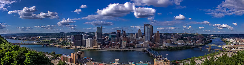
Pittsburgh skyline (from top of Mount Washington). On the far left, the Monongahela River joins the Allegheny River to form the Ohio River, which is the largest branch of Mississippi. You can travel on a boat from Pittsburgh to New Orleans and Golf of Mexico. |
| Date | |
| Source | Pittsburgh skyline panorama |
| Author | Always Shooting |
| Camera location | | View this and other nearby images on: OpenStreetMap |
|---|
.jpg¶ms=040.431638_N_-080.006587_E_globe:Earth_type:camera_source:Flickr_&language=en)
Licensing[edit]
.jpg&action=edit§ion=2)
This file is licensed under the Creative Commons Attribution 2.0 Generic license.
- You are free:
- to share – to copy, distribute and transmit the work
- to remix – to adapt the work
- Under the following conditions:
- attribution – You must give appropriate credit, provide a link to the license, and indicate if changes were made. You may do so in any reasonable manner, but not in any way that suggests the licensor endorses you or your use.
| This image was originally posted to Flickr by Always Shooting at https://flickr.com/photos/93199639@N05/14980315539. It was reviewed on 12 September 2015 by FlickreviewR and was confirmed to be licensed under the terms of the cc-by-2.0. |
File history
Click on a date/time to view the file as it appeared at that time.
| Date/Time | Thumbnail | Dimensions | User | Comment | |
|---|---|---|---|---|---|
| current | 05:34, 12 September 2015 | 6,435 × 1,718 (5.65 MB) | ויקיג'אנקי (talk | contribs) | Transferred from Flickr via Flickr2Commons |
You cannot overwrite this file.
File usage on Commons
The following page uses this file:
.jpg&oldid=486601248)