File:Plan of the city north of K Street next the Creek (R) - (West End, N.W. Washington D.C.). LOC 88694104.jpg
Jump to navigation
Jump to search

Size of this preview: 377 × 599 pixels. Other resolutions: 151 × 240 pixels | 302 × 480 pixels | 483 × 768 pixels | 644 × 1,024 pixels | 1,289 × 2,048 pixels | 2,736 × 4,348 pixels.
Original file (2,736 × 4,348 pixels, file size: 1.26 MB, MIME type: image/jpeg)
Captions
Captions
Add a one-line explanation of what this file represents
Summary
[edit]| Description |
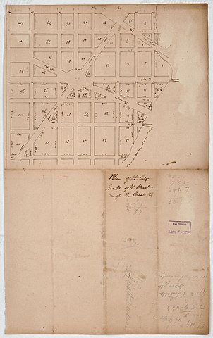
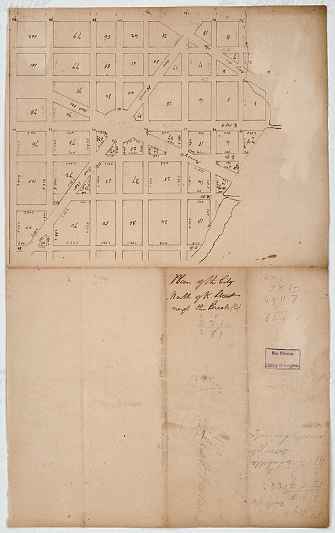
English: Shows block numbers and dimensions. Covers area bounded by Rock Creek, N, 20th, and G streets N.W. Pen-and-ink and lead pencil. Fold-lined, faced with gauze, and mounted on cloth backing. Includes notes and computations. Available also through the Library of Congress Web site as a raster image. Vault DCP |
||
| Title | Plan of the city north of K Street next the Creek (R) : [West End, N.W. Washington D.C.]. | ||
| Shelf ID | G3852.W43 18-- .P5 | ||
| Date | |||
| Source | https://www.loc.gov/item/88694104/ | ||
| Author | Unknown author | ||
| Permission (Reusing this file) |
|
||
| Other versions |
|
||
| Location | United States · Washington D.C. · District Of Columbia · Washington · West End | ||
| Part of | American Memory · Cities And Towns · Catalog · Geography And Map Division | ||
| Subject | Maps, Manuscript · Washington · United States · District Of Columbia · West End · West End (Washington, D.C.) · Manuscript Maps |


_-_(West_End,_N.W._Washington_D.C.)._LOC_88694104.jpg&action=edit§ion=1)
Licensing
[edit]_-_(West_End,_N.W._Washington_D.C.)._LOC_88694104.jpg&action=edit§ion=2)
|
This is a faithful photographic reproduction of a two-dimensional, public domain work of art. The work of art itself is in the public domain for the following reason:
The official position taken by the Wikimedia Foundation is that "faithful reproductions of two-dimensional public domain works of art are public domain".
This photographic reproduction is therefore also considered to be in the public domain in the United States. In other jurisdictions, re-use of this content may be restricted; see Reuse of PD-Art photographs for details. | ||||
File history
Click on a date/time to view the file as it appeared at that time.
| Date/Time | Thumbnail | Dimensions | User | Comment | |
|---|---|---|---|---|---|
| current | 17:07, 17 May 2018 | | 2,736 × 4,348 (1.26 MB) | Fæ (talk | contribs) | LOC Maps https://www.loc.gov/item/88694104/ #10305 |
You cannot overwrite this file.
File usage on Commons
The following page uses this file:
_-_(West_End,_N.W._Washington_D.C.)._LOC_88694104.jpg&oldid=632670228)