File:Plan topographique d'Uriage - dressé par J. Boiton... - btv1b55011361d.jpg
Jump to navigation
Jump to search

Size of this preview: 781 × 599 pixels. Other resolutions: 313 × 240 pixels | 626 × 480 pixels | 1,001 × 768 pixels | 1,280 × 982 pixels | 2,560 × 1,965 pixels | 4,718 × 3,621 pixels.
Original file (4,718 × 3,621 pixels, file size: 2.42 MB, MIME type: image/jpeg)
Captions
Captions
Add a one-line explanation of what this file represents
Summary
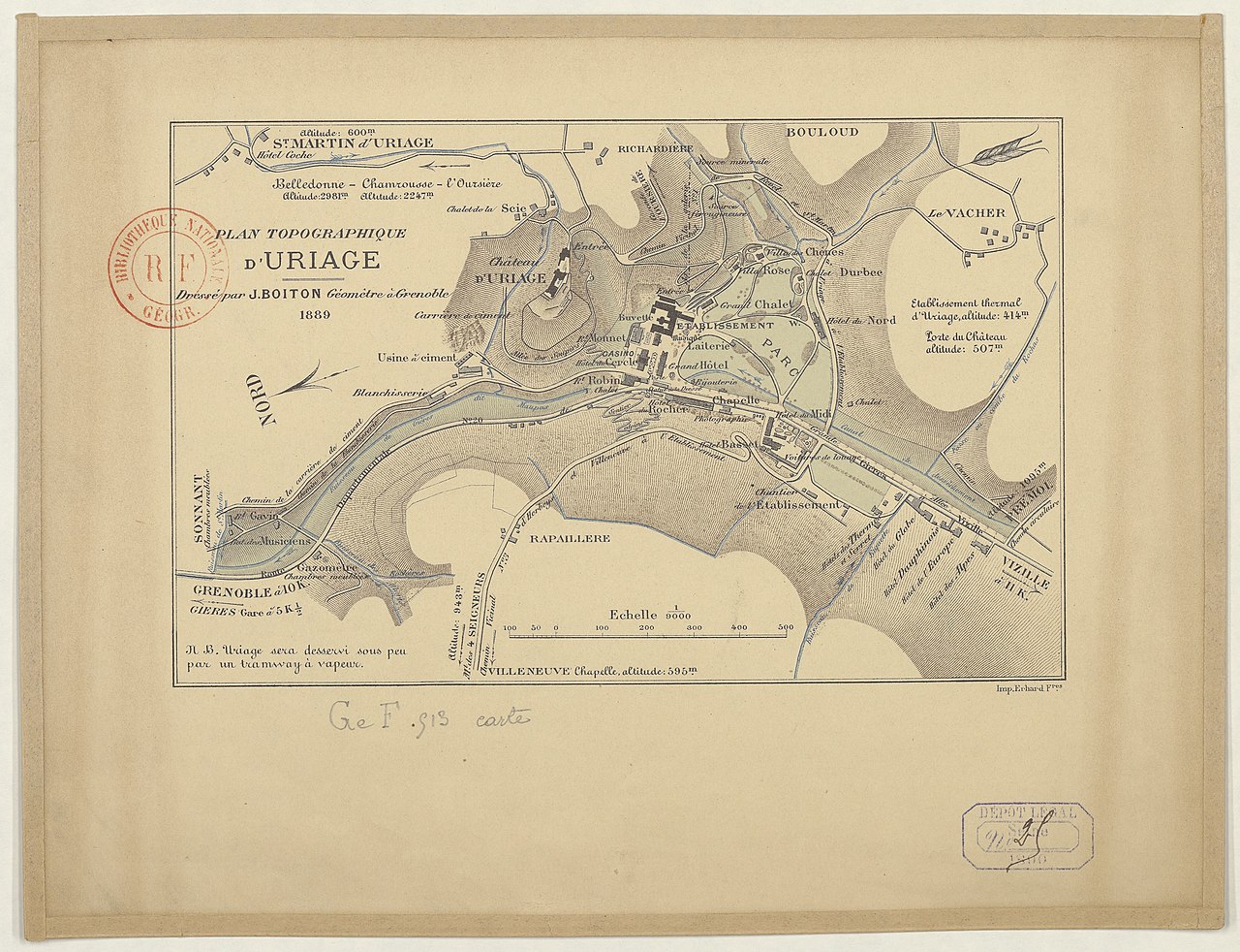
[edit]| Plan topographique d'Uriage / dressé par J. Boiton,...
( |
|||||||||||||||||||||||||||
|---|---|---|---|---|---|---|---|---|---|---|---|---|---|---|---|---|---|---|---|---|---|---|---|---|---|---|---|
| Author |
Boiton, J. (18..-19..? ; géomètre). Dessinateur |
||||||||||||||||||||||||||
| Title |
Plan topographique d'Uriage / dressé par J. Boiton,... |
||||||||||||||||||||||||||
| Description |
Français : Sujet : Uriage-les-Bains
Échelle(s) : 1:9 000 Couverture : France – Auvergne-Rhône-Alpes – Isère E 5°49' / N 45°8' Langue : français Éditeur : Imp. Erhard f[rè]res (Paris) |
||||||||||||||||||||||||||
| Date | 1889 | ||||||||||||||||||||||||||
| Dimensions | height: 21.5 cm (8.4 in); width: 14 cm (5.5 in) | ||||||||||||||||||||||||||
| Collection |
|
||||||||||||||||||||||||||
| References |
Français : Notice du catalogue : http://catalogue.bnf.fr/ark:/12148/cb45184432p |
||||||||||||||||||||||||||
| Source/Photographer |
Français : Bibliothèque nationale de France, département Cartes et plans, GE F CARTE-513
Bibliothèque nationale de France |
||||||||||||||||||||||||||
| Permission (Reusing this file) |
|
||||||||||||||||||||||||||

File history
Click on a date/time to view the file as it appeared at that time.
| Date/Time | Thumbnail | Dimensions | User | Comment | |
|---|---|---|---|---|---|
| current | 13:37, 14 August 2022 | | 4,718 × 3,621 (2.42 MB) | Gzen92Bot (talk | contribs) | Gallica btv1b55011361d |
You cannot overwrite this file.
File usage on Commons
The following page uses this file: