File:Plano de la Ciudad de Veracruz de 1777 - Veracruz, Veracruz. México.jpg
Jump to navigation
Jump to search

Size of this preview: 800 × 429 pixels. Other resolutions: 320 × 171 pixels | 640 × 343 pixels | 1,024 × 549 pixels | 1,484 × 795 pixels.
Original file (1,484 × 795 pixels, file size: 218 KB, MIME type: image/jpeg)
Captions
Captions
Add a one-line explanation of what this file represents
| Title |
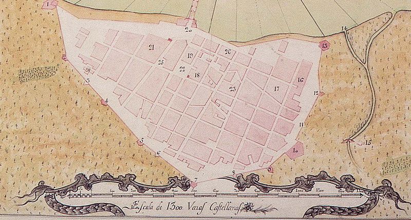
Plano del Puerto y Ciudad de Vera-Cruz en la Costa Occidental del Reino de Nueva España |
||||
| Description |
English: Historical map of Veracruz City (1777) — State of Veracruz. eastern Mexico
Español: Plano de la ciudad amurallada. Año 1777 |
||||
| Creator | |||||
| Permission (Reusing this file) |
|
||||
| Geotemporal data | |||||
| Map location | Veracruz | ||||
| Scale | 1:3600 | ||||
| Georeferencing | If inappropriate please set warp_status = skip to hide. | ||||
| Archival data | |||||
| Dimensions | 49 × 74 cm | ||||
| Other versions | 1 | ||||
File history
Click on a date/time to view the file as it appeared at that time.
| Date/Time | Thumbnail | Dimensions | User | Comment | |
|---|---|---|---|---|---|
| current | 02:08, 28 June 2007 | | 1,484 × 795 (218 KB) | Gengiskanhg (talk | contribs) | {{Information |Description=English Old photos of Veracruz City. State of Veracruz. Mexico. Spanish Fotos viejas de la Ciudad de Veracruz. Estado de Veracruz. México. Plano de la ciudad amurallada. Año 1777. |Source=Unknow |Date=Each date is given in t |
You cannot overwrite this file.
File usage on Commons
The following 2 pages use this file:
File usage on other wikis
The following other wikis use this file:
- Usage on ast.wikipedia.org
- Usage on de.wikipedia.org
- Usage on es.wikipedia.org
- Usage on ga.wikipedia.org