File:Poland map (1814).jpg
Jump to navigation
Jump to search
Size of this preview: 716 × 600 pixels. Other resolutions: 287 × 240 pixels | 573 × 480 pixels | 917 × 768 pixels | 1,222 × 1,024 pixels | 1,486 × 1,245 pixels.
Original file (1,486 × 1,245 pixels, file size: 426 KB, MIME type: image/jpeg)
Captions
Captions
Add a one-line explanation of what this file represents
Summary[edit]
.jpg&action=edit§ion=1)
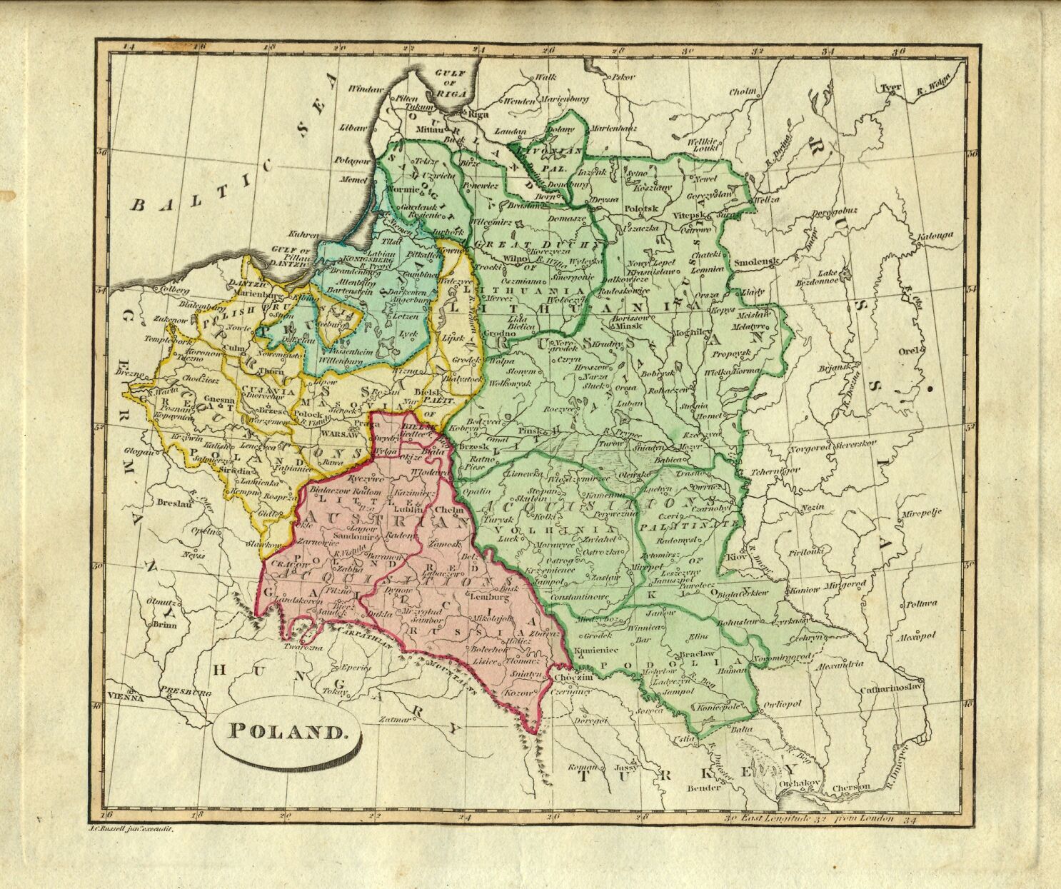
| Description | Third Partition of the Polish–Lithuanian Commonwealth in 1793 among Prussia, the Austrian Empire, and the Russian Empire displayed in *Ostell's New General Atlas* (London: Cradock and Joy, 1814); |
| Date | |
| Source | [1] |
| Author | Ostell's New General Atlas (London: Cradock and Joy, 1814) with modern hand coloring. |
| Permission (Reusing this file) |
Public Domain due to age |
![[1]](http://www.columbia.edu/itc/mealac/pritchett/00maplinks/colonial/ostell1814/poland1814.jpg)
Licensing[edit]
.jpg&action=edit§ion=2)
|
This work is in the public domain in its country of origin and other countries and areas where the copyright term is the author's life plus 100 years or fewer. This work is in the public domain in the United States because it was published (or registered with the U.S. Copyright Office) before January 1, 1929. | |
| This file has been identified as being free of known restrictions under copyright law, including all related and neighboring rights. | |
File history
Click on a date/time to view the file as it appeared at that time.
| Date/Time | Thumbnail | Dimensions | User | Comment | |
|---|---|---|---|---|---|
| current | 20:42, 9 July 2007 | | 1,486 × 1,245 (426 KB) | Piotrus (talk | contribs) | {{Information |Description=Poland from *Ostell's New General Atlas* (London: Cradock and Joy, 1814); with modern hand coloring. |Source=[http://www.columbia.edu/itc/mealac/pritchett/00maplinks/colonial/ostell1814/poland1814.jpg] |Date=1910 |Author= |Perm |
You cannot overwrite this file.
File usage
There are no pages that use this file.
Global file usage
The following other wikis use this file:
- Usage on en.wikipedia.org
- Usage on es.wikipedia.org
- Usage on lt.wikibooks.org
.jpg&oldid=726091160)