File:PonderosaRangeMap.png
Jump to navigation
Jump to search

Size of this preview: 450 × 600 pixels. Other resolutions: 180 × 240 pixels | 360 × 480 pixels | 576 × 768 pixels | 768 × 1,024 pixels | 2,083 × 2,777 pixels.
Original file (2,083 × 2,777 pixels, file size: 636 KB, MIME type: image/png)
Captions
Captions
Add a one-line explanation of what this file represents
Summary
[edit]
| Description |
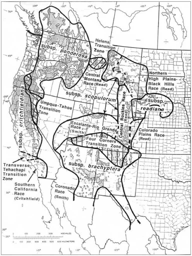
English: Range map of Pinus ponderosa |
| Date | |
| Source | Pinus ponderosa: A Taxonomic Review With Five Subspecies in the United States, Pacific Southwest Research Station Research Paper PSW-RP-264, p. 2 |
| Author | Robert Z. Callaham (talk · contribs) |
| Permission (Reusing this file) |
PD-USGov-USDA |
Licensing
[edit]
This image or file is a work of a United States Department of Agriculture employee, taken or made as part of that person's official duties. As a work of the U.S. federal government, the image is in the public domain.
|
 |
File history
Click on a date/time to view the file as it appeared at that time.
| Date/Time | Thumbnail | Dimensions | User | Comment | |
|---|---|---|---|---|---|
| current | 05:26, 28 January 2014 | | 2,083 × 2,777 (636 KB) | Hike395 (talk | contribs) | {{Information |Description ={{en|1=Range map of Pinus Ponderosa}} |Source =http://www.fs.fed.us/psw/publications/documents/psw_rp264/psw_rp264.pdf |Author =Robert Z. Callaham |Date =2013-09 |Permission =PD-USGov-USDA |o... |
You cannot overwrite this file.
File usage on Commons
The following page uses this file:
File usage on other wikis
The following other wikis use this file:
- Usage on cy.wikipedia.org
- Usage on he.wikipedia.org
- Usage on lt.wikipedia.org
- Usage on ro.wikipedia.org