File:Pont de Zaehringen.tif
Jump to navigation
Jump to search

Size of this JPG preview of this TIF file: 800 × 533 pixels. Other resolutions: 320 × 213 pixels | 640 × 427 pixels | 1,024 × 683 pixels | 1,280 × 853 pixels | 2,560 × 1,707 pixels | 5,760 × 3,840 pixels.
Original file (5,760 × 3,840 pixels, file size: 63.41 MB, MIME type: image/tiff)
Captions
Captions
Add a one-line explanation of what this file represents
Summary
[edit]| Louis Vonlanthen: Pont de Zaehringen (Vonlanthen)
|
|||||||||||||||||||||||||||
|---|---|---|---|---|---|---|---|---|---|---|---|---|---|---|---|---|---|---|---|---|---|---|---|---|---|---|---|
| Artist |
|
 | |||||||||||||||||||||||||
| Title |
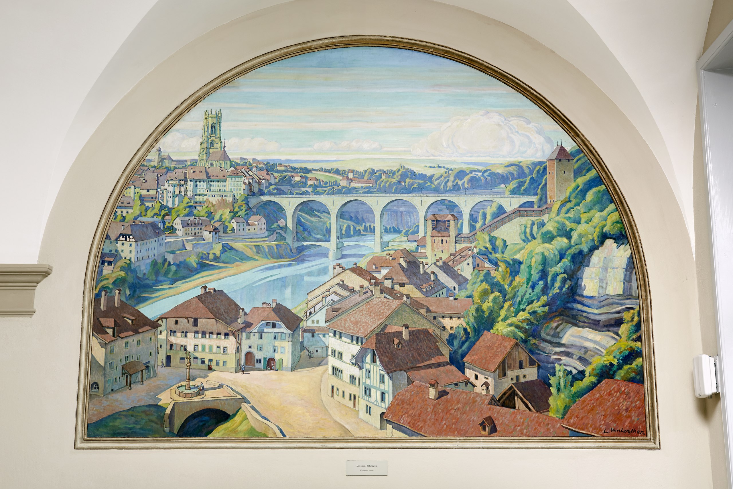
French: Pont de Zaehringen à Fribourg Zaehringen Bridge in Fribourg |
||||||||||||||||||||||||||
| Object type | painting | ||||||||||||||||||||||||||
| Description |
The painting shows the city of Fribourg, Switzerland, with the cathedral and the Zähringer Bridge from the southeast, on this side of the Sarine. In the foreground is the city quarter of the Auge. The picture is completed by a frame painted on the wall. |
||||||||||||||||||||||||||
| Depicted place | Fribourg, Switzerland, with the cathedral an the Zaehringer bridge | ||||||||||||||||||||||||||
| Date | 1926 | ||||||||||||||||||||||||||
| Medium | oil over wall on canvas | ||||||||||||||||||||||||||
| Dimensions | 285 × 213 cm (112.2 × 83.8 in) | ||||||||||||||||||||||||||
| Collection |
|
||||||||||||||||||||||||||
| Current location |
ETH Zentrum, HG, Nordrisalit, Geschoss E, Westwand |
||||||||||||||||||||||||||
| Object location |
|
||||||||||||||||||||||||||
| Object history | Until 2017: On loan, Art Collection of the Swiss Confederation, Bern; January 1926, donation, Direction des travaux publics Fribourg | ||||||||||||||||||||||||||
| Source/Photographer | http://doi.org/10.21263/ethz-a-000000275 | ||||||||||||||||||||||||||

Licensing
[edit]| This file is made available under the Creative Commons CC0 1.0 Universal Public Domain Dedication. | |
| The person who associated a work with this deed has dedicated the work to the public domain by waiving all of their rights to the work worldwide under copyright law, including all related and neighboring rights, to the extent allowed by law. You can copy, modify, distribute and perform the work, even for commercial purposes, all without asking permission.
|
| Object location | | View this and other nearby images on: OpenStreetMap |
|---|
File history
Click on a date/time to view the file as it appeared at that time.
| Date/Time | Thumbnail | Dimensions | User | Comment | |
|---|---|---|---|---|---|
| current | 10:30, 14 May 2022 |  | 5,760 × 3,840 (63.41 MB) | Matutinho (talk | contribs) | Uploaded a work by Louis Vonlanthen from http://doi.org/10.21263/ethz-a-000000275 with UploadWizard |
You cannot overwrite this file.
File usage on Commons
The following page uses this file:
File usage on other wikis
The following other wikis use this file:
- Usage on de.wikipedia.org
- Usage on www.wikidata.org