File:Popcorn Clouds over the Southeast United States (MODIS).jpg
Original file (4,666 × 3,998 pixels, file size: 12.24 MB, MIME type: image/jpeg)
Captions
Captions
Summary
[edit].jpg&action=edit§ion=1)
| Description |
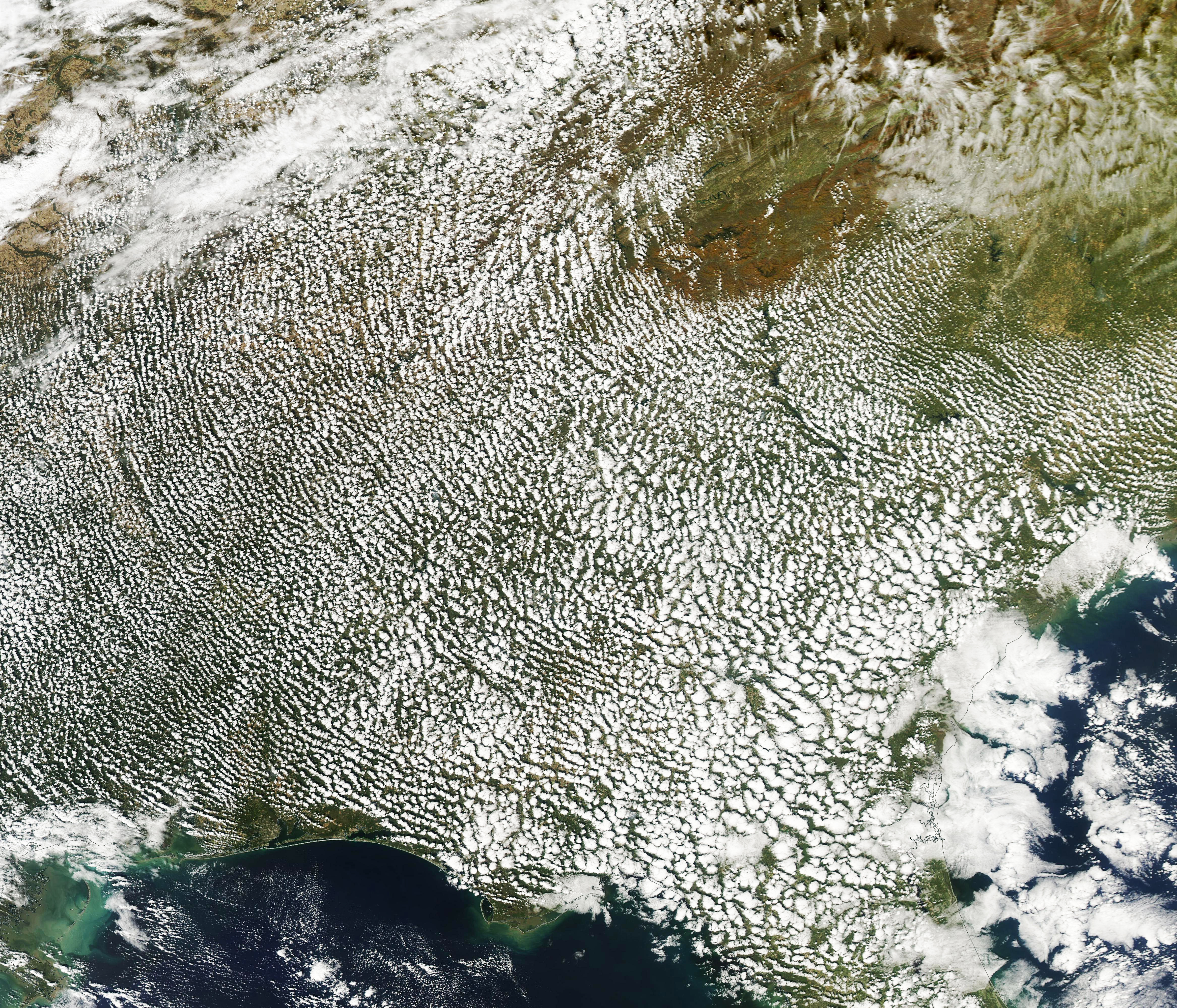
English: Widespread popcorn clouds dotted the landscape over the southeastern United States on October 26, 2023, when the Moderate Resolution Imaging Spectroradiometer (MODIS) on NASA’s Aqua satellite captured this true-color image.
These clouds, which get their name from their popcorn-like puffy appearance, covered parts of nine states, from southern Kentucky in the north to Florida in the south. Despite the thick layer over land, the sky over the Gulf of Mexico remained clear. In the northeast, a gap in the cloud cover reveals dynamic red tones of autumn leaves in the mountains surrounding the tall peaks of Clingmans Dome and Mount Mitchell near the boundary between Tennessee (west) and North Carolina (east) in the Great Smoky Mountains. Popcorn clouds, more properly called cirrocumulus clouds, form when heat from the Sun warms fields, forests, and land surfaces. The heat then rises, warming the air over the land and as it rises, the air also carries water vapor which, at the proper height and temperature, condenses into clouds. Bodies of water, on the other hand, do not change temperature as rapidly; the water remains cooler even during full Sun exposure. The water does not heat up enough to significantly warm the air above it, preventing air from rising to make clouds. This, and many additional climate processes, can be traced to the different average heat capacity of water and land. |
||
| Date | Taken on 26 October 2023 | ||
| Source |
Popcorn Clouds over the Southeast United States (direct link)
|
||
| Author | MODIS Land Rapid Response Team, NASA GSFC |
| This media is a product of the Aqua mission Credit and attribution belongs to the mission team, if not already specified in the "author" row |
Licensing
[edit].jpg&action=edit§ion=2)
| This file is in the public domain in the United States because it was solely created by NASA. NASA copyright policy states that "NASA material is not protected by copyright unless noted". (See Template:PD-USGov, NASA copyright policy page or JPL Image Use Policy.) | ||
 |
Warnings:
|
File history
Click on a date/time to view the file as it appeared at that time.
| Date/Time | Thumbnail | Dimensions | User | Comment | |
|---|---|---|---|---|---|
| current | 05:05, 30 October 2023 | | 4,666 × 3,998 (12.24 MB) | OptimusPrimeBot (talk | contribs) | #Spacemedia - Upload of http://modis.gsfc.nasa.gov/gallery/images/image10302023_250m.jpg via Commons:Spacemedia |
You cannot overwrite this file.
File usage on Commons
There are no pages that use this file.
.jpg&oldid=816941125)