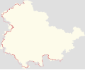
File:Positionskarte des Iron Curtain Trail (ICT bzw. EV13) in Thüringen.svg

Original file (SVG file, nominally 3,000 × 2,477 pixels, file size: 327 KB)
Captions
Captions
Summary
[edit]| DescriptionPositionskarte des Iron Curtain Trail (ICT bzw. EV13) in Thüringen.svg |
Deutsch: Positionskarte des Iron Curtain Trail (ICT bzw. EV13) in Thüringen |
| Date | |
| Source | Own work |
| Author | Cmuelle8 |
| Permission (Reusing this file) |
Dieses Erzeugnis (Produced Work) basiert auf Kartendaten © OpenStreetMap Mitwirkende, verfügbar unter OdbL. (Details) |
Licensing
[edit]| This file is made available under the Creative Commons CC0 1.0 Universal Public Domain Dedication. | |
| The person who associated a work with this deed has dedicated the work to the public domain by waiving all of their rights to the work worldwide under copyright law, including all related and neighboring rights, to the extent allowed by law. You can copy, modify, distribute and perform the work, even for commercial purposes, all without asking permission.
http://creativecommons.org/publicdomain/zero/1.0/deed.enCC0Creative Commons Zero, Public Domain Dedicationfalsefalse |
Howto
[edit]# Erstellt mit einer stark modifizierten Version von gpx2svg
# Relationsdaten-Download mittels e. g. rel2gpx
sudo apt-get install rel2gpx
rel2gpx -g 62366
for i in 4851313 4851314 4851315 ; do rel2gpx -g $i ; done
# aus den letzten 3 gpx Dateien z.B. mit JOSM die innerhalb Thüringens
# liegenden Teile von den grenznahen separieren und in 2 neue GPX speichern
# ggf. Daten an den bbox-Grenzen Thüringens "clippen" bzw. beschneiden
wget -qO - 'https://de.wikipedia.org/wiki/Benutzer:Cmuelle8/gpx2svg.py' \
| sed -e '1,/<pre>/d' -e '/<.pre>/,$d' -e 's/>/>/g' -e 's/</</g' -e 's/ / /g' \
> gpx2svg.py
chmod +x gpx2svg.py
python3 ./gpx2svg.py -c \
-i Thüringen_3m-Fehler-vereinfacht-mit-josm.gpx z \
-i Iron_Curtain_Trail_near_but_out_of_DE-TH.gpx d \
-i Iron_Curtain_Trail_within_DE-TH.gpx d \
-sl > 'Positionskarte des Iron Curtain Trail (ICT bzw. EV13) in Thüringen.svg'
File history
Click on a date/time to view the file as it appeared at that time.
| Date/Time | Thumbnail | Dimensions | User | Comment | |
|---|---|---|---|---|---|
| current | 19:12, 5 June 2021 |  | 3,000 × 2,477 (327 KB) | Cmuelle8 (talk | contribs) | Fortsetzung südsüdöstlich ergänzt (blasse Darstellung), damit konsistent zu Fortsetzung an nördlicher Ländergrenze |
| 12:04, 1 June 2021 |  | 3,000 × 2,477 (319 KB) | Cmuelle8 (talk | contribs) | Uploaded own work with UploadWizard |
You cannot overwrite this file.
File usage on Commons
The following page uses this file:
- File:Positionskarte der Radroute EuroVelo 13 in Thüringen.svg (file redirect)
File usage on other wikis
The following other wikis use this file:
- Usage on de.wikipedia.org
Metadata
This file contains additional information such as Exif metadata which may have been added by the digital camera, scanner, or software program used to create or digitize it. If the file has been modified from its original state, some details such as the timestamp may not fully reflect those of the original file. The timestamp is only as accurate as the clock in the camera, and it may be completely wrong.
| Width | 3000.0px |
|---|---|
| Height | 2476.588678775451px |